![]()
1950 Census Dataset on the Amazon Web Services (AWS) Registry of Open Data
The National Archives and Records Administration (NARA) publishes the 1950 Census dataset on the AWS Registry of Open Data. This documentation guides users in how to access the data.
Table of Contents
About the Dataset
Population Schedules
Image Details
Metadata Index Details
Access Methods
Accessing the Full Dataset
Accessing Portions of the Dataset
Accessing the Dataset By State/Territory
Enumeration District Summaries by State
About the Dataset
The 1950 Census dataset - over 165 terabytes of data - includes the metadata index, the population schedule and other forms, the enumeration district maps, and the enumeration district descriptions for the 1950 Census records. Technical details for each part of the dataset are provided below. The 1950 Census dataset was digitized by the National Archives and Records Administration (NARA) and released publicly on April 1, 2022. The AWS Registry of Open Data, started in 2008, is a service provided by AWS to store open, public datasets for free so that they can be accessed and analyzed on AWS.
Population Schedules
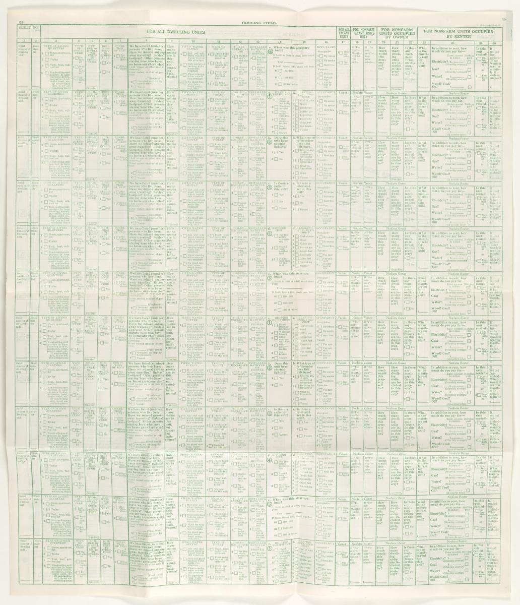
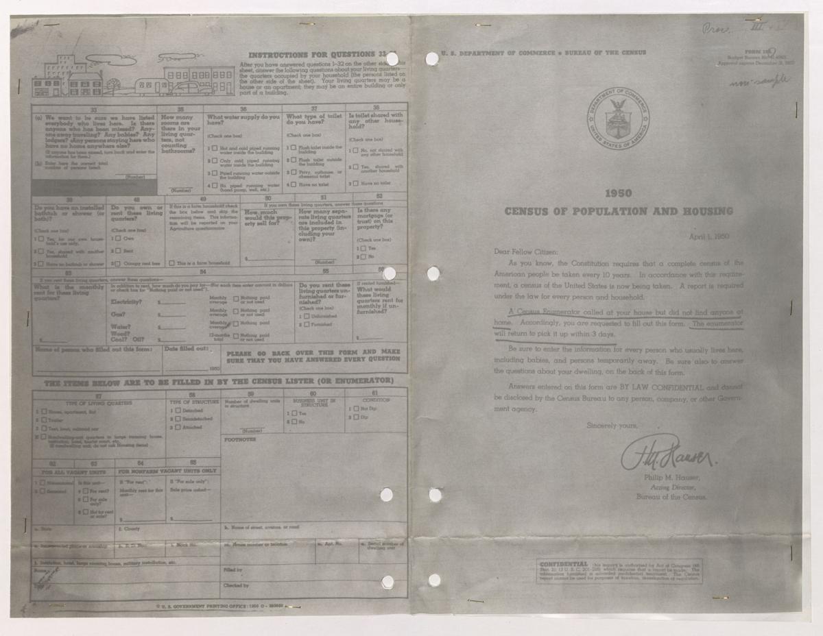
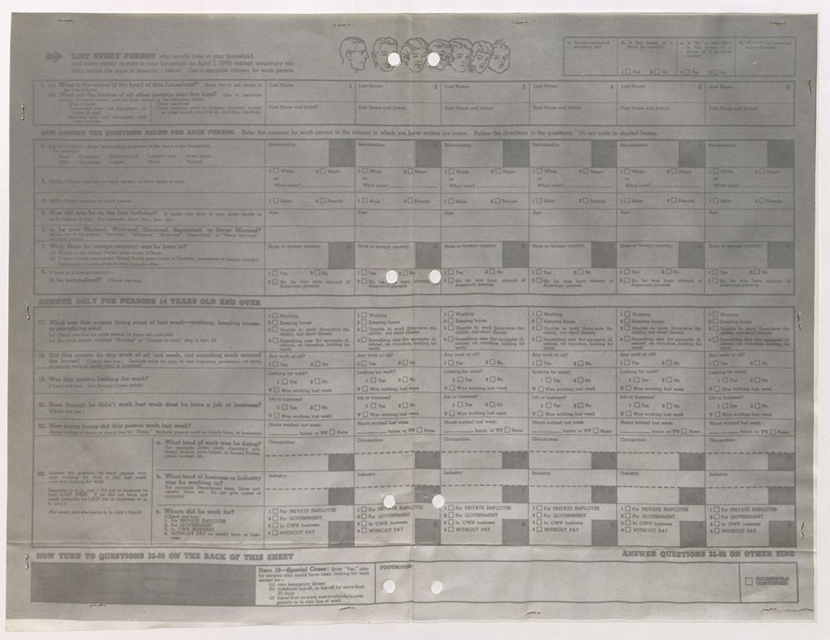
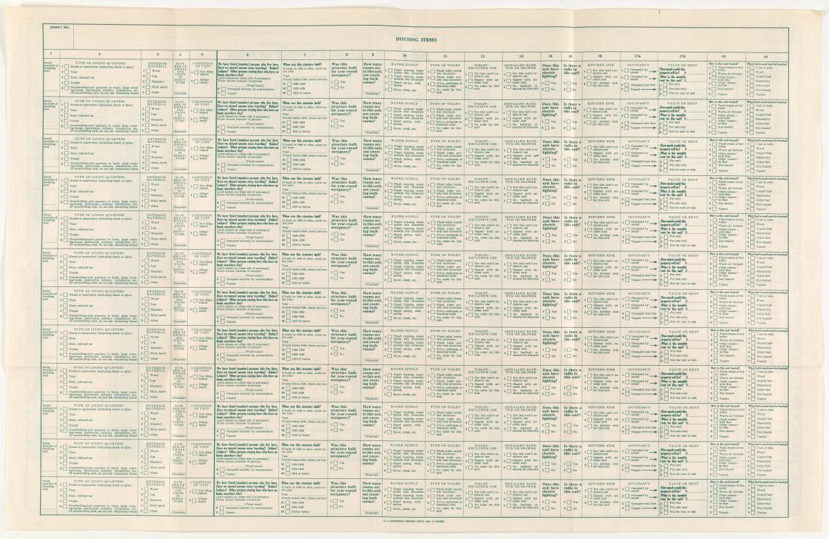
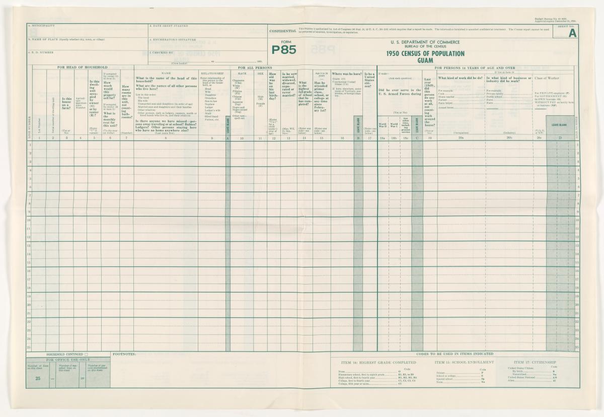
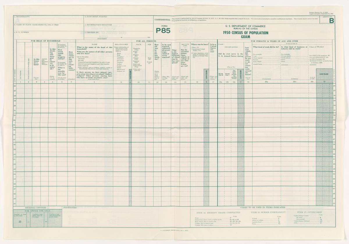
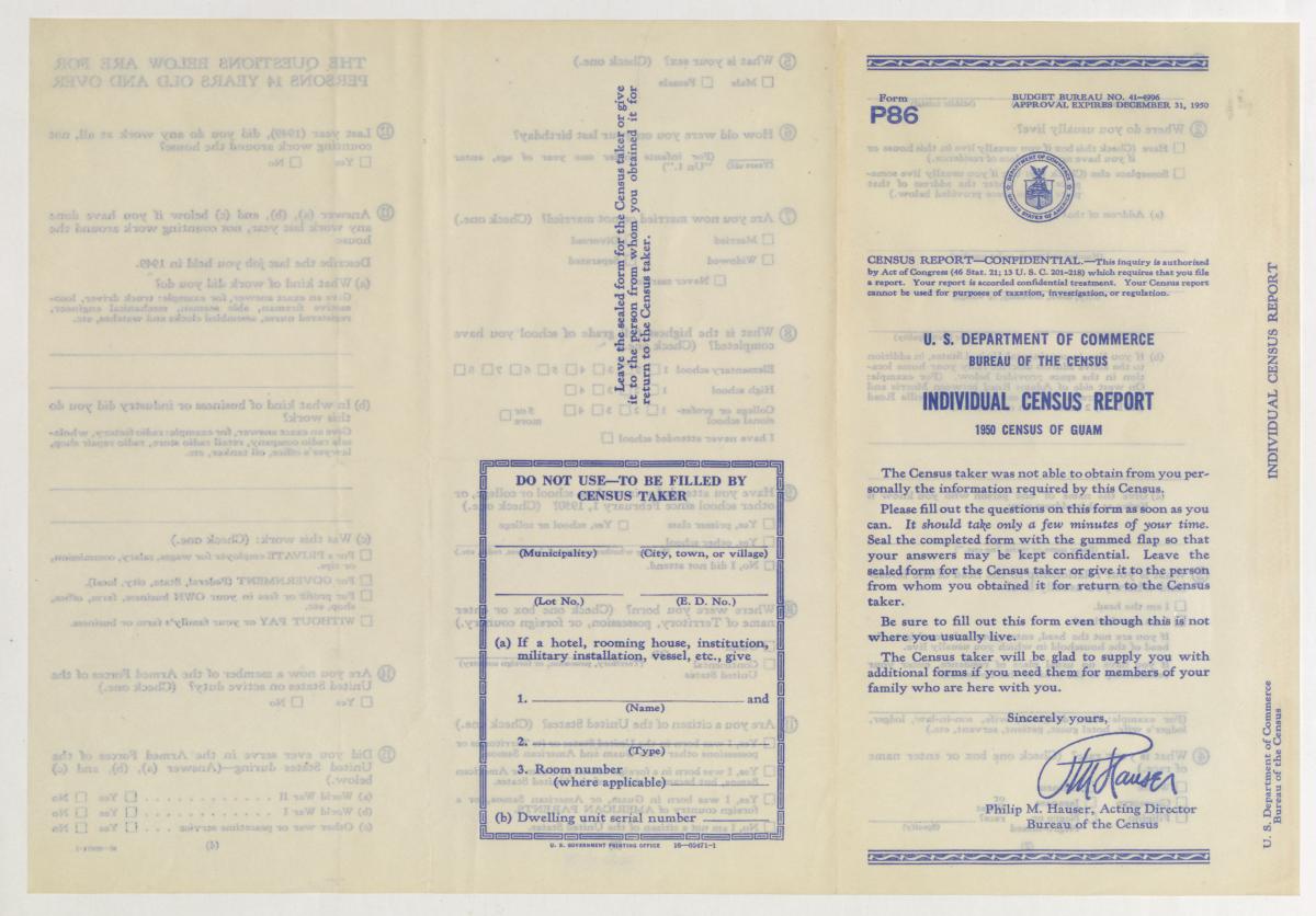
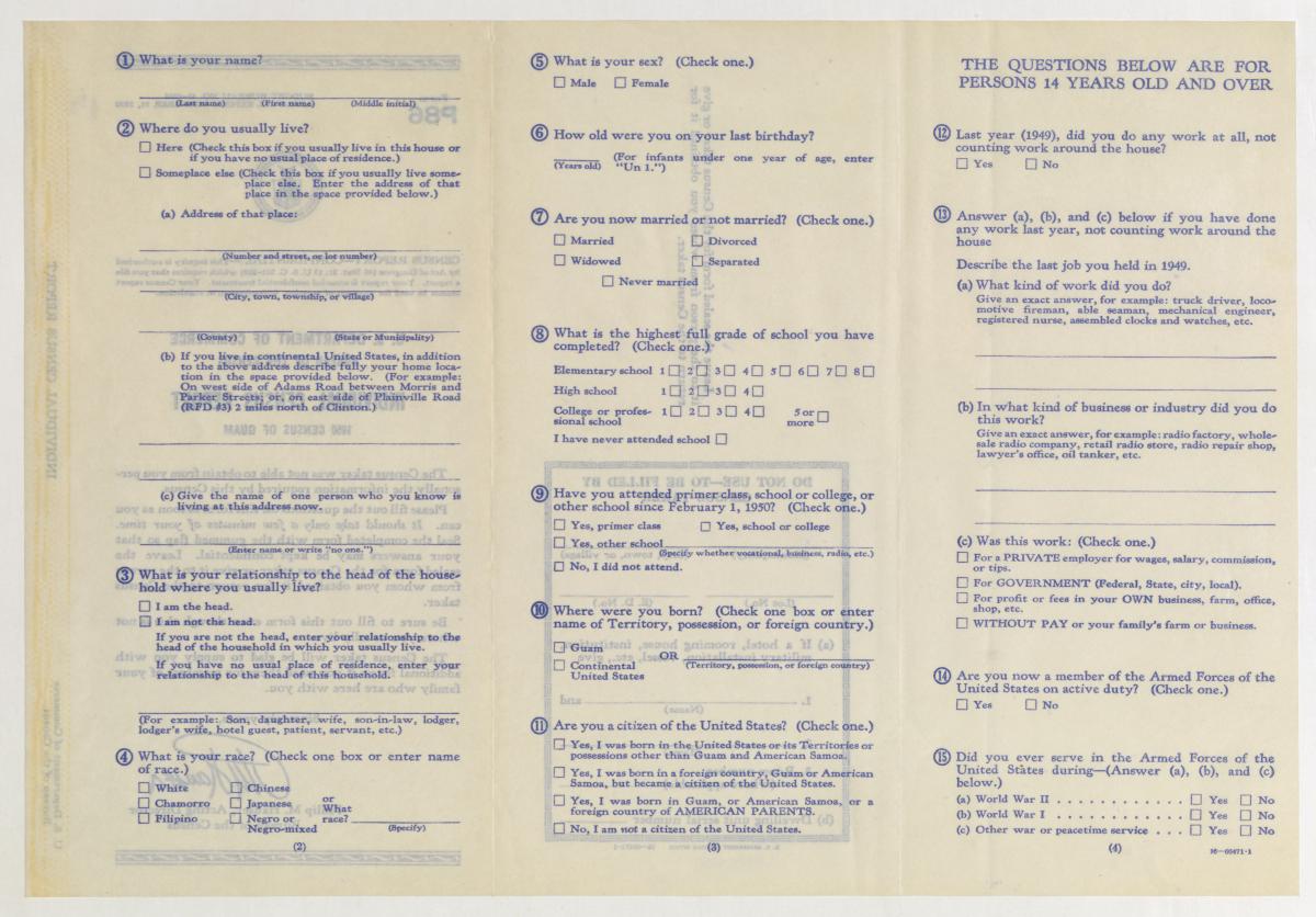
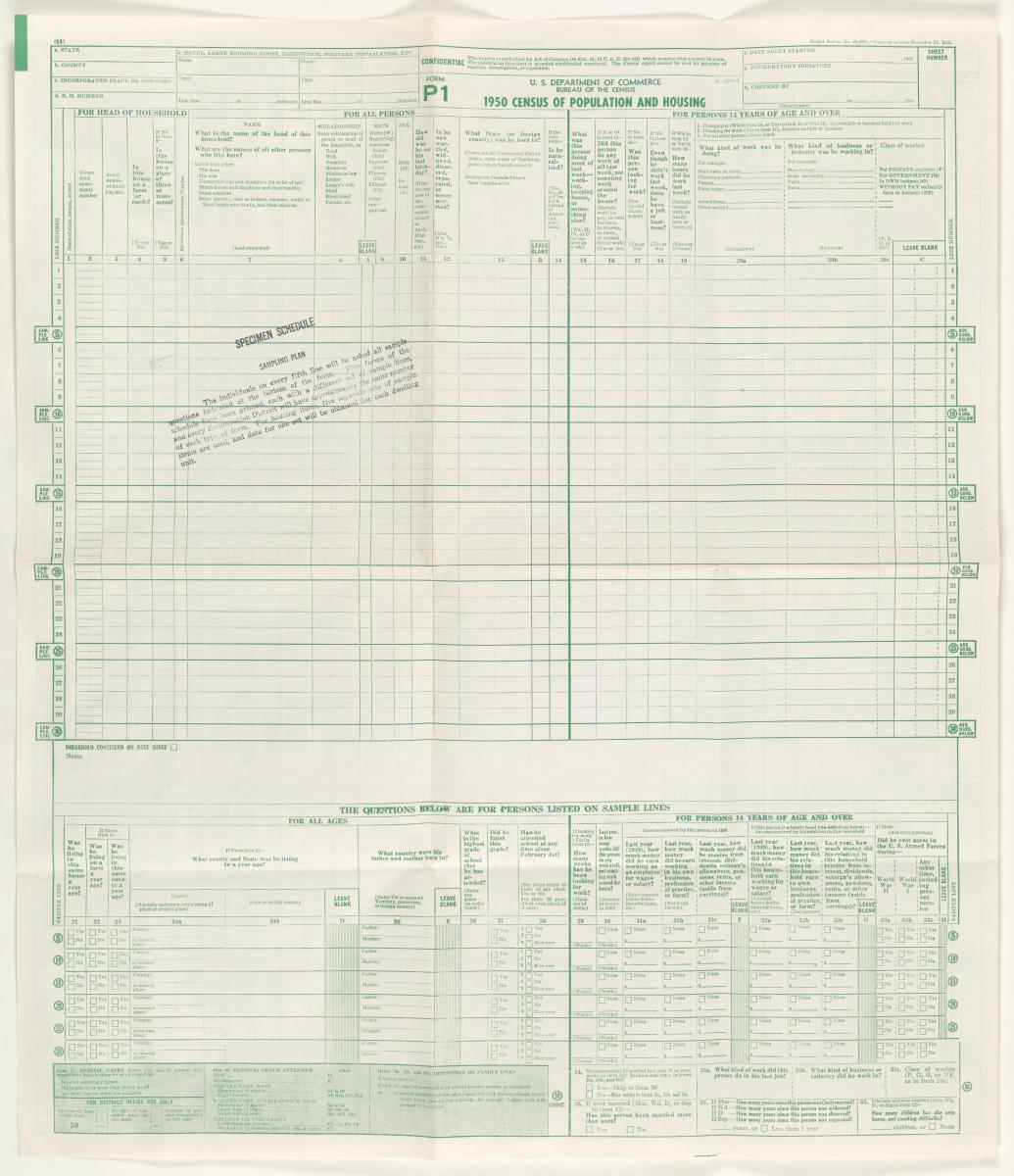
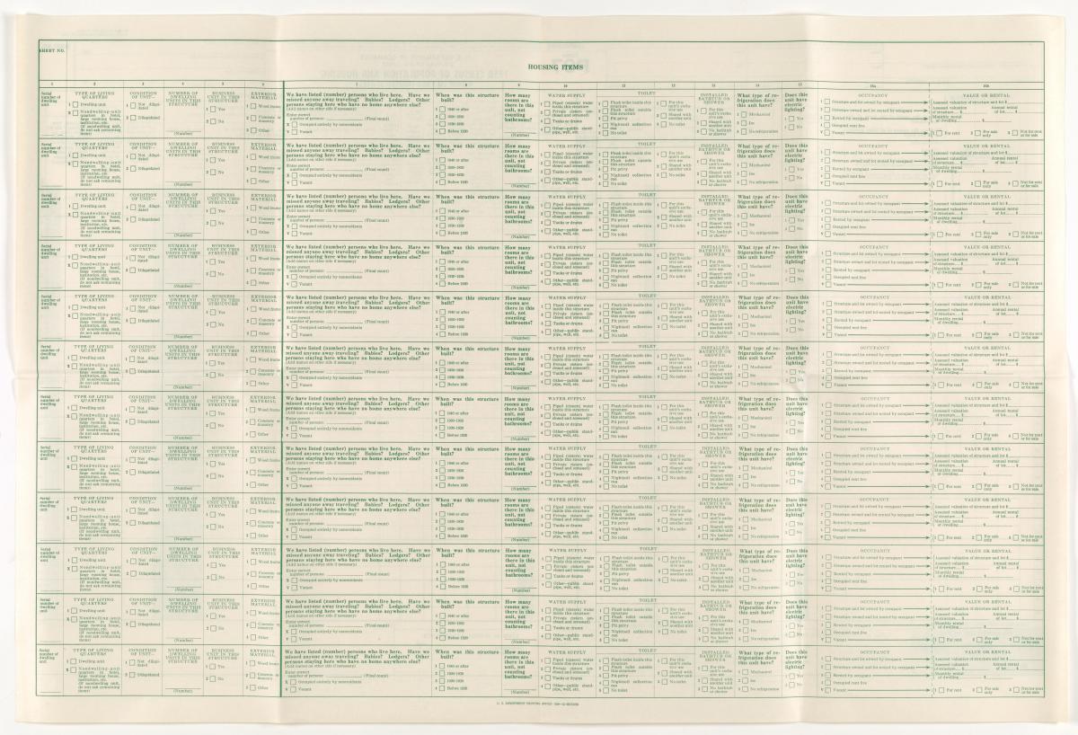
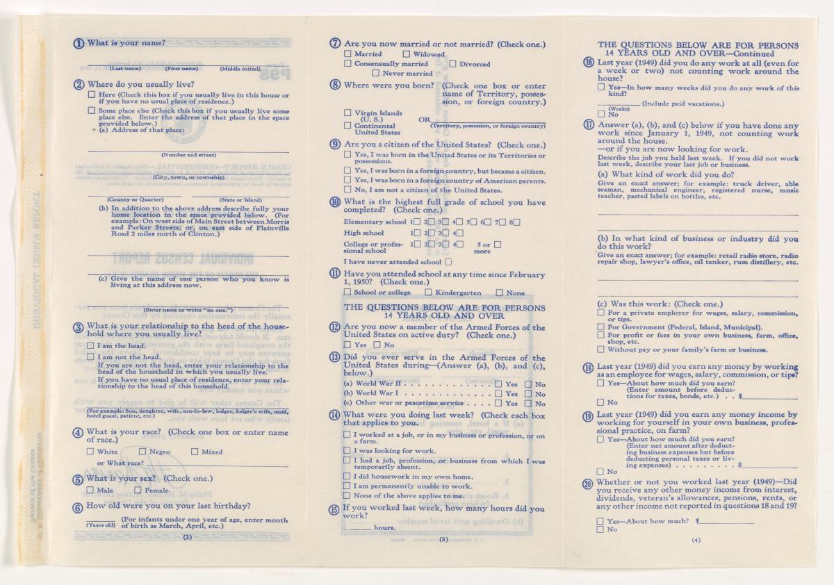
The 1950 Census population schedules were created by the Bureau of the Census in an attempt to enumerate every person living in the United States on April 1, 1950, although some persons were missed. The vast majority of forms in the population schedules are standard large form population schedules, which list up to 30 names with corresponding responses to the census questions collected by census enumerators. The reverse side of the P1 form asked questions concerning the characteristics of the inhabitants' housing. The housing (reverse) side was not microfilmed (in 1952) at the same time as the population (front) side of the form, so they are no longer extant. Only the aggregate statistical housing data remains preserved in the published reports of the Bureau of the Census. Scattered throughout the population schedules, there are Individual Census Reports and other forms that were used for special circumstances. In other circumstances, information from individual reports were transcribed into the standard schedule forms.
Image Details
Approximately 6.5 million digital TIFF images and corresponding JPEG derivative images of the microfilmed P1 “1950 Census of Population and Housing” forms and a scattering of Individual Census Reports and other forms for U.S. states and territories.
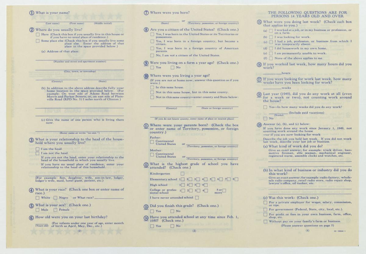
Form P1: Census of Population and Housing

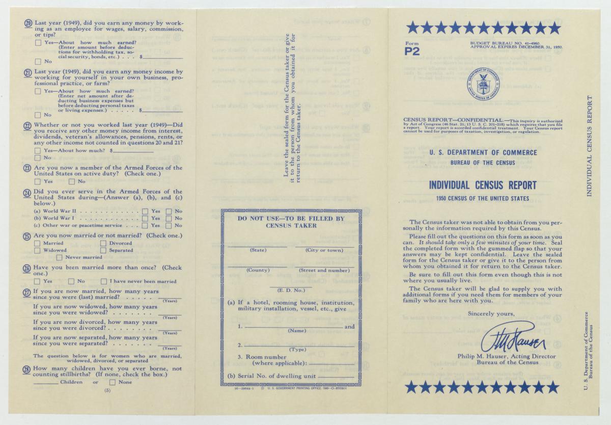
Form P2: Individual Census Report
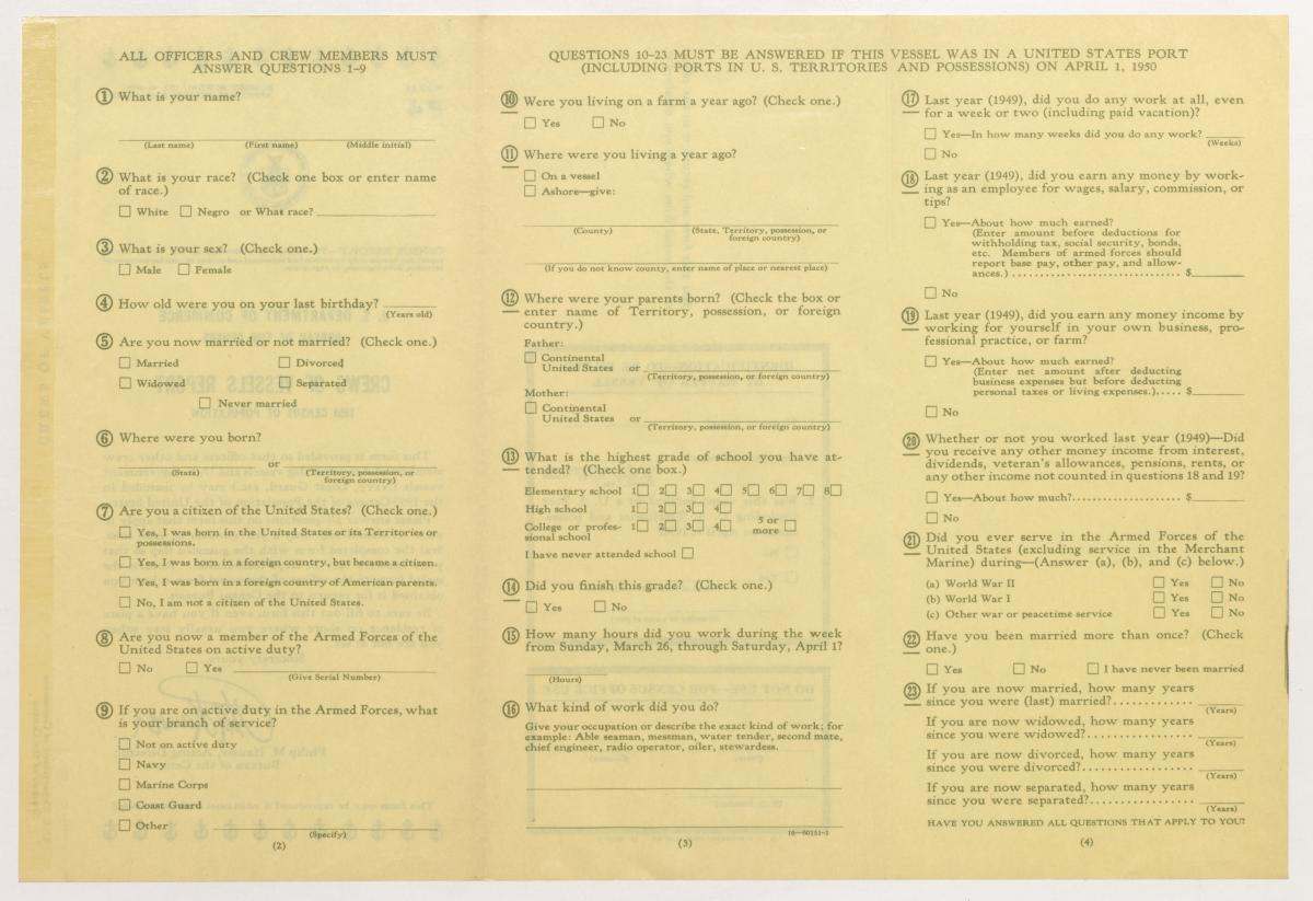
Form P4: Crews of Vessels Report

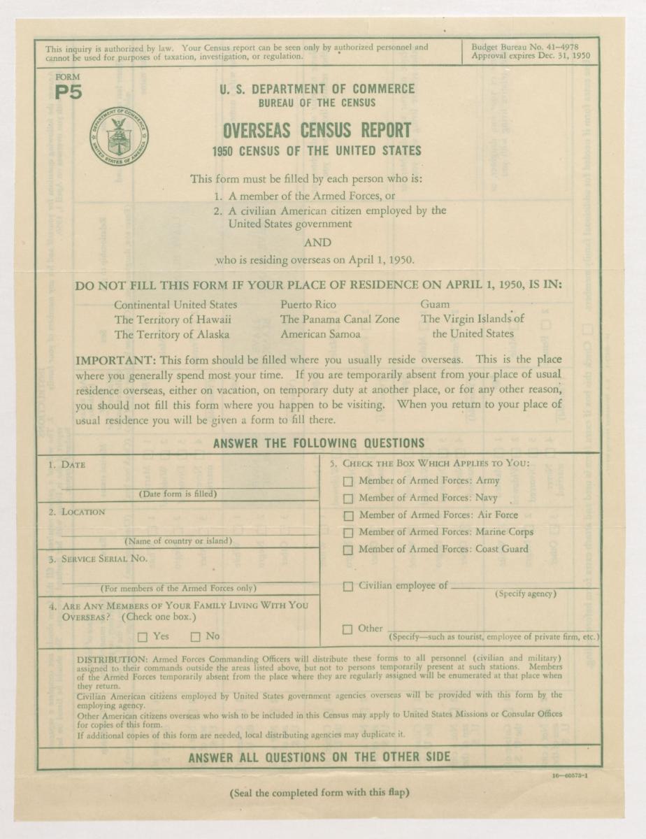
Form P5: Overseas Census Report
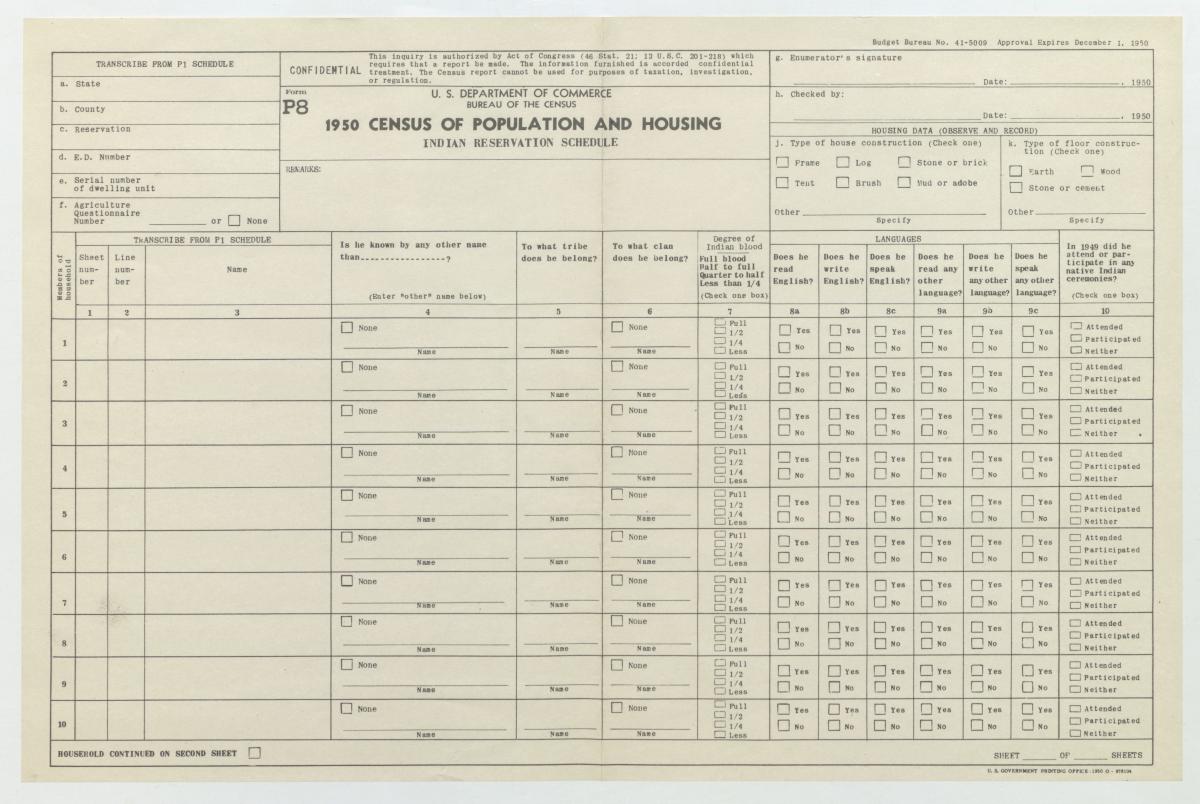
Form P8: Indian Reservation Schedule
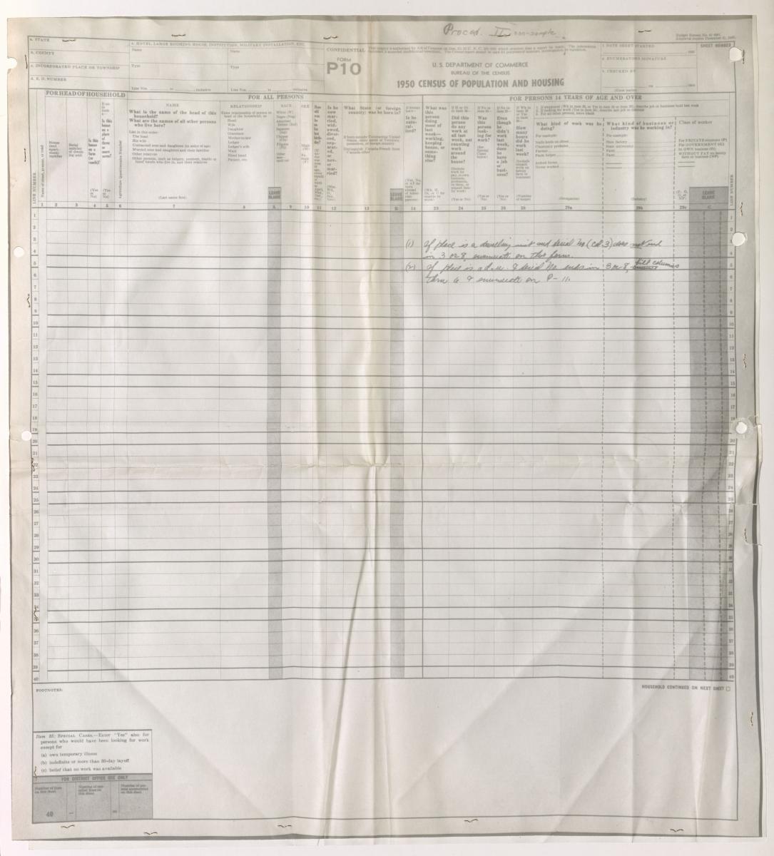
Form P10: Census of Population and Housing
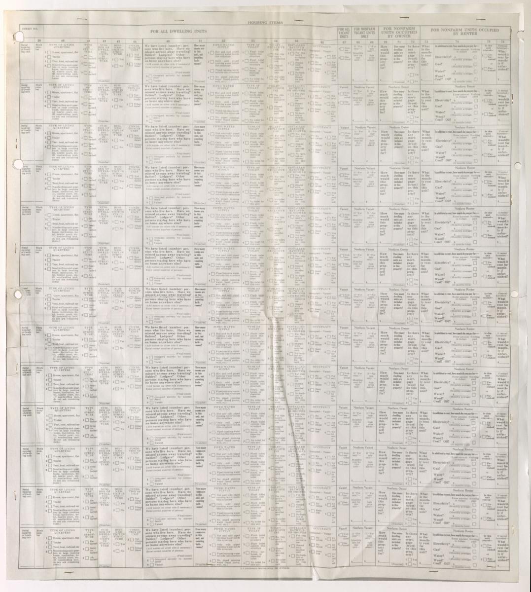
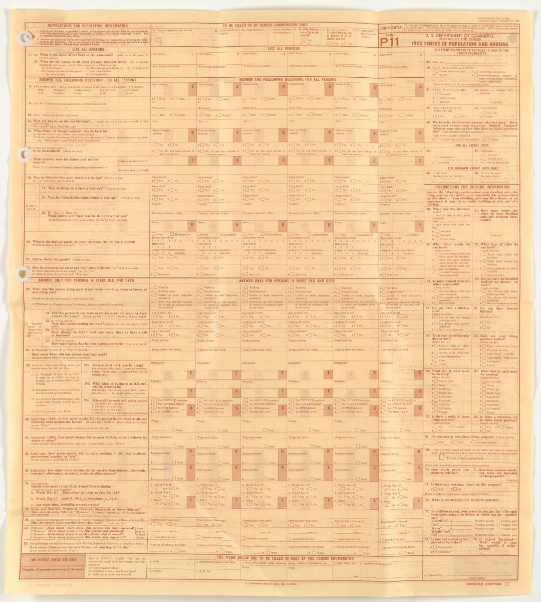
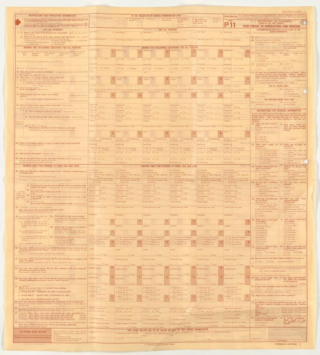
Form P11: Census of Population and Housing
Form P12A: Census of Population and Housing (household schedule)
Form P12A: Census of Population and Housing (household schedule) (front)
Image Specifications: Microfilm Source
Form P12A: Census of Population and Housing (household schedule) (back)
Image Specifications: Microfilm Source
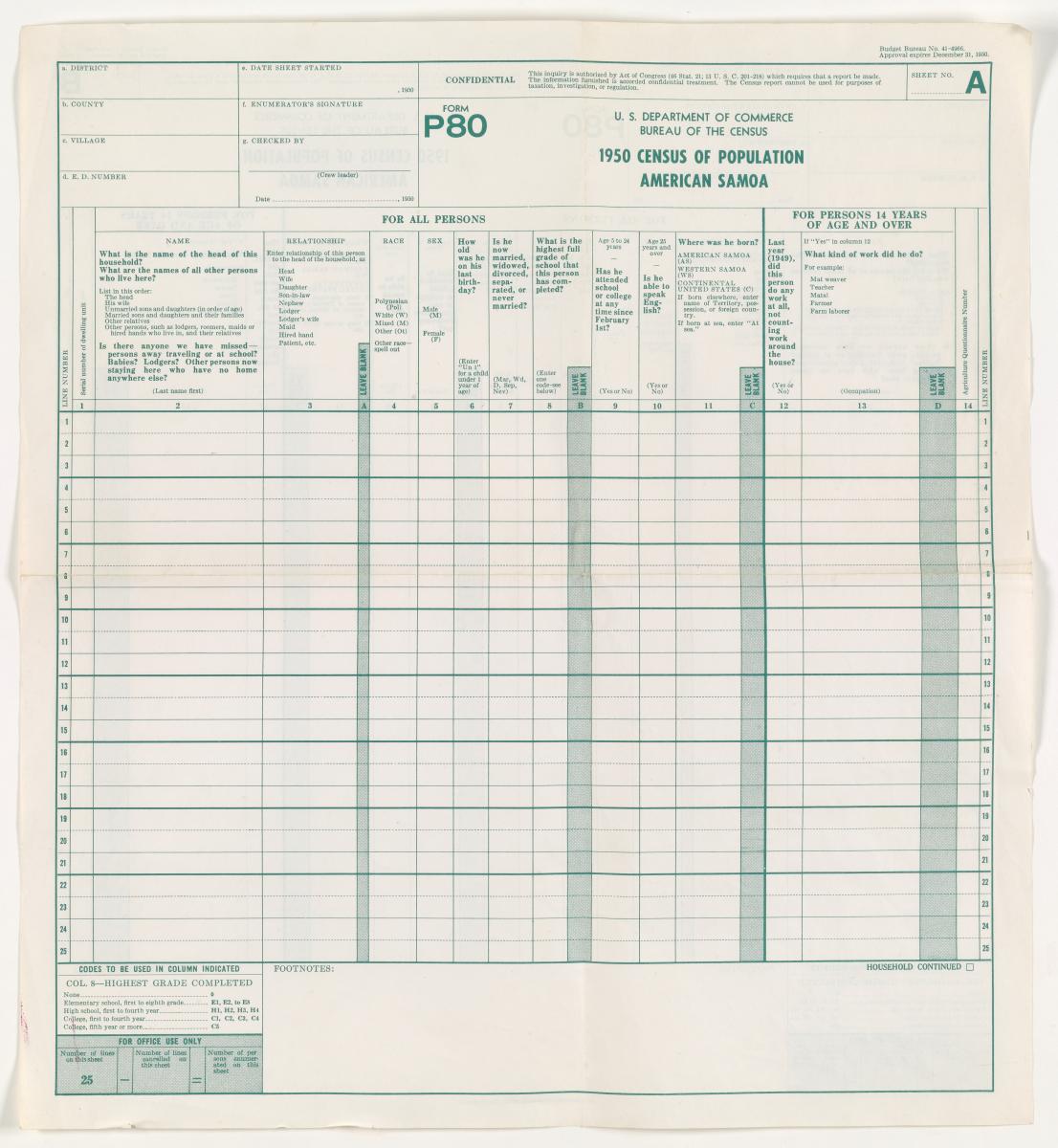
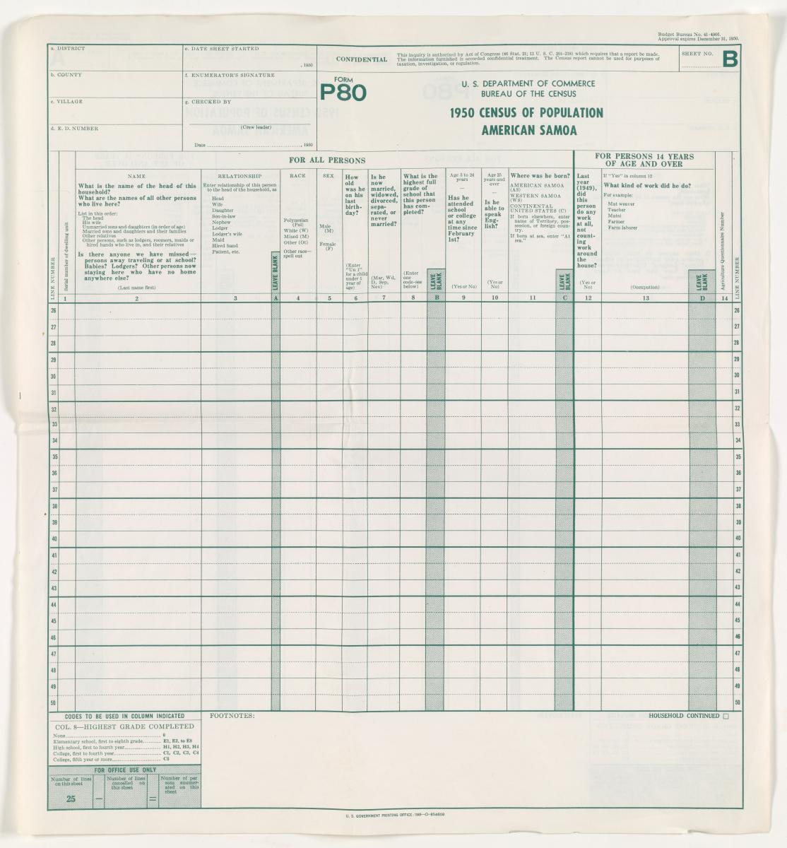
Form P80: Population of American Samoa
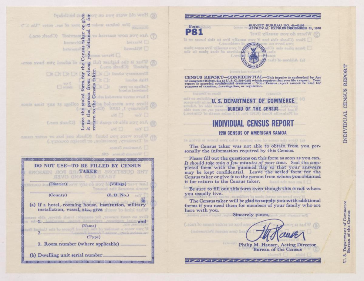
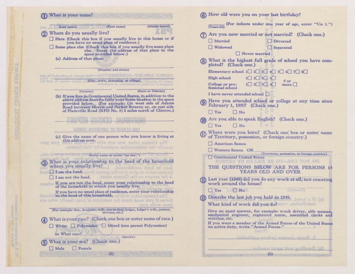
Form P81: American Samoa Individual Census Report
Form P82: Population and Housing of Alaska

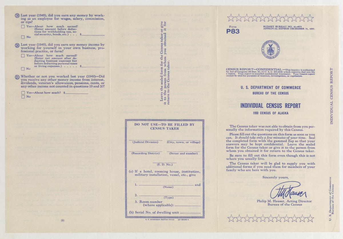
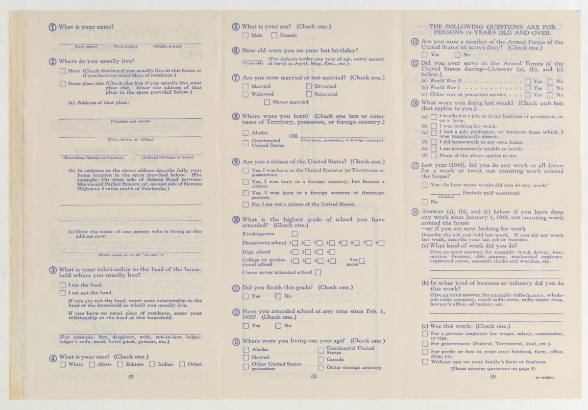
Form P83: Alaska Individual Census Report
Form P85: Population of Guam
Form P86: Guam Individual Census Report
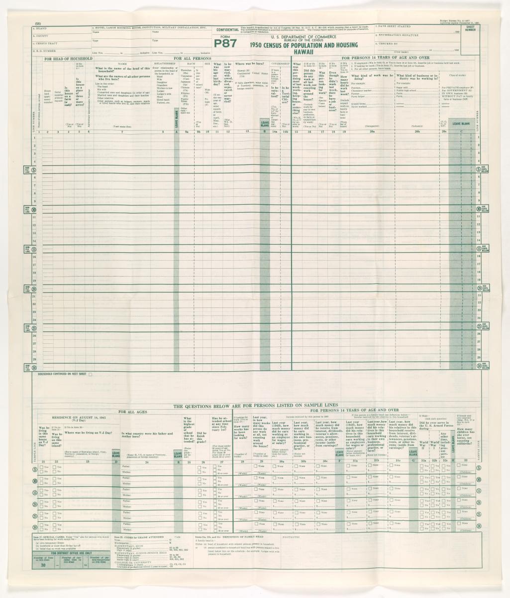
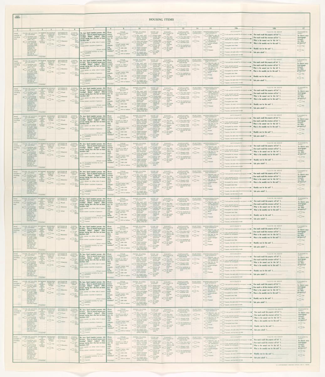
Form P87: Population and Housing of Hawaii
Form P88: Hawaii Individual Census Report
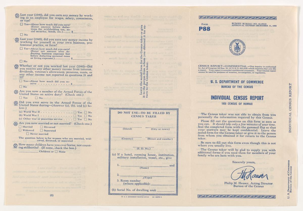
Form P88: Hawaii Individual Census Report (front)
Image Specifications: Microfilm Source; Paper Source
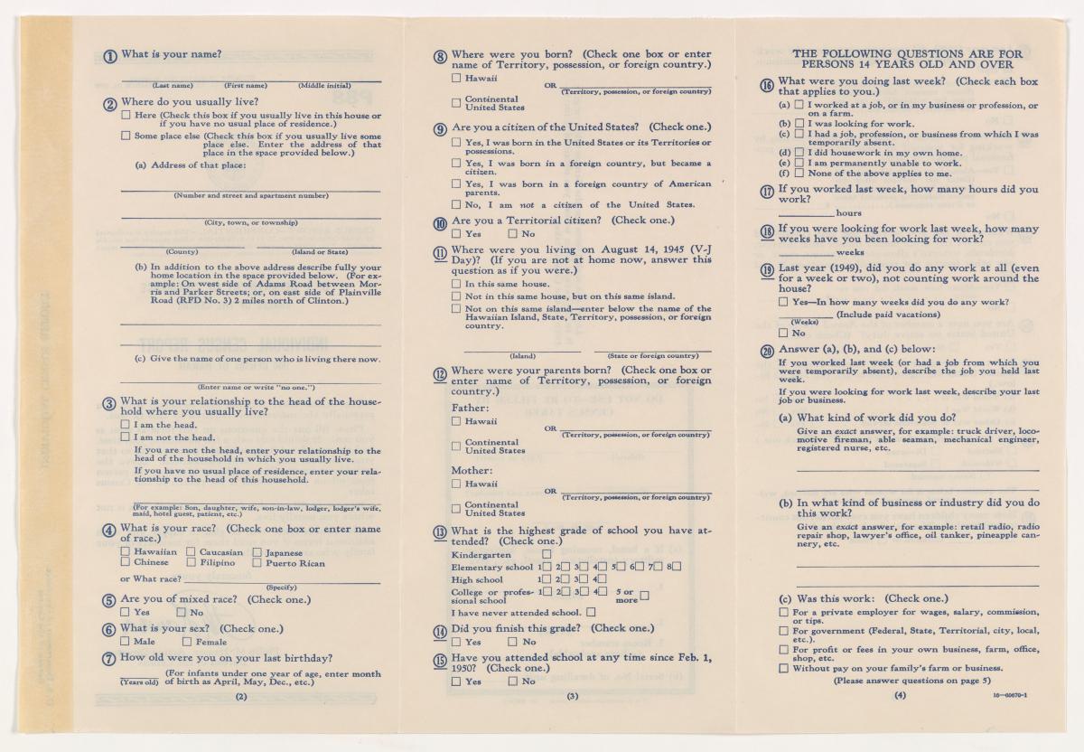
Form P88 - Hawaii Individual Census Report (back)
Image Specifications: Microfilm Source; Paper Source
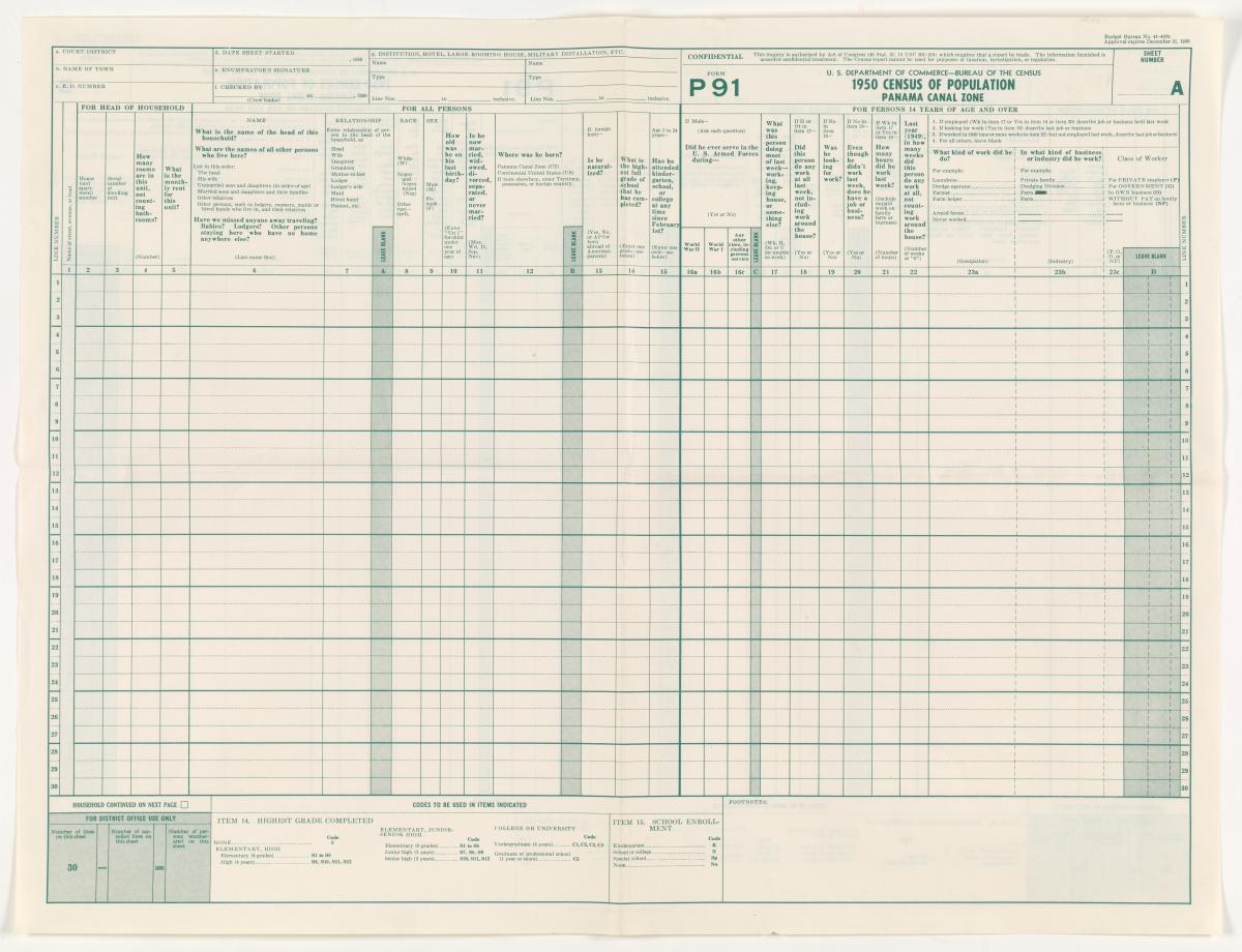
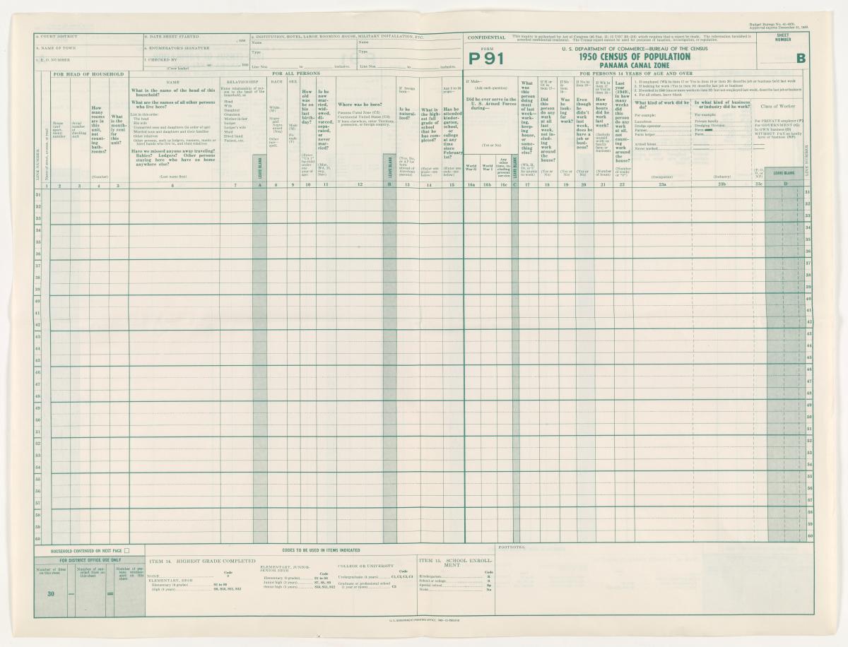
Form P91: Population of Panama Canal Zone
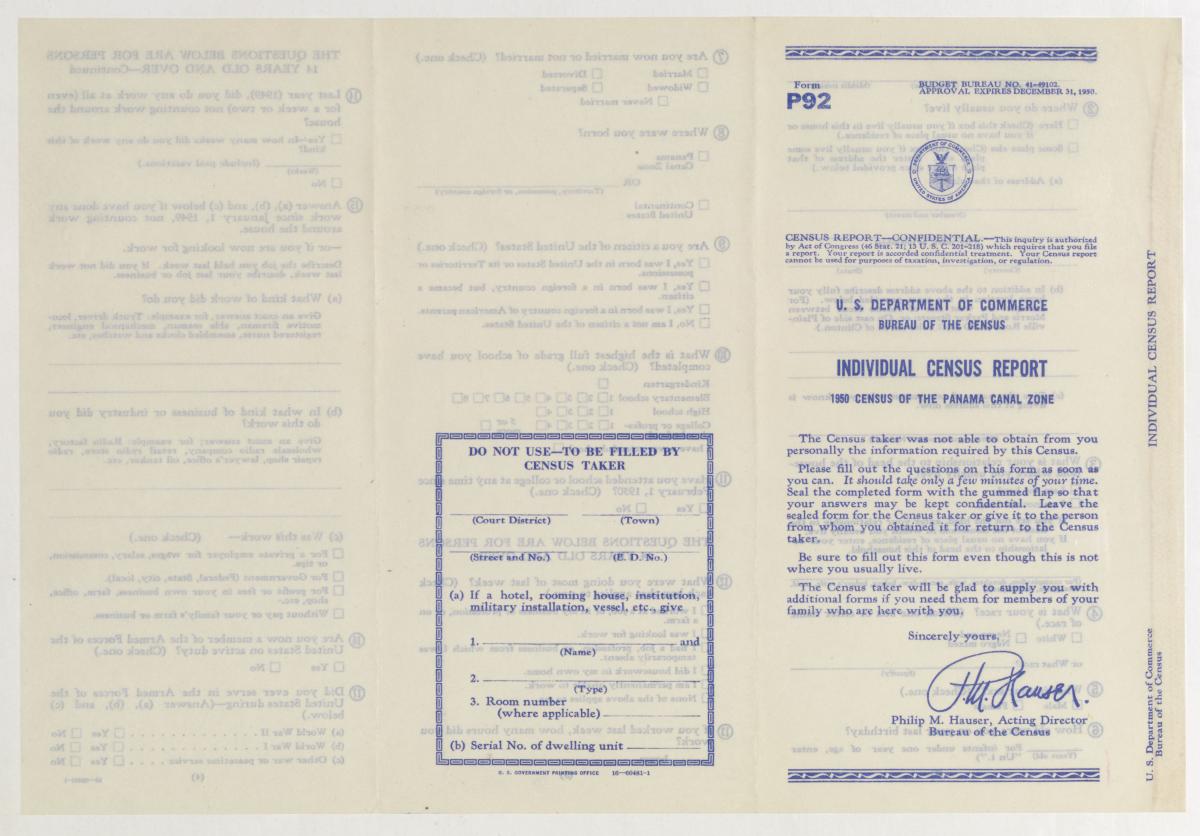
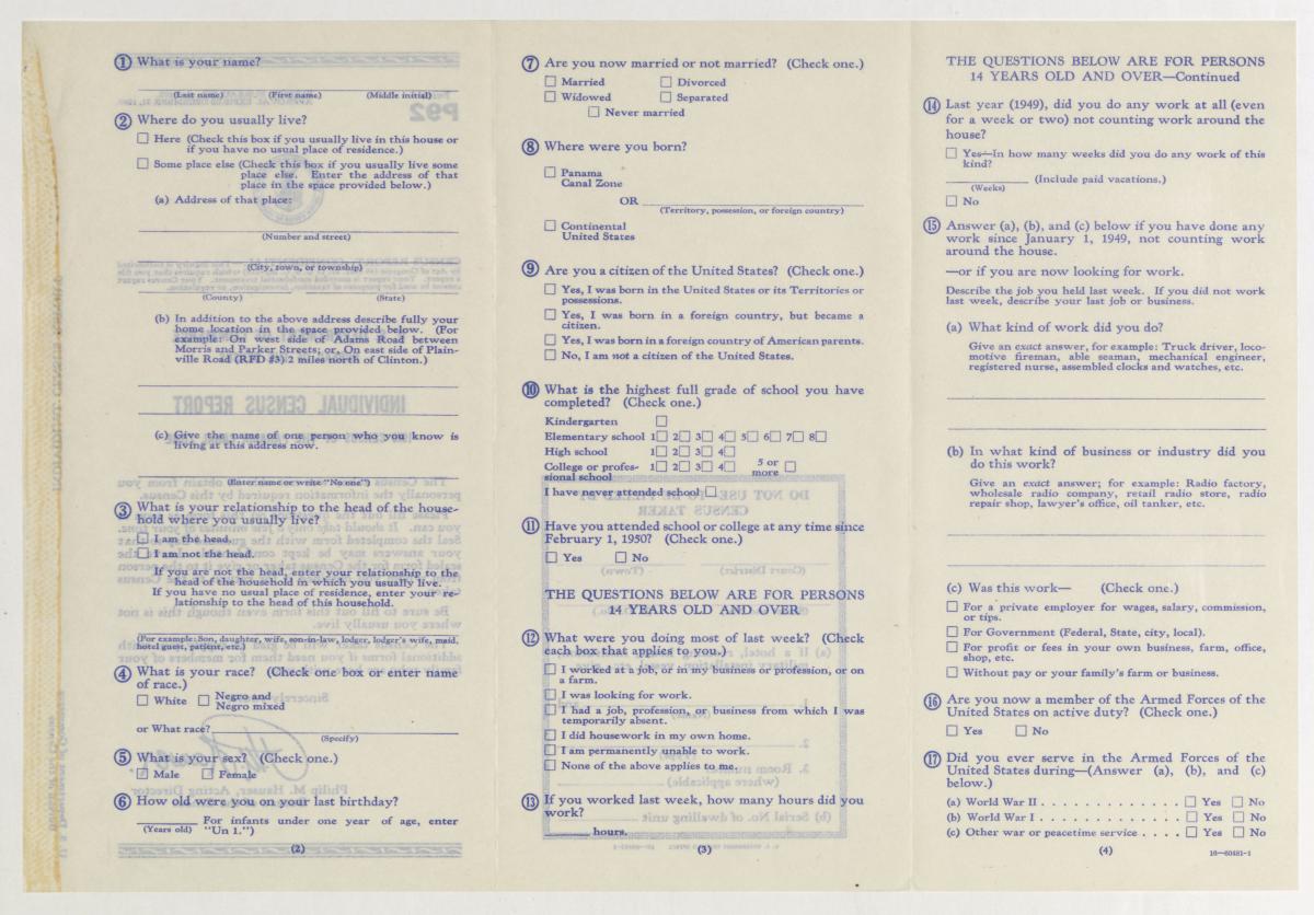
Form P92: Panama Canal Zone Individual Census Report
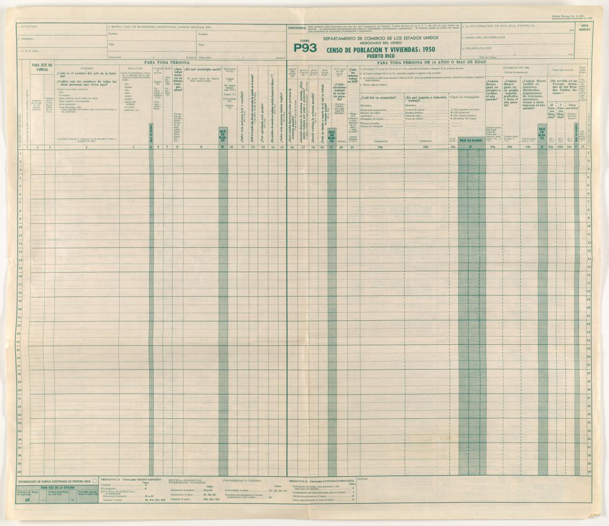
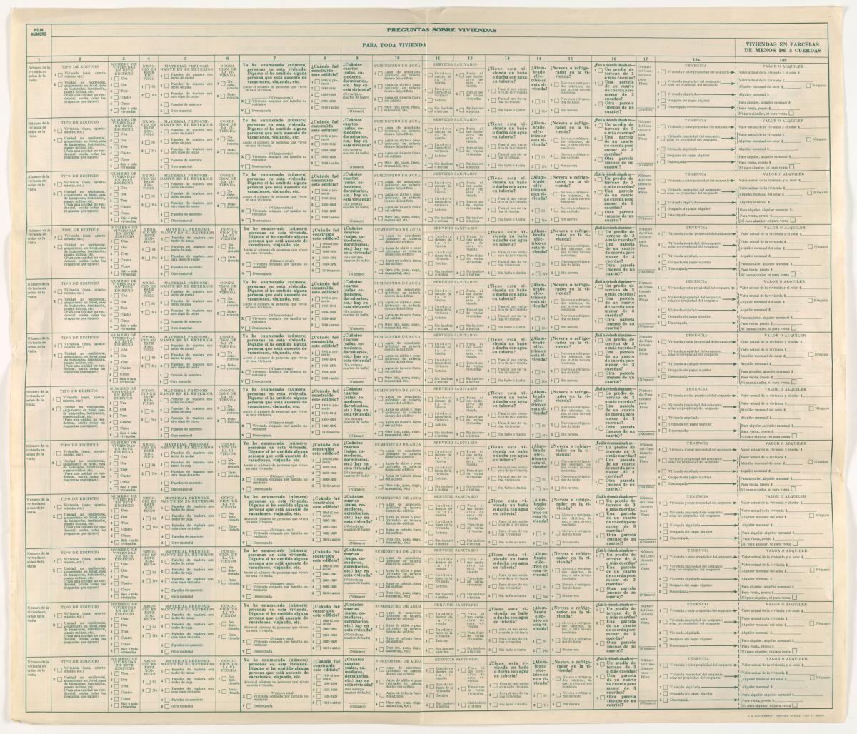
Form P93: Population of Puerto Rico
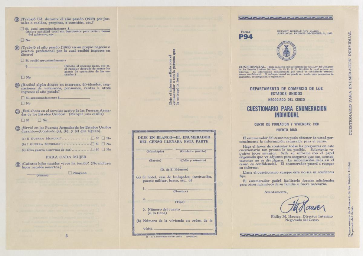
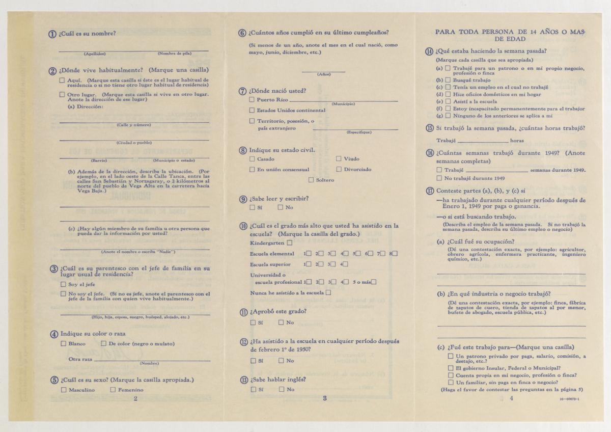
Form P94: Puerto Rico Individual Census Report
Form P97: Population and Housing of U.S. Virgin Islands
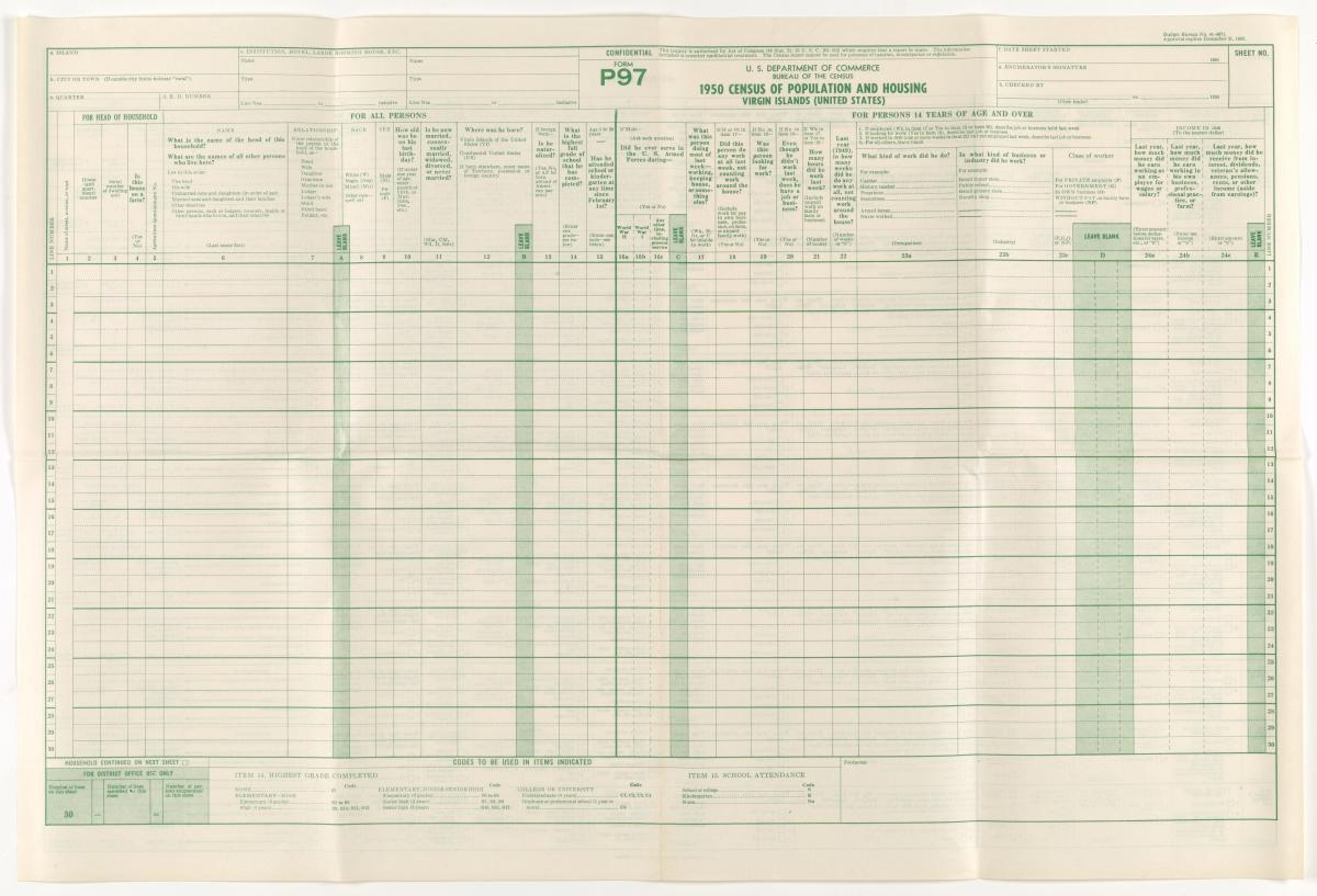
Form P97: Population and Housing of U.S. Virgin Islands (front)
Image Specifications: Microfilm Source
Form P97: Population and Housing of U.S. Virgin Islands (back)
Image Specifications: Microfilm Source
Form P98: U.S. Virgin Islands Individual Census Report
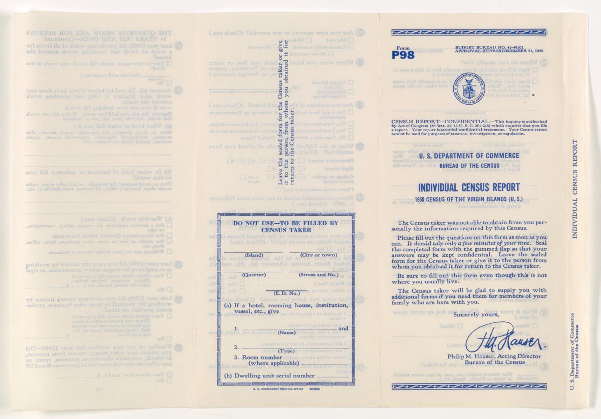
Form P98: U.S. Virgin Islands Individual Census Report (front)
Image Specifications: Microfilm Source
Form P98 - U.S. Virgin Islands Individual Census Report (back)
Image Specifications: Microfilm Source
Enumeration District Maps
The 1950 Census enumeration district maps contain maps of counties, cities, and other minor civil divisions that show enumeration district, census tract, and related boundaries and numbers used for each census. The coverage is nationwide and includes territorial areas. There are approximately 9,600 digitized images of the 1950 Census Enumeration District Maps, which are fully described in the NARA Catalog Entry: Enumeration District and Related Maps, 1880 - 1990. A small number of Enumeration Districts do not have corresponding maps.
Image Specifications
- 24 bit color JPEG images
- Digitized with imaging equipment set at 300 dpi at original size (varies, 20” - 50” per side) with 5,000 to 12,000 pixels on the longest dimension
- JPEG images are 4 to 8 MB
Enumeration District Descriptions
The 1950 Census enumeration district descriptions contain written descriptions of Census Districts, Subdivisions, and Enumeration Districts. There are approximately 63,000 digitized images of the 1950 Census Enumeration District Descriptions, which are fully described in the NARA Catalog Entry: Enumeration District Descriptions, 1850 - 1950. A small number of Enumeration Districts do not have corresponding descriptions.
Image Specifications
- 8 bit grayscale JPEG images
- Digitized with imaging equipment set at 400 dpi with 2,100 to 2,200 pixels on the longest dimension
- JPEG images are 1 to 2 MB
Metadata Index Details
Metadata for the dataset will be provided in JSON format and will include the fields listed below. Not all metadata entries will include a Native American Reservation Name as they are only on the approximately 35,000 images of the “Indian Reservation Schedule.” The provided example does include a Native American Reservation Name.
- State
- County (City information provided when available)
- Enumeration district number
- Enumeration district description
- Microfilm roll number
- Folder and image file names
- Native American Reservation Name from “Indian Reservation Schedule” if applicable
Access Methods
Users can access the full 1950 Census dataset using the Amazon Resource Name (ARN), a method to uniquely identify resources on AWS so that users can locate the dataset.
Additionally, users can access both the full dataset and specific portions of the dataset using the AWS Command Line Interface (CLI), an open source tool that enables users to interact with AWS services using commands in their command-line. Documentation for AWS CLI is available here.
Accessing the Full Dataset
The full dataset can be accessed with the following ARN:
arn:aws:s3:::nara-1950-census
To list the full dataset using AWS CLI, use the following command:
aws s3 ls --recursive s3://nara-1950-census/ --no-sign-request
To pull the full dataset using AWS CLI, use the following command:
aws s3 sync s3://nara-1950-census/ [destination] --no-sign-request
Accessing Portions of the Dataset
To pull portions of the dataset, i.e. only the metadata index, only the population schedules, only the enumeration district maps, only the enumeration district descriptions, or any combination thereof, the following AWS CLI commands can be used:
| Dataset Portion | Description | AWS CLI Command |
|---|---|---|
| Metadata Index | Full metadata index to the 1950 Census holdings, including the population schedules, the enumeration district maps, and the enumeration district descriptions. Metadata is in JSON format. | aws s3 sync s3://nara-1950-census/metadata/ [destination] --no-sign-request |
| Population Schedules | Digitized images of the forms (population schedules) used by Census enumerators to enumerate U.S. citizens. Images are both tiff and JPG. |
aws s3 sync s3://nara-1950-census/1950census/ [destination] --no-sign-request aws s3 sync s3://nara-1950-census/tiff/1950census/ [destination] --no-sign-request
|
| Indian Reservation Population Schedules | Digitized images of the forms (Indian reservation population schedules) used by Census enumerators to enumerate U.S. citizens. Images are both tiff and JPG. |
aws s3 sync s3://nara-1950-census/1950-IndianCensus/ [destination] --no-sign-request aws s3 sync s3://nara-1950-census/tiff/1950-IndianCensus/ [destination] --no-sign-request |
| Maps | Digitized images of annotated maps of counties, cities, and other minor civil divisions that show enumeration districts, census tract, and related boundaries and numbers used for each census. Images are JPG. | aws s3 sync s3://nara-1950-census/1950census-maps/ [destination] --no-sign-request |
| Enumeration District Descriptions | Digitized images of written descriptions of geographic areas included within enumeration districts. Images are JPG. | aws s3 sync s3://nara-1950-census/1950census-descriptions/ [destination] --no-sign-request |
Accessing the Dataset By State/Territory
To pull images for specific states and territories, the following AWS CLI commands can be used based on the example provided for Alaska. The two-letter abbreviations for states and territories can be viewed below:
| State/Territory | Dataset Portion | AWS CLI Command |
|---|---|---|
| Alaska | ||
| Population Schedules | aws s3 sync s3://nara-1950-census/1950census/43290879-Alaska/ [destination] --no-sign-request | |
| Enumeration District Maps | aws s3 sync s3://nara-1950-census/1950census-maps/Alaska/ [destination] --no-sign-request | |
| Enumeration District Descriptions | aws s3 sync s3://nara-1950-census/1950census-descriptions/Alaska/ [destination] --no-sign-request |
Enumeration District Summaries by State
Below are links to HTML tables and JSON files for each state and territory that list counties, enumeration districts, geographic descriptions of each enumeration district, and the relevant directory paths to use for AWS CLI commands. It is important to note that not all cities/towns are indexed in the geographic descriptions.