![]()
German Flown Foreign Aerial Photography (GX) in Record Group 373: Records of the Defense Intelligence Agency
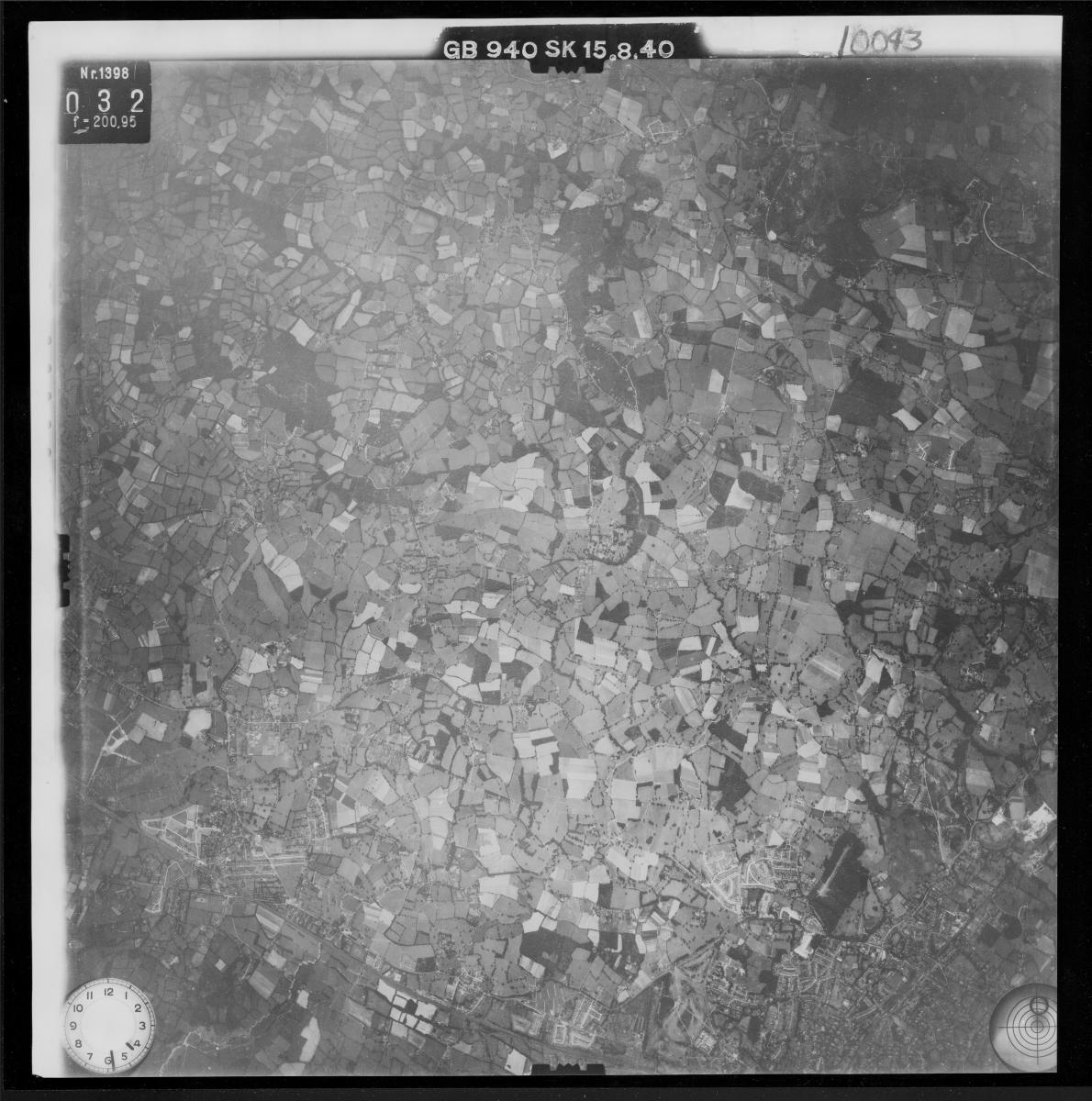
The National Archives Cartographic Branch holds approximately 1.2 million aerial photographs taken by the German Luftwaffe during World War II. Commonly referred to as GX prints, these photographs are in the series German Flown Aerial Photographs, 1939 - 1945.
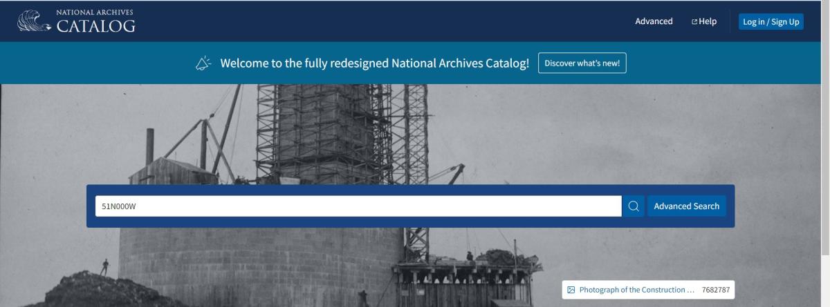
Similar to other foreign photography, GX prints can be located using the Overlay Indexes for Aerial Photography. These overlay indexes are filed by degree square. To see if your degree square is available, you can enter it directly into the main search bar in our catalog as shown in the following examples. The latitude must be two digits and the longitude must be three digits. (Ex: 48N002E; 56N003W)
When you click the search button with the degree square in the search bar, the file unit for the overlays will appear in the results.

After clicking on the title of the degree square file unit you can see the individual overlay indexes.
You can hover the mouse over the scan and click the "Click to interact" button or the plus button in the upper left hand side to zoom in on the image. You can download the scans by clicking the download button to the left under the image.
To search for coverage using these index overlays, locate your area of interest on the map and place the overlays to line up the 30 minute line and corners to match the map. It can be helpful to place a sticky note on your computer screen on the area of interest on the map so that as you search through the overlays you can match up the area with available coverage.

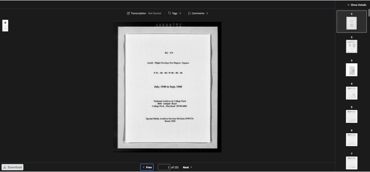
RG 373, Overlay Indexes for Aerial Photography of the Defense Intelligence Agency, 1935 - 1971, Overlay indexes for degree square 51N000W
Please note that while you can zoom in on the map to find a location, you must be zoomed out to the default scale (seen above) to have the map line up with the overlays. Since the overlays correspond directly with the locations on the map, you can line up the bottom of the item box, where the "Previous" and "Next" buttons are, with the bottom of your internet browser screen. That way you can ensure that the overlays are properly lined up with the map.
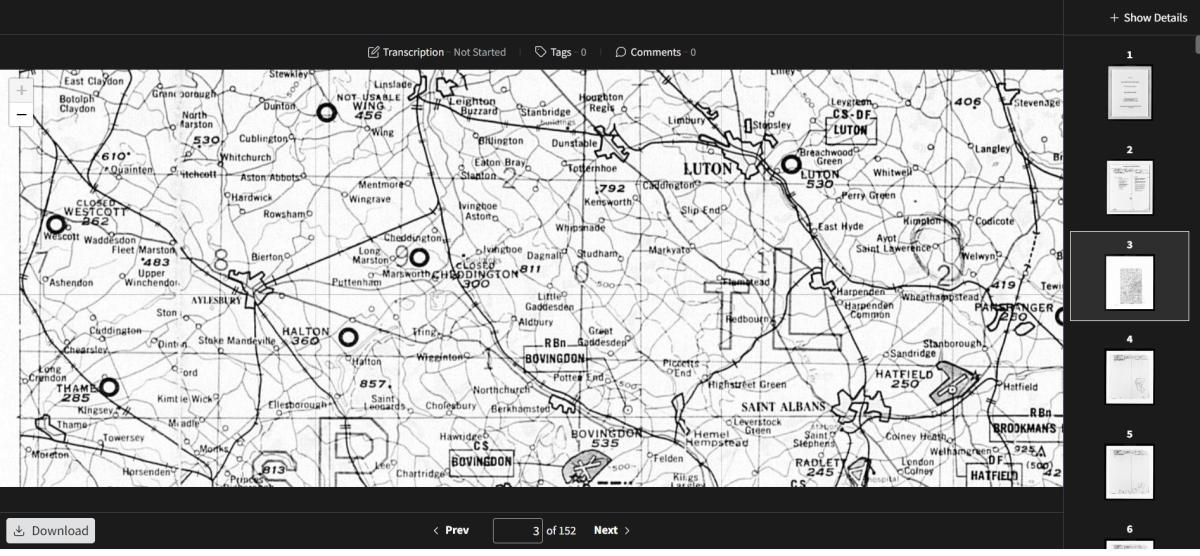
When navigating through the overlay images, if you zoom in or out on an image, you can reset the placement of the overlay by clicking either the "Previous" or "Next" button below the image and navigate back to it. This will reset the image to the default placement.
After identifying your area of interest on the map, you can search through the overlays by scrolling through the thumbnails on the right of the screen or clicking on the "Next" and "Previous" buttons below the image.
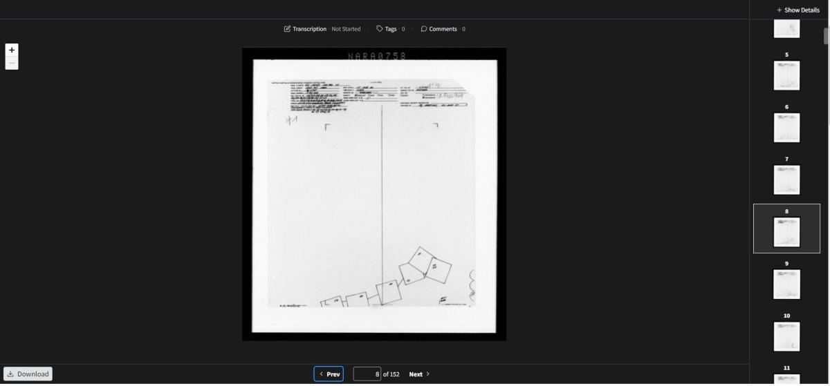
RG 373, Overlay Indexes for Aerial Photography of the Defense Intelligence Agency, 1935 - 1971, Overlay indexes for degree square 51N000W, Sheet NARA 758
German flown aerial prints will include either a GX, TUGX or DTGX number. These numbers handwritten in the top left line labeled "Orgn. And Sortie." The numbers are used to locate the specific box of photographic prints. Along with the GX number there is often a camera position identifier, such as SD, SK or SG. These are also needed with the GX number to locate the photographs if it is provided on the overlay.
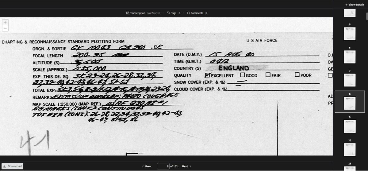
The numbered boxes on the overlay represent the individual exposure numbers within that GX box. The lines connecting the squares also represent photographs included in the box and can be used to estimate the number for a print within the range of exposures.
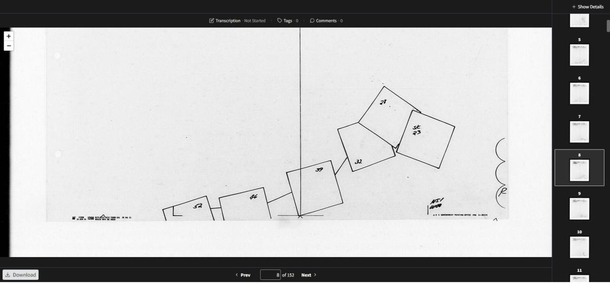
To locate the photographs, you need a citation with the GX number, scale identifier (if shown) and exposure number. Using this overlay as an example, a citation would look like the following:
GX 10043 SK, Exposure 32
Using the GX number and scale identifier, you can request to view the box of photographs in the Cartographic Research Room. The print with the exposure number can be found in the box.
In addition to using the overlays to locate photographs, the Cartographic Research Room holds additional finding aids for GX prints related to Operation Dick Tracy. Occasionally the Dick Tracy, or DTGX, photographs are referenced in the overlays, but the additional finding aids provide extensive detail related to available coverage for these specific photographs.
Once you access the box in our research room, you can take pictures of the photographs or scan them. We have aerial film scanners available. If you have a USB capable laptop, you can bring it to our research room and scan the photographs to your computer. You can learn more about aerial photography reproductions here.
NARA has a partnership with the National Collection of Aerial Photography, Scotland. The photographs scanned by NCAP are currently being added to the NARA Catalog and can be viewed via the series description.
You can view a related blog post on the Unwritten Record blog here: Researching Foreign Aerial Photography – Captured German Aerial Prints.
If you have any questions about researching or accessing these photographs, please contact the Cartographic Branch at carto@nara.gov.