![]()
Aerial Photography at the National Archives at Denver, Colorado
Contact Information for NARA at Denver
Record Group 30: Federal Highway Construction Photos, 1919 - 1971
This series consists of over 60,000 photographic prints and negatives documenting construction work on federal highway projects in Colorado, Wyoming, New Mexico, Utah, South Dakota, and Texas. This series is partially digitized.
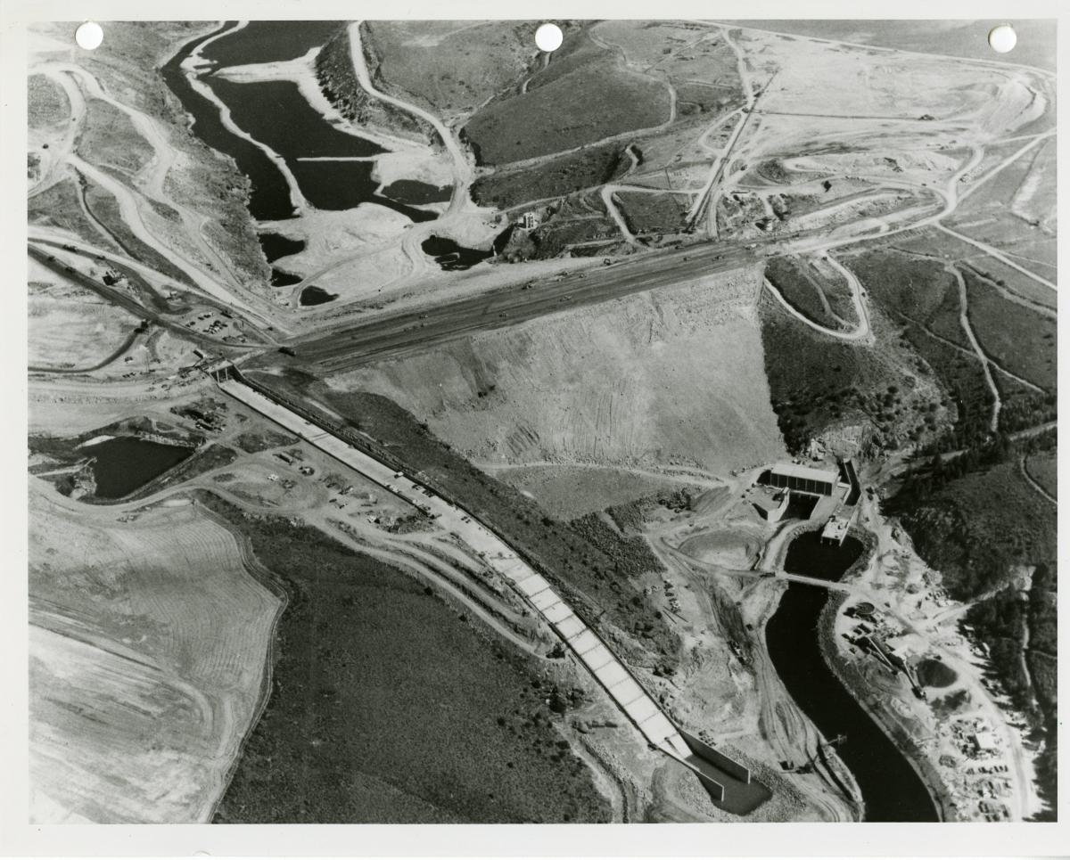
Record Group 49: Aerial Photographs, 1948 - 1960
This series consists of aerial photographs.
Record Group 49: Group Survey Files, 1933 - 1966
This series consists of group survey files compiled by field survey parties under the contract system initiated in 1910. These particular surveys are generally "dependent resurveys" conducted at the request of the Forest Service, the Grazing Service, or the U.S. Geological Survey. Typically included in a file are lists of the existing land use entries within the survey area; papers authorizing the survey; special instructions with occasional supplements which often include a history of the surveys of the area, procedures to be followed, and diagrams and drawings; lists of equipment issued to the survey party; original and copies of correspondence relating to the survey; field notes; and drawings with notations about the survey work. Also included are correspondence received from and copies of answers sent to land owners concerning the impact the resurvey would have on their holdings. If the survey was protested, the file also includes correspondence concerning the protest, depositions relating to the conduct of the survey, and explanations of conditions by the surveyors. Also included occasionally are notations on expenditures, documents detailing problems associated with the survey, and annotated plats and aerial photographs.
Record Group 49: Records Related to Resource Inventories, Studies, and Survey Files, 1979 - 1990
This series consists of records related to resource inventories, studies, and surveys. Types of records include reports, maps, management plans, conclusions, correspondence, aerial photographs, and memorandums. Topics covered include forage, hydrology, arid regions, ecology, proposed primitive areas, and designated wilderness areas. The finding aid for the series is available at NARA at Denver.
Record Group 49: Records Relating to Resource Inventory Studies, 1/1/1983 - 10/31/1983
This series consists of records related to resource inventories, studies, and surveys. Types of records include reports, maps, management plans, conclusions, correspondence, aerial photographs, and memorandums. Topics covered include forage, hydrology, arid regions, ecology, proposed primitive areas, and designated wilderness areas.
Record Group 49: Resources Inventories, Studies, and Surveys, 1922 - 1982
This series consists of resource studies, inventories, and surveys, primarily for grazing allotments in western Colorado. The files include classification data, inspection reports, maps, and aerial photographs.
Record Group 54: Research Reports, Including Aerial Photographs and Precipitation Charts, 1934 - 1941
This series consists of research reports, including aerial photographs and precipitation charts pertaining to New Mexico, Texas, and Arizona. The finding aid for the series is available at NARA at Denver.
Record Group 70: Photographs, Maps, Charts, Graphs and Correspondence, 1957 - 1961
This series consists of photographs, maps, charts, graphs and correspondence pertaining to the San Manual copper mine in Pinal Canyon, Arizona. Contained are aerial and other photographs, contour information, information on slope conditions, and information on ore extraction.
Record Group 75: Aerial Photographs, 1947
This series consists of aerial photographs of the Missouri River from the area around Yankton, South Dakota to the area around Stanton, North Dakota.
Record Group 75: Correspondence Files, 1917 - 1958
This series consists of administrative records of the Fort Belknap Indian Agency. The major subject matters are General and Statistical Information, Administrative, Financial and Accounting, Lands, Buildings and Building Equipment, Supplies and Farm Stock, Military Activities, Health and Social Relations, Education, and Industries and Employment. The types of records include correspondence, memorandums, maps, journals, and census and medical records. The finding aid for the series is available at NARA at Denver.
Record Group 75: Soil Survey and Cost Reports, 1933 - 1953
This series consists of soil survey reports, planning and classification reports, irrigation project construction and maintenance budget estimates, soil classification reports, farm records detailing percentages of irrigable land, and livestock and crop yields. There are also some land classification aerial photographs.
Record Group 77: Civil Works Project Files, 9/1/1949 - 12/31/1970
This series consists of aerial photography contact sheets for the Rio Grande valley and basin.
Record Group 77: Hydrology Data Maps, 12/1969 - 9/1980
This series consists of hydrological data maps created by U.S. Army Engineer District, Albuquerque. The records also include blueprints, manuscripts, cross sections, topographical maps, and occasional orthophotos or aerial photographs. These documents cover the Rio Grande, Puerco Rio Salado and Arkansas Rivers, Abiquiu Reservoir, and the watersheds for Albuquerque, Sandia, Las Cruces, Alamogordo, New Mexico; and Fort Bliss and El Paso, Texas. The finding aid for the series is available at NARA at Denver.
Record Group 77: Plans, Maps, and Worksheets, 1937 - 1962
This series consists of plans, maps, and worksheets prepared by the Office of the Chief of Engineers, Southwest Division, Albuquerque District. The types of records include highway plans, drainage reports, aerial photographs, maps, and quadrangle maps for hydrology studies. The records cover Lordsburg, New Mexico and the surrounding vicinity. The finding aid for the series is available at NARA at Denver.
Record Group 77: Survey Reports, 1937 - 1954
This series consists of survey report files for the Office of the Chief of Engineers, Southwest Division, Albuquerque District. The types of records include survey reports, photographs, maps, aerial photographs, economic data reports, flood control reports, public hearings, and correspondence. These surveys cover the Rio Chamita Stream; Tularosa and Cibola Creeks; Arkansas, Animas, Huerfano, Purgatoire, Rio Grande, Pecos, and Rio Hondo Rivers; John Martin, Galisteo, Jemez Canyon, and Cochiti Reservoirs; El Paso, Texas; and Alamogordo, Las Cruces, Socorro, and Albuquerque, New Mexico. The finding aid for the series is available at NARA at Denver.
Record Group 79: General Correspondence, 1954 - 1968
This series consists of general correspondence for the Washington Office, Office of Design and Construction. The correspondence relates to subjects such as Mission 66, creation of master plans, health and safety concerns, fiscal policies, dedication services, forestry law and legislation, interpretive planning, and water rights. Records exist for most of the National Park Service areas existing by 1968. The finding aid for the series is available at NARA at Denver. This series is partially digitized.
Record Group 95: Records relating to Timber Sales, Inspection Reports, Special Use Permits, Annual Fire Reports, and Other Historical Files, 1897 - 1984
This series consists of records relating to timber sales, inspection reports, special use permits, annual fire reports, and other historical files. Other topics covered in the series include public information releases, transportation plans, work performance evaluations, mining claims, and trespass. The finding aid for the series is available at NARA at Denver. This series is partially digitized.
Record Group 114: General Records, 1935 - 1936
This series includes correspondence, memorandums, technical studies and papers, and reports concerning drought relief, hydrology, research, range management, proposed projects, aerial photography, grazing, grasses, and forestry. There is information relating to Black Squirrel Creek (Col-1), Springfield (Col-2), Cherry Creek (Col-3), and Smokey Hill River (Col-4). The records appear to have been maintained primarily by A. E. McClymonds, State Coordinator, and A. E. Jones, Soil Conservationist, in Colorado Springs.
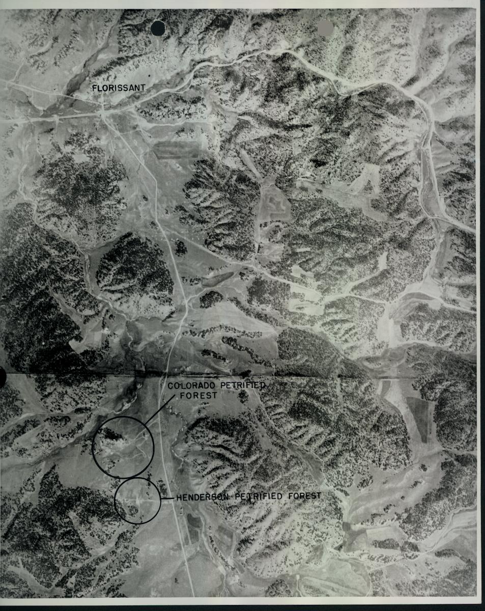
Record Group 115: Aerial Photographs, 1937 - 1938
This series consists of aerial photographs.
Record Group 115: Aerial Photographs, 1952
This series consists of aerial photographs of forest lands in the Rocky Mountain region.
Record Group 115: Aerial Photographs, 1965 - 1969
This series consists of aerial photographs created by the Department of the Interior, Bureau of Reclamation, Region 1, Pacific Northwest. The photographs cover the Oroville-Tonasket Unit of the Chief Joseph Dam Project.
Record Group 115: Aerial Photographs and General Files, 1963 - 1980
This series consists of aerial photographs and general files, primarily related to projects in New Mexico, created by the Department of the Interior, Bureau of Reclamation, Region 4, Upper Colorado. Topics covered in this series include canals and rivers. The finding aid for the series is available at NARA at Denver.
Record Group 115: Land Classification Aerial Photographs, 1952 - 1967
This series consists of land classification aerial photographs created by Department of the Interior, Bureau of Reclamation, Region 1, Pacific Northwest.
Record Group 115: Land Classification Aerial Photographs and Plats, 1937 - 1997
This series consists of land classification aerial photographs and plats. Locations include the Yuma River, Cliff Divide, Yellow Jacket, White River, Gunnison River, Savory Pothook, Basalt, and West Divide Projects. The finding aid for the series is available at NARA at Denver.
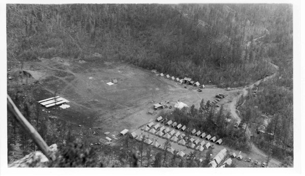
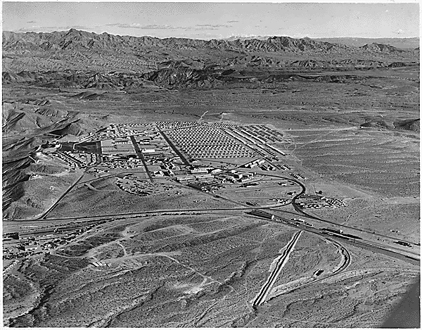
Record Group 115: Construction Photographs, 1903 - 1972
This series consists of photographs that chronicle the construction progress of various Bureau of Reclamation projects in Washington, Oregon, California, Arizona, Utah, Idaho, Montana, Wyoming, Colorado, New Mexico, Texas, Oklahoma, Kansas, Nebraska, South Dakota, and North Dakota. Images include project sites, construction work in progress, and a variety of scenes depicting local events and ceremonies related to project construction and dedications. The series was compiled primarily from periodic narrative or work reports, such as weekly and monthly construction progress reports. This series is partially digitized.
Record Group 115: Photographs, 1902 - 2002
This series consists of photographs created by the Department of the Interior, Bureau of Reclamation, Denver Office. The topics of the photographs include reclamation projects; Teton, Guernsey, and Grand Coulee Dams; staff; Bureau of Reclamation 90th anniversary commemorations; the Kansas Project; and Aspen, Colorado. This series also includes some aerial photographs. The finding aid for the series is available at NARA at Denver. This series is partially digitized.
Record Group 115: Photographs and Related Indexes, 1912 - 1993
This series consists of photographs and related indexes. The finding aid for the series is available at NARA at Denver.
Record Group 115: Project Studies, Correspondence, and Supporting Data, 1938 - 1968
This series consists of project studies, correspondence, and supporting data created by the Department of the Interior, Bureau of Reclamation, Region 5, Southwest. The records include aerial photographs, drawings and maps. Topics covered in this series include canals and dams.
Record Group 115: Records Relating to Aerial Surveys, 6/27/1987
This series consists of records relating to aerial surveys created by the Department of the Interior, Bureau of Reclamation, Engineering and Research Center. The types of records include photographs, notebooks, and reports. The surveys are for Box Butte and Seminoe Dams, and the Mirage Flats Project.
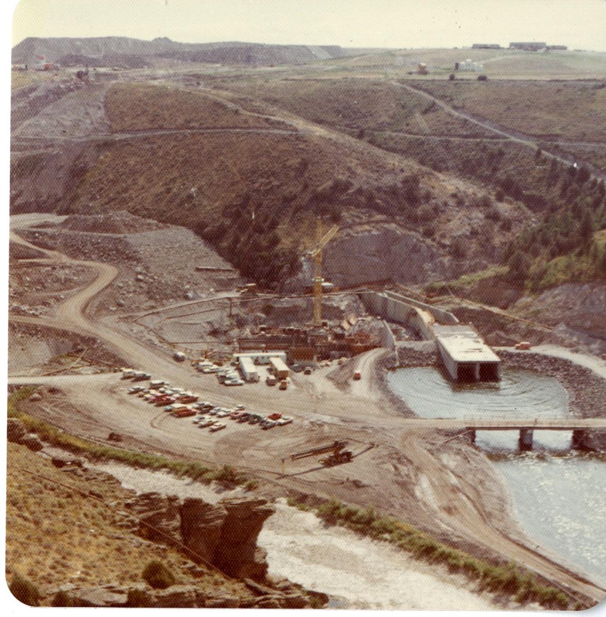
Record Group 115: Records Relating to the Failure of Grand Teton Dam, 1976 - 1981
This series consists of records related to the failure of Teton Dam created by the Department of the Interior, Bureau of Reclamation, Engineering and Research Center. The types of records include photographs, reports, records of investigations, depositions, exhibits, and transcripts of hearings. The finding aid for the series is available at NARA at Denver. This series is partially digitized.
Record Group 115: Records Relating to Planning Boards and Commissions, 1936 - 1968
This series consists of records relating to planning boards and commissions. The records include correspondence, reports, memorandums, field notes, drawings, and aerial photographs. Records relate to the U.S. Study Commission on the Neches, Trinity, Brazos, Colorado, Guadalupe, San Antonio, Nueces, and San Jacinto River Basins and intervening areas. The finding aid for the series is available at NARA at Denver.
Record Group 115: Texas Basin Aerial Photographs and Maps, 1938 - 1968
This series consists of aerial photographs and maps of the Texas Basin created by the Department of the Interior, Bureau of Reclamation, Region 5, Southwest. The finding aid for the series is available at NARA at Denver.
Record Group 338: Historical Records, 1918 - 1996
This series consists of historical records of Fitzsimons Army Medical Center. The records detail the daily activities of the hospital. Topics include the daily running of the hospital, surgery and rehabilitation treatments performed on injured soldiers and veterans, medical care for soldiers and their family members, military funerals, special events and holidays, and the treatment and lodging of President Dwight D. Eisenhower and Mrs. Mamie Eisenhower during his recovery from a heart attack. Types of records found in this series include correspondence, books, reports, photographs, posters, drawings, and publications, including the hospital's magazine "The Stethoscope." The finding aid for the series is available at NARA at Denver. This series is partially digitized.

Record Group 341: Reports Regarding Proposed Air Force Academy Site Selection, 1950
This series consists of reports regarding site selection for the proposed Air Force Academy. This series is fully digitized.

Record Group 434: Aerial Photographs, 1994
This series consists of still aerial photographs documenting the entirely of the Rocky Flats plant and surrounding grounds.
Record Group 434: Uranium Operation Records, 1943 - 2002
This series consists of uranium operation records for the Department of Energy, Office of Nuclear Energy, Science, and Technology, Idaho Operations Office, Grand Junction Office. The types of records include drawings, weekly progress reports, operation studies, cost estimates, memorandums, raw data computation sheets, aerial photographs, data analysis reports, quality assurance records, and milling and metallurgical reports. These records also cover work performed by the Vanadium Corporation of America. The finding aid for the series is available at NARA at Denver.