![]()
Aerial Photography at the National Archives at Kansas City, Missouri
Contact Information for NARA at Kansas City
Record Group 21: Civil Case Files, 1938 - 1997
This series contains papers filed in civil proceedings which may include petitions, bills of complaint, transcripts of testimony and of record, writs, answers, depositions, exhibits, motions, court orders, decrees, findings of fact and conclusions of law, cross-petitions, affidavits, decisions, writs of error, notices, summonses, mandates, pleas, praecipes, subpoenas, and other related papers. If the case were appealed to a higher court, then information and papers relating to that appeal might be found in the case file. This series is indexed by the series Civil Dockets, 1939-1970. This series is partially digitized.
Record Group 21: Equity and Law Case Files, 1893 - 1939
This series consists of equity and law case files. Equity case files may contain bills in equity, supplemental bills, bills of complaint, affidavits, agreements, answers, amended answers, bonds, decrees, demurrers, depositions, exhibits, injunctions, joinders, motions for injunctions, motions for extensions of time, motions to dismiss complaints, notices of appeals and motions, and orders overruling demurrers; petitions, including petitions for restraining orders, petitions to show cause, petitions to distribute assets, petitions to produce documents, and petitions to stay proceedings; praecipes, proofs of service, replications, reports of special masters, rules for attachment, stipulations, subpoenas, testimony, warrants, and writs of certiorari. Law case files may contain petitions, bills of complaint, transcripts of testimony and of record, writs, answers, depositions, exhibits, motions, court orders, judgments or decrees, findings of fact and conclusions of law, cross-petitions, affidavits, decisions, writs of error, notices, summonses, mandates, pleas, praecipes, subpoenas, and other related papers. This series is partially digitized.
Record Group 22: Annual Reports, 1931 - 1963
This series consists of annual reports. The reports reflect both fiscal year and calendar year activities at stations in Arkansas, Illinois, Indiana, Iowa, Kansas, Kentucky, Louisiana, Michigan, Minnesota, Missouri, Nebraska, North Dakota, Ohio, Oklahoma, South Dakota, and Wisconsin. The records consist of narrative reports and standard forms. Topics discussed in the reports include construction and operation of fisheries; funding for employee salaries; spawning seasons; egg shipments; output of fish and eggs; and annual costs for fish maintenance. This series is partially digitized.
Record Group 27: Decimal Correspondence Files, 1950 - 1964
This series of decimal correspondence files documents a comprehensive range of functions, activities, and programs of the Central Regional Office and its regional Weather Bureau stations and substations. Topics of the correspondence include administration, weather observation and recording equipment, cooperative facilities and activities with airlines and airports, forecasts and warnings, commercial air travel, radar, natural disasters, and publications. This series also includes circulars, memorandums, published bulletins, reports, photographs, instructions, and blueprints of weather bureau facilities. The finding aid for the series is available at NARA at Kansas City. This series is partially digitized.
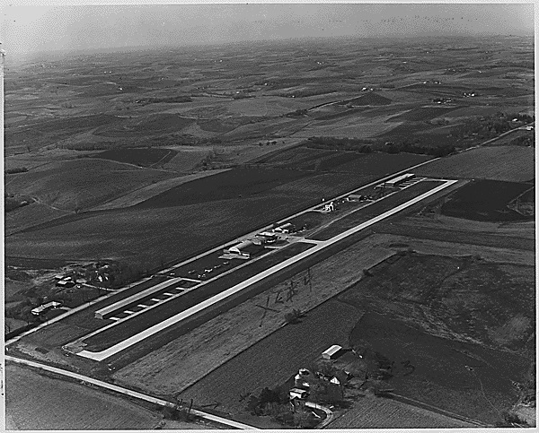
Record Group 70: Photomaps of Aerial Images, ca. 1946
This series consists of aerial images. Included in this series are aerial photomaps of the region encompassing the manganese ore deposits near Chamberlain, South Dakota. The records at the beginning of the series are composites of all the images in the series with the corresponding alpha-numeric geographic numbers to aid in finding specific photographs.
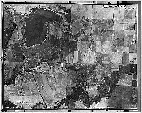
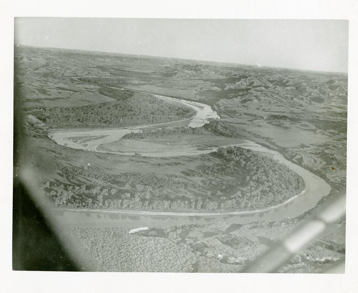
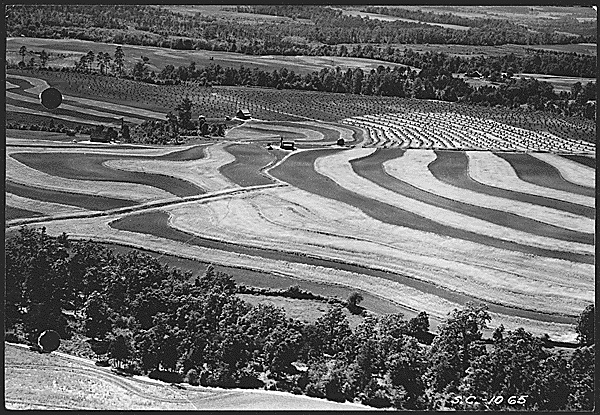
Record Group 75: Aerial Photographs, 1923 - 1967
This series consists of aerial photographs. The records are aerial photographs of the Missouri River, including adjacent land, depicting stretches of the river from Kansas City, Missouri, to Sioux City, Iowa, and from Sioux City, Iowa, to Rulo, Nebraska. The photographs originated from the Omaha District of the Office of the Chief of Engineers, and provide information on the boundaries of Indian land allotments, topography, and changes in the Missouri River. The finding aid for the series is available at NARA at Kansas City.
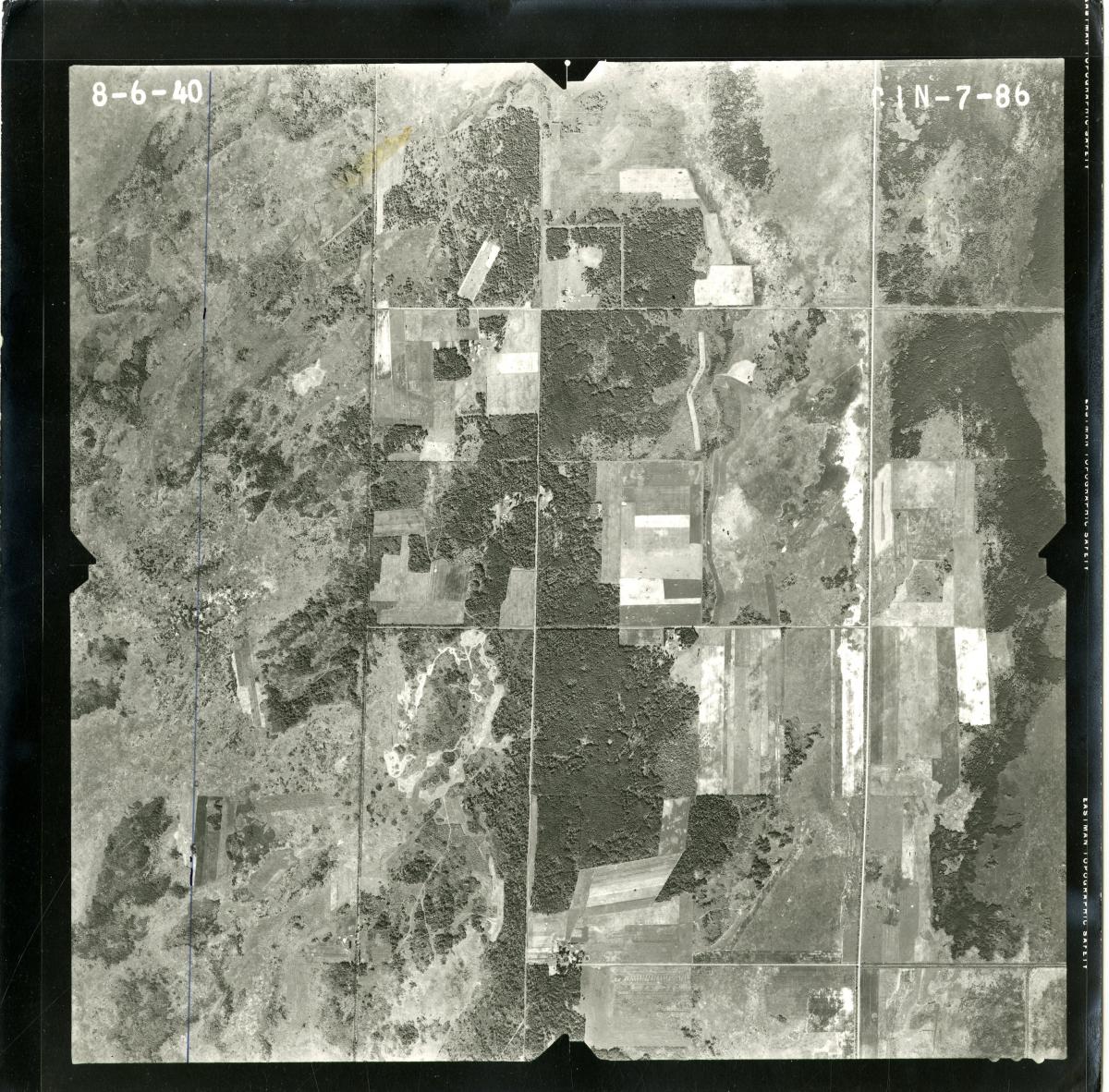
Record Group 75: Aerial Photographs, 8/17/1950 - 7/25/1962
This series consists of aerial photographs. The records are photographs of Indian land allotments of land in Kansas, Iowa, and on the Sac and Fox Reservation. The finding aid for the series is available at NARA at Kansas City.
Record Group 75: Land Correspondence Files, 1904 - 1983
This series consists of land correspondence files. The records provide information on topics related to Indian land, including leases; boundaries; lease cancellations; legal services; right of way; easements; sales; patents in fee; estates; taxation; crops; Indian allotments; land transactions; crop insurance; payment; delinquent leases; trespass; judgment funds; petroleum, natural gas, and mineral rights; recreation areas; real property; roads; and drainage. Other topics covered in the records include old age assistance; students; schools; hearings; buildings; the Winnebago Tribe of Nebraska; the Omaha Tribe of Nebraska; the Ponca Tribe of Native Americans; and the Santee Sioux Tribe of Nebraska. The records include correspondence. The correspondents include the Aberdeen Area Office and the Commissioner of Indian Affairs. The records also include lists; memorandums; standards; proposals; bonds; land grant records; clippings; photographs; forms; copies of legislative acts; newsletters; claims; warranty deeds; affidavits; requests for appraisals; vouchers; certifications; deeds to restricted Indian land; consents to sales; administrative orders transferring inherited interest in Indian land; agreements; grants of easement; appraisal reports; announcements; abstracts; bids; authorities to grant leases; reports; minutes; land title status reports; applications; lease cards; plats; civil court records; lease contracts; deeds to inherited Indian lands; statistics; land sale advertisements; leases; maps; blueprints; audits of land leases; aerial photographs; and regulations. The records include copies of the constitution, bylaws, and charter of the Santee Sioux Tribe of Nebraska. The finding aid for the series is available at NARA at Kansas City.
Record Group 75: Maps, Drawings, and Charts, 1936 - 1983
This series consists of maps, drawings, and charts. The records include plats showing Indian land allotments on Indian reservations, including the Sac and Fox Indian Reservations; geological survey maps; blueprints and project drawings of agency housing, water-supply, and building construction projects; aerial photographs of the Missouri River; topographic maps; road maps; township plats; charts of land purchases; Indian reservation maps; and transparencies. The finding aid for the series is available at NARA at Kansas City.
Record Group 75: Photographs, 1900 - 1960
This series consists of photographs. The photographs depict individual Indians, children, and families; agency employees; Indian dwellings; Indian day schools; Fort Berthold Agency buildings; Civilian Conservation Corps--Indian Division work; gardens, livestock, and agricultural activities; farms; Indian land; highway construction; equipment and supplies; agricultural extension work; 4-H Club members and activities; forestry; and soil conservation. The records include photographs of the Fort Berthold Indian Reservation taken in 1946 prior to the construction of Garrison Dam, depicting land tracts that would be flooded as well as land tracts to which Indians were relocated. The records include aerial views, photographic blueprints, and postcards. The finding aid for the series is available at NARA at Kansas City. This series is partially digitized.
Record Group 75: Photographs, 1910 - 1965
This series consists of photographs. The photographs depict individual Indians, children, and families; Indian dwellings; Indian day schools; Red Lake Agency buildings; Civilian Conservation Corps--Indian Division work; gardens and farms; Indian and agency land; roads; equipment and supplies; agricultural extension work; 4-H Club members and activities; forestry, timber, and sawmills; accidents; fishing; and fairs. The records also include aerial photographs of the Red Lake Indian Reservation. The finding aid for the series is available at NARA at Kansas City. This series is partially digitized.
Record Group 77: Economic Data Files, 1937 - 1956
This series consists of economic data files. The records discuss subjects related to the economic impact of floods and flood damage, including crop statistics and yield studies, sedimentation and soil surveys, non-crop agricultural and farm damages, urban damages, flood control benefits, emergency flood plans, private levee systems and their costs, levee failure floods, ice flooding, and direct and indirect flood damage to specific rivers and districts. There is also a collection of transcripts of newspaper articles about specific incidents of flooding throughout the region. Included in this series are charts, graphs, forms, reports, newspaper clippings, and aerial photographs, and photographs of flooding and flood damage. The rivers and locations covered in this series include the Little Sioux River, the Platte River, the Boyer River, the Missouri River, the Tongue River, the Powder River, the Yellowstone River, the Milk River, the Smith River, the Big Horn River, the Nishnabotna River, Iowa, North Dakota, Montana, and Wyoming among others. The finding aid for the series is available at NARA at Kansas City.
Record Group 77: General Administrative Files, 1940 - 1963
This series consists of general administrative records. The correspondence, telegrams, reports, annual reports, memorandums, clippings, photographs, aerial photographs, maps, charts, organizational charts, architectural drawings, circulars, minutes, and regulations relate to administrative functions of the office, government property issues, contracts, construction projects, all manner of personnel issues, plans and specifications, management improvement projects, supplies, funding and accounts, and acquisitions. The records also relate to specific projects the district undertook including work on dams, reservoirs, levees, irrigation, soil, flood control, and geology reports. The records cover projects that took place in many locations within the Missouri River District including, but not limited to, the Garrison Dam; the Fort Peck Dam; the Fort Randall Dam; the Gavins Point Dam; the Harlan County Dam; the Kanopolis Dam; the Missouri River; the Mississippi River; the Grand River; the Kansas River; the Platte River; the James River; the Yellowstone River; the Milk River; the Snake Creek; the Gasconade River; the Niobrara River; Glasgow, Montana; Council Bluffs, Iowa; Havre, Montana; Omaha, Nebraska; Mandan, North Dakota; Williston, North Dakota; Iowa; Nebraska; North Dakota; South Dakota; Montana; and Missouri. The finding aid for the series is available at NARA at Kansas City.
Record Group 77: General Correspondence, 1926 - 1940
This series consists of general correspondence. This series also includes reports, minutes, newsletters, circulars, aerial photographs, maps, and blueprints. Topics covered by the records include: flood control of reservoirs, floods, dredging, navigation, snags, spillways, banks and shores, towboats, flood plains, conferences, interviews, meetings, and the water supply. The finding aid for the series is available at NARA at Kansas City.
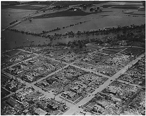
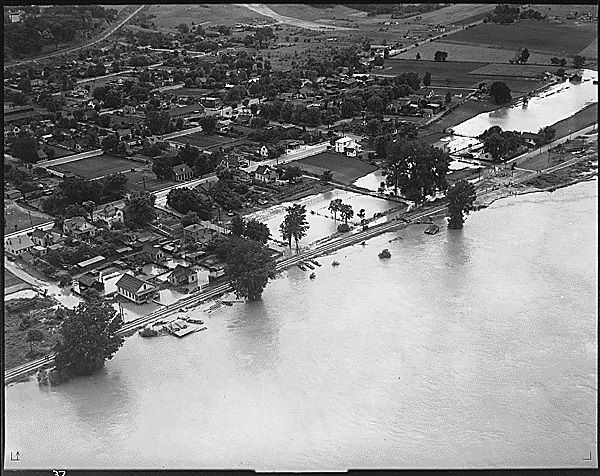
Record Group 77: Records Relating to the 1951 and 1952 Floods in Kansas and Missouri, 1951 - 1952
This series consists of records relating to the 1951 and 1952 floods in Kansas and Missouri. The records document the response of the Kansas City District to flooding of the Kansas and Missouri Rivers. Locations covered include Junction City, Kansas; Kansas City, Kansas; Lawrence, Kansas; Manhattan, Kansas; Osawatomie, Kansas; Salina, Kansas; Topeka, Kansas; Jefferson City, Missouri; Kansas City, Missouri; and Saint Joseph, Missouri. The records include aerial photographs, applications, authorizations, awards, bids, bills, Army bulletins, correspondence, decisions, dispatches, estimates, instructions, logs, maps, memorandums, messages, newspapers, notes, payrolls, photographs, posters, regulations, reports, rosters, summaries, and vouchers. The finding aid for the series is available at NARA at Kansas City.
Record Group 77: St. Louis District: Photographs, 1890 - 1970
This series is partially digitized.
Record Group 77: Scientific Assessment and Strategy Team (SAST) Files, 1/1/1993 - 7/31/1997
This series consists of the Scientific Assessment and Strategy Team (SAST) files. The files document the team's effort to study the effects of the 1993 floods of the Upper Mississippi River and Missouri River Basins. The records include administrative correspondence; aerial and satellite photographs from before, during, and after the flooding; and navigational charts. Also included in the records are maps and transparencies depicting natural resources in the river basins, flood probabilities, levees, and the extent of the flooding. Reports in the files include preliminary reports; quarterly flood study status reports; reports on the impact of levees on the middle Mississippi River, and levee failure; flood damage cost reports; and a final report on flood plain management. Video recordings of news reports, workshops, and press conferences are also included in the records. The finding aid for the series is available at NARA at Kansas City.
Record Group 79: General Files, 1951 - 1964
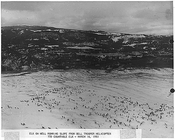
This series consists of administrative and program records of Region II (later referred to as the Midwest Region) of the National Park Service. The records include correspondence between the regional director and directors of other regional offices, as well as correspondence with park superintendents and park personnel, representatives of other federal and local government agencies, and private contractors and individuals. In addition, there are memoranda and directives, narrative and statistical reports, accident reports, minutes of meetings, commendations, cost estimates, Congressional bills, tables, and complaints and suggestions regarding park services and personnel; there are also maps, photographs, press clippings, and a variety of in-house studies and reports relating to the future development of, and the history of, particular National Park Service sites. The series includes content relating to the following National Park Service sites: Glacier National Park, Grand Teton National Park, Rocky Mountain National Park, Wind Cave National Park, Yellowstone National Park, Badlands National Park, Black Canyon of the Gunnison National Park, Custer Battlefield National Monument, Devils Tower National Monument, Dinosaur National Monument, Fort Laramie National Historic Site, Scotts Bluff National Historic Site, Theodore Roosevelt National Memorial, Jefferson National Expansion Memorial, Grand Portage National Monument, Colorado National Monument, Mount Rushmore National Memorial, and Shadow Mountain Recreation Area. This series is partially digitized.
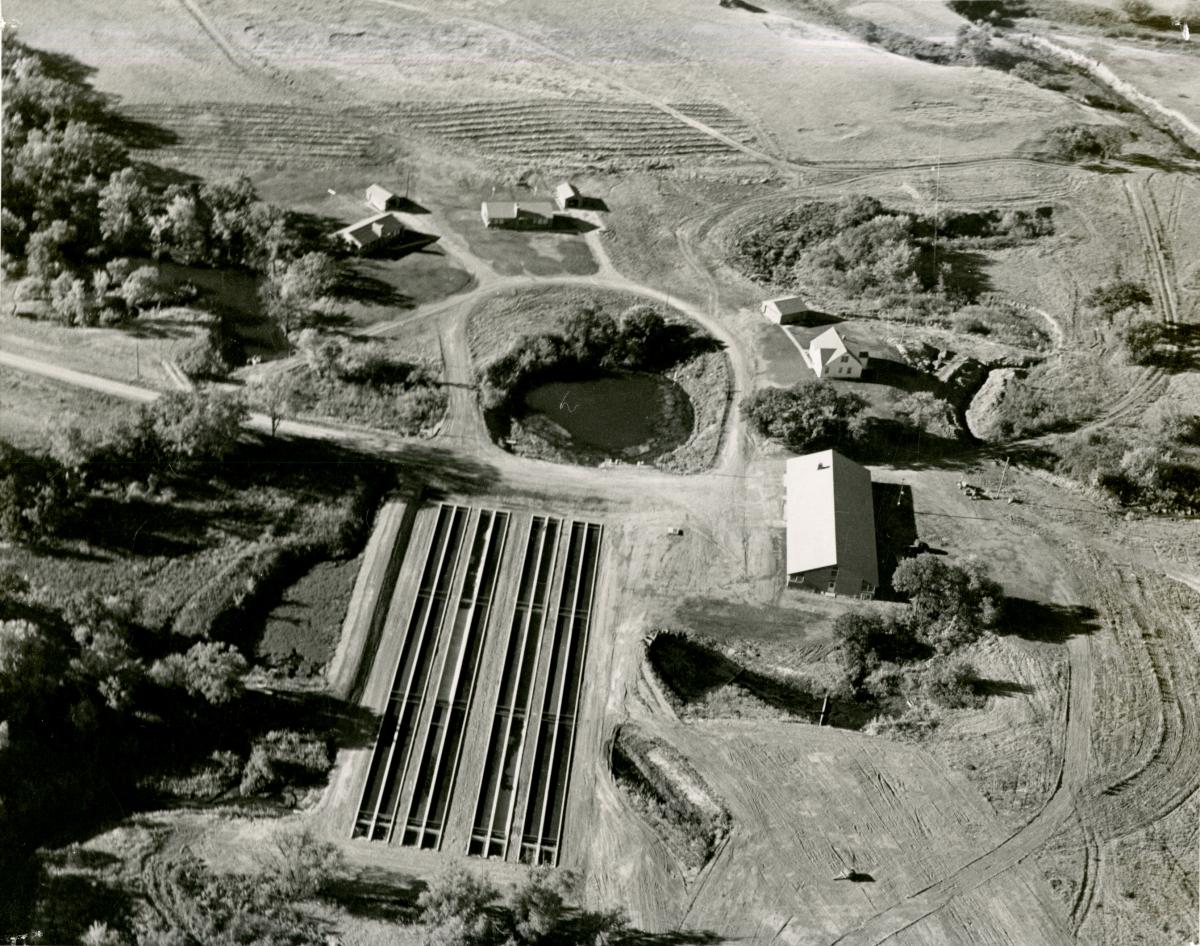
Record Group 95: General Administration Files, 1961 - 1963
This series consists of general administrative files relating to the development and administration of sites and facilities within Nebraska National Forest. Individual files include contracts and permits, analysis of plans, cartographic surveys (including aerial photography), research, and correspondence related to facility issues (such as buildings, water and sanitation, signs, radio and telephone systems, as well as transportation systems, and improvements).
Record Group 114: Annual Reports, 1930 - 1947
This series consists of annual project reports. The records include reports of project managers that were submitted annually to the Soil Conservation Service Upper Mississippi Regional Office. The records are narrative and statistical reports, many including photographs and maps, describing the work accomplished within defined soil, watershed, forestry, and demonstration areas. The records also include memorandums, information leaflets, and newsletters. This series is partially digitized.
Record Group 114: General Records, 1933 - 1934
This series consists of general records. The records include the correspondence from the Mankato, Kansas, project office concerning the Limestone Creek Project of the Soil Erosion Service. Information in the records includes agronomy; employees and labor; Emergency Conservation Work; aerial photography; meetings and conferences; seed and soil sampling; wages; equipment and supplies; range conservation and management; terracing; and hydrology. The records also include photographs. The finding aid for the series is available at NARA at Kansas City.
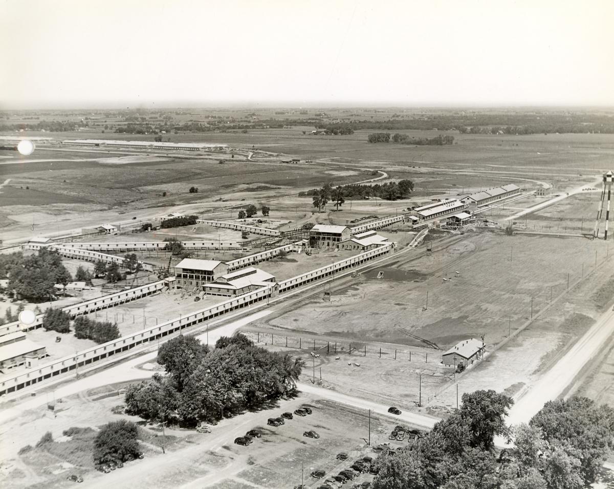
Record Group 156: Numbered Plant Histories, 1940 - 6/30/1946
This series consists of numbered plant histories. The records comprise a narrative report describing the establishment and operation of the Iowa Ordnance Plant during World War II. Meant to be an ongoing summary of plant operations, the history was begun after the plant's establishment, and Sections 1 through 6 are thus retrospective in nature. Sections 7 through 14, subtitled “Quarterly Historical Reports,” provide information on employees, budget, and production statistics, and activities of military personnel and civilian employees for a specific fiscal quarter. Topics in the records include physical descriptions of the land, buildings, and surrounding community of Burlington, Iowa; the process of designing and building the plant, including land acquisition, contractors, and labor union agreements; and the operations of specific areas of the plant, including shell and bomb manufacturing processes, component lines, storage facilities, transportation and maintenance facilities, and the plant administration. The report describes the plant's physical utilities, including electricity, steam power, sewers, and water. The records also describe the plant's administration and employee workforce, including organizational charts, payroll procedures and forms, tables of wages for specific jobs, timekeeping forms, a manpower survey, and employee training manuals. The records include information about the financial administration of the plant, including property accountability flow charts and forms, as well as cost accounting and budgeting. Standard practice procedures for producing military explosives such as shells, bombs, trench mortars, and fuzes are included, as well as production statistics and reports. The records also include information on production control and inspections, security measures, and the plant's fire department officials and employees, as well as two large explosions that occurred on December 12, 1941, and March 4, 1942. The records include orders, correspondence, memorandums, maps, census statistics, contracts, change orders, land surveys, telegrams, schedules, graphs, and tables. Photographs illustrate the text of the reports. They include aerial views of the plant and the city of Burlington; dwellings and buildings at the plant; photographic reproductions of maps and plans of the plant; and construction work on various plant structures. There are also photographs of wreckage left by explosions at the plant and equipment used in the areas where the explosions occurred, as well as photographic reproductions of editorial cartoons pertaining to the plant, and photographic reproductions of propaganda and safety posters. Photos also depict the plant hospital; plant security; fuzes; four sample employee identification badges; photographs of x-rayed ordnance; plant buildings; employees at work; ordnance and pieces of equipment used at the plant; ordnance storage facilities; and vehicles. The finding aid for the series is available at NARA at Kansas City.
Record Group 156: Progress Photographs, 12/31/1940 - 1/24/1942
This series consists of progress photographs. The records comprise a photographic record of the development and construction of the Iowa Ordnance Plant. The photographs include many detailed views of buildings, as well as aerial photographs of the plant with directional notation, identification of buildings, and times and dates the photographs were taken noted. The finding aid for the series is available at NARA at Kansas City. This series is partially digitized.
Record Group 156: Progress Photographs, 5/8/1942 - 5/15/1944
This series consists of progress photographs. The records comprise a photographic record of the development and building of the Cornhusker Ordnance Plant near Grand Island, Nebraska. The photographs include views of the buildings at the plant, identified by name; and aerial views of the plant, with directional notations. The records also include maps of the plant, and a narrative report titled "Operating Improvements at the Cornhusker Ordnance Plant," dated May 15, 1944, that includes photographs of equipment. The finding aid for the series is available at NARA at Kansas City.
Record Group 156: Unit History Files, 1941 - 1945
This series consists of unit history files. The records are quarterly reports on the progress and development of the Jayhawk Ordnance Works, including narrative histories, employee audits, production engineering schedules, emergency management plans, blueprints, posters, newspaper clippings from "Pittsburg Sun" and "Pittsburg Headlight," organizational charts, and award certificates. The records include copies of "The Jayhawker," a magazine published for employees of the ordnance plant. The records also include aerial photographs of the facility, as well as photographs of buses, employees, identity badges, and 1943 flood damage to the facility. The finding aid for the series is available at NARA at Kansas City.
Record Group 310: Unpublished Research Data, ca. 1937 - ca. 1966
This series consists of unpublished research data. The records in this series were created as a result of studies, surveys, or experiments of a preliminary nature, and include aerial photographs, hydrographic survey charts, maps, photomaps, tabulations, forms, reports, recording charts, correspondence relating to operations, tables, charts, curve tables, thermograph curves, notes, summaries, survey books, and reservoir data cards. Subjects covered in these records include rainfall and runoff data, precipitation records, rainfall intensity, soil temperature and moisture, cover density information, infiltration data, Wheatstone Bridge calibrations, surface flow characteristics, stream gaging stations, proposed watershed studies, precipitation depth and time correction, and seismic data. The records contain data collected from four watersheds in Edwardsville, Illinois; four watersheds in Fennimore, Wisconsin; Alhambra, Illinois; Treynor, Iowa; Mule Creek, Iowa; and Sabetha Lake, Kansas. Other records relate to the Big Blue River; Colby, Wisconsin; Norton, Kansas; Randolph, Kansas; North Dakota; South Dakota; and Wyoming. The records in this series contain a considerable amount of data from the Department of Commerce Weather Bureau. The finding aid for the series is available at NARA at Kansas City. This series is partially digitized.
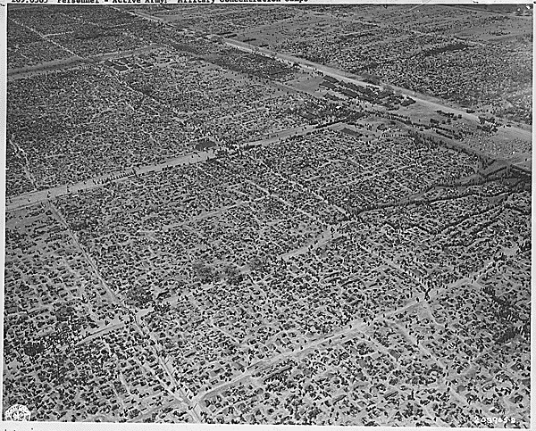
Record Group 338: Signal Corps Photograph Collection: Equipment File, ca. 1972 - 1994
This series consists of a Signal Corps photograph collection equipment file. The photographs depict equipment including weapons; vehicles; aircraft; survey instruments; drafting instruments; camouflage; fire fighting supplies; construction supplies; uniforms; and medical supplies. The photographs illustrate topics including training; organization; prisoners of war; atrocities; military construction; and tactics. The finding aid for the series is available at NARA at Kansas City. This series is partially digitized.
Record Group 412: Environmental Impact Statement Coordination Files, 1971 - 1976
This series consists of environmental impact statement coordination files. The records include the final environmental statements for various projects in Iowa, Kansas, Missouri, and Nebraska; correspondence with numerous Federal agencies, state agencies, and private individuals with an interest in the environmental statements. There are also comments on the draft environmental statements; aerial photographs of the proposed projects; legal notices of public hearings; newspaper clippings; and checklists for environmental impact statement responses by various Federal agencies.