![]()
Aerial Photography in Record Group 142: Records of the Tennessee Valley Authority in Special List 25
Aerial photographs for RG 142: Records of the Tennessee Valley Authority are in the series Aerial Photography of the Tennessee Valley Authority, 1933 - 1943. This series covers various counties in Alabama, Georgia, Kentucky, North Carolina, South Carolina, Tennessee and Virginia. Like other series of domestic photographs, you begin the search for these by using Special List 25, available for download digitally here and in the Cartographic Research Room.
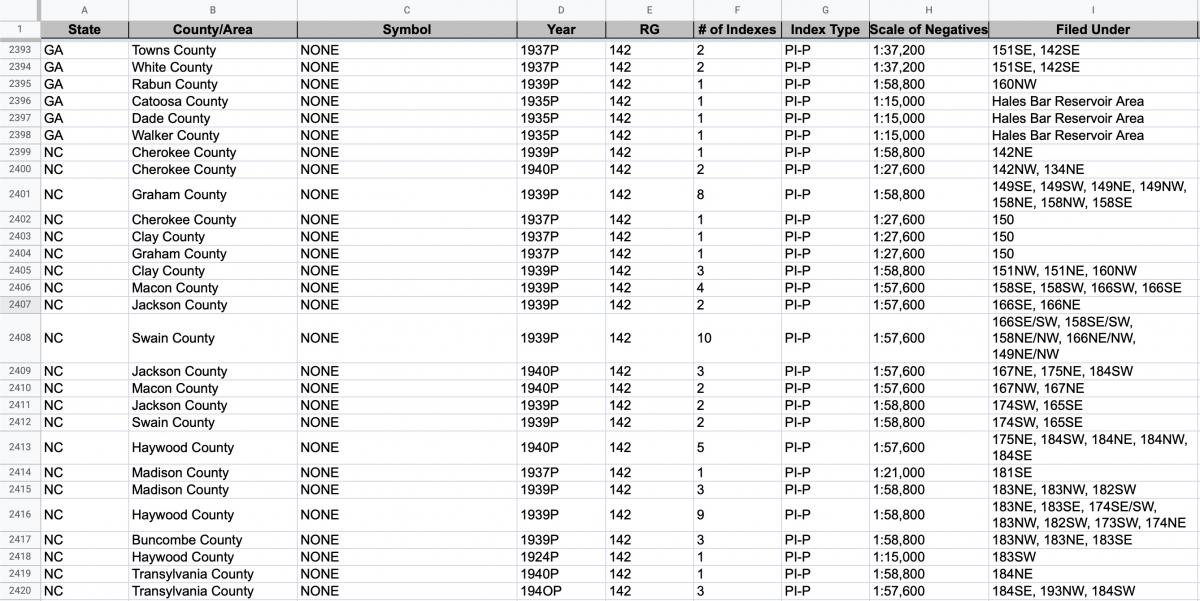
The indexes are filed by quad or project name. You can check the “Filed Under” field to see where the indexes for a specific county are filed.
Indexes for photographs in RG 142 are in the series Indexes for Aerial Photography of the Tennessee Valley Authority, 1933 - 1943. All of the indexes are available digitally online in our Catalog. The indexes are photomosaics.
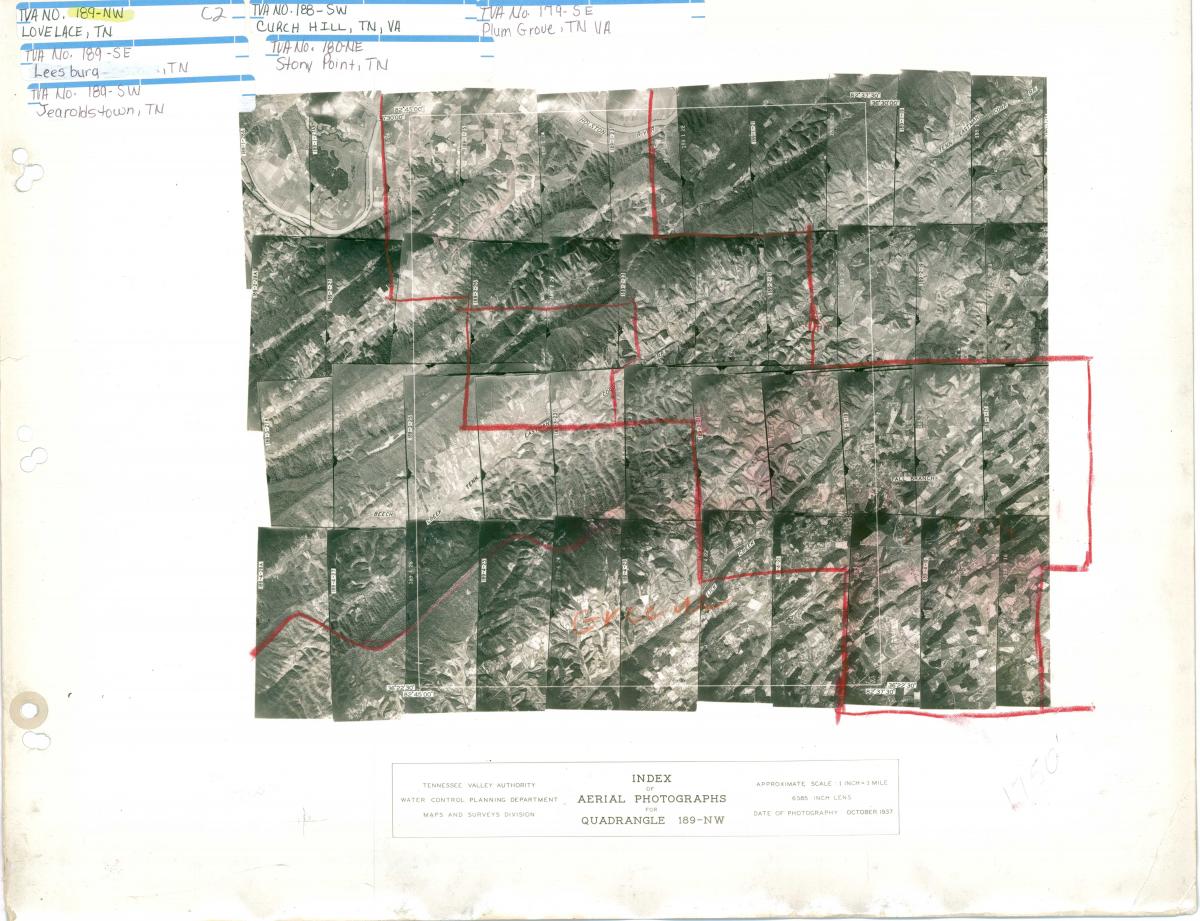
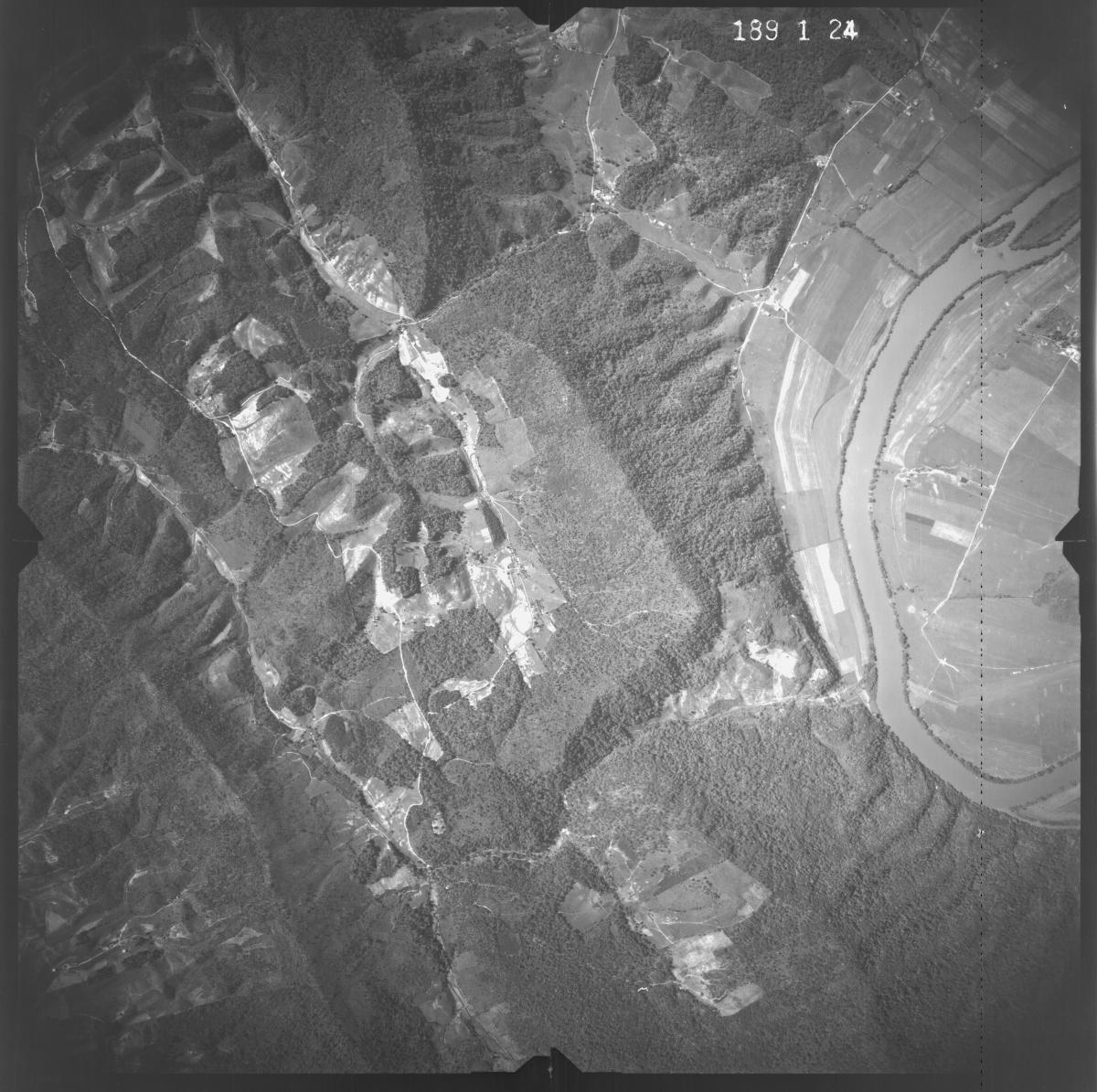
You can search the index to find your area of interest. Each frame on the index includes a roll and exposure number. Along with the quad number, this will create a citation which can be used to find which film can the images are on (ex: 189-1-24).
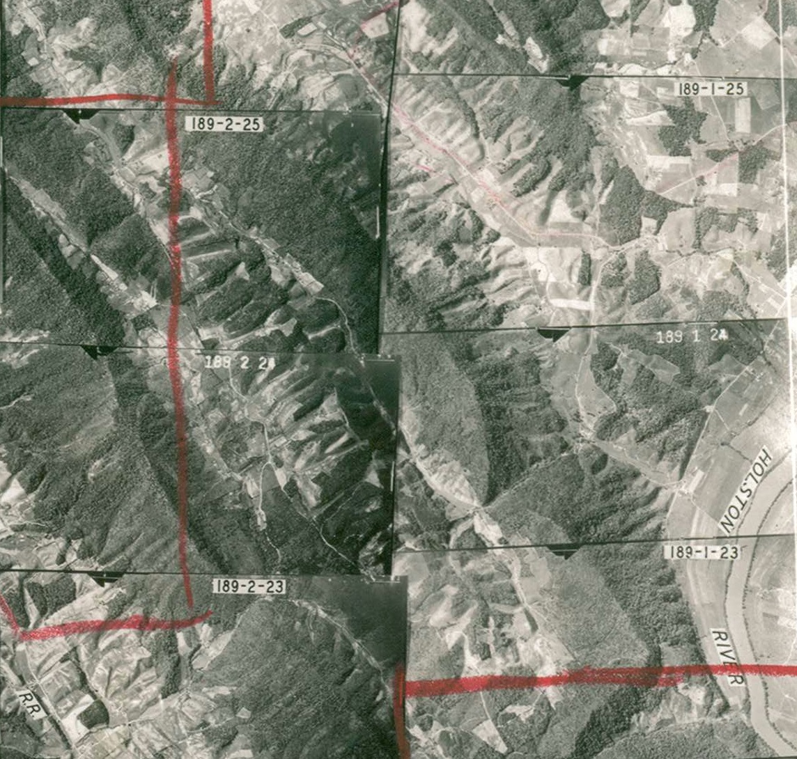

The quad, roll and frame numbers can be searched in the “Miscellaneous RG Can Locator,” available digitally in the Cartographic Research Room.
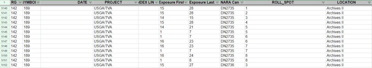
In this case, the photographs for 189-1 would be on film can DN2735, which is available to view onsite.
Once you order the cans at our facility, you can view and copy them in the Cartographic Research Room. We have light tables which allow you to view the film and take photographs on a personal camera. We also have aerial film scanners available. If you have a USB capable laptop, you can bring it to our research room and scan the photographs to your computer. You can learn more about aerial film reproductions here.
If you have any questions about these photographs, you can contact the Cartographic Branch at carto@nara.gov.