![]()
US Flown Foreign Aerial Photography in Record Group 373: Records of the Defense Intelligence Agency
Aerial Photographs, 1935 - 1970
The National Archives Cartographic Branch holds aerial photographs of foreign areas flown by the United States Air Force (USAF). This photography can be found in the series Aerial Photographs, 1935 - 1970, from Record Group 373, Records of the Defense Intelligence Agency.
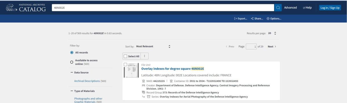
The indexes for these photographs are Overlay Indexes for Aerial Photography, 1935-1971. These overlay indexes are filed by degree square, which is an identifier used to denote a certain area by latitude and longitude. To search for a particular degree square, enter it directly into the main search bar in the National Archives Catalog as shown in the following examples. The latitude must be two digits and the longitude must be three digits (Ex: 48N002E; 56N003W).

When you click the search button with the degree square in the search bar, the file unit for the overlays will appear in the results.
After clicking on the title of the degree square file unit you can see the individual overlay indexes.
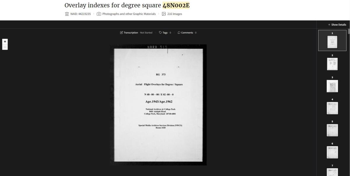
You can hover the mouse over the scan and click the "Click to interact" button or the plus button in the upper left hand side to zoom in on the image. You can download the scans by clicking the download button to the left under the image.
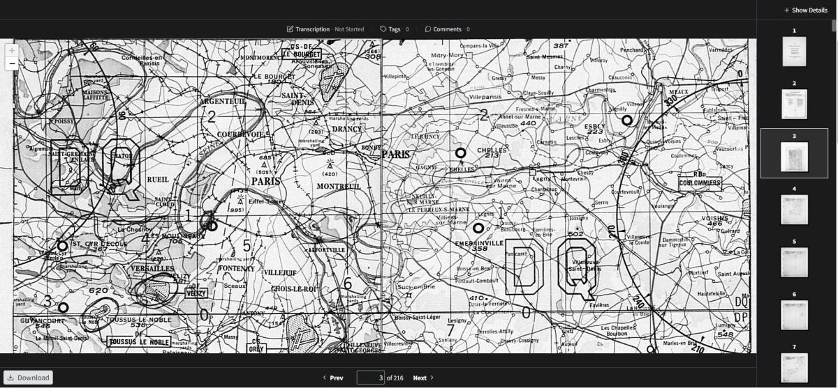
To search for coverage using these index overlays, locate your area of interest on the map and place the overlays to line up the 30 minute line and corners to match the map. It can be helpful to place a sticky note on your computer screen on the area of interest on the map so that as you search through the overlays you can match up the area with available coverage.
RG 373, Overlay Indexes for Aerial Photography of the Defense Intelligence Agency, 1935 - 1971, Overlay indexes for degree square 48N002E, Map
Please note that while you can zoom in on the map to find a location, you must be zoomed out to the default scale (seen above) to have the map line up with the overlays. Since the overlays correspond directly with the locations on the map, you can line up the bottom of the item box, where the "Previous" and "Next" buttons are, with the bottom of your internet browser screen. That way you can ensure that the overlays are properly lined up with the map.
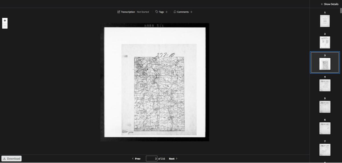
After identifying your area of interest on the map, you can search through the overlays by scrolling through the thumbnails on the right of the screen or clicking on the "Next" and "Previous" buttons below the image.
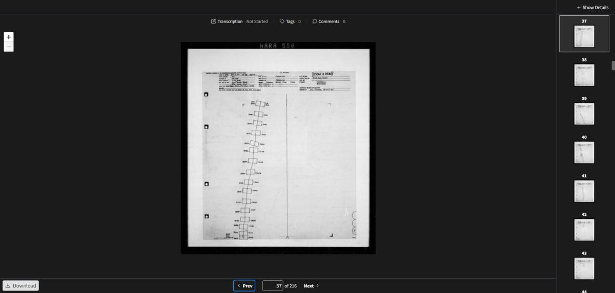
RG 373, Overlay Indexes for Aerial Photography of the Defense Intelligence Agency, 1935 - 1971, Overlay indexes for degree square 48N002E, Sheet NARA 550
When navigating through the overlay images, if you zoom in or out on an image, you can reset the placement of the overlay by clicking either the "Previous" or "Next" button below the image and navigate back to it. This will reset the image to the default placement.
Each overlay represents a flight or part of a flight. The scale, date, mission number and spot number are almost always included at the top of the overlays. Spot numbers will consist of a letter and number combination usually in parentheses or (Ex: “A-1913”). The spot numbers are used to locate the photographic prints or reel of film that the images are on.

Spot numbers can sometimes be hard to identify on an overlay. If you have any questions about a spot number you can email the Cartographic Branch at carto@nara.gov. On the above overlay, there are two spot numbers: D5362 and D5363. That means that any exposures of interest may be under either of these spot numbers.
The numbered boxes on the overlays represent available photographs for the area. The lines connecting the boxes also represent coverage. You would need to estimate the exposure number based on the location between numbered boxes. The overlays often also include an identifier for the exposures in the “Total Exp.” field and with the exposures. In this case the identifiers are LSV and RSV. This indicates that multiple cameras were used for this mission.
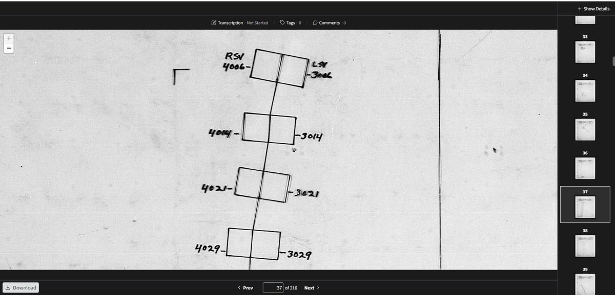
To locate the photographs, you need a citation with the spot number and exposure number. In cases like this where the overlay includes multiple spot numbers, both film cans would need to be located and ordered as the photographs of interest could be filed under either spot number. Using this overlay as an example, a citation would look like the following:
Spot Number D5362 or Spot Number D5363, Exposure RSV-4006.
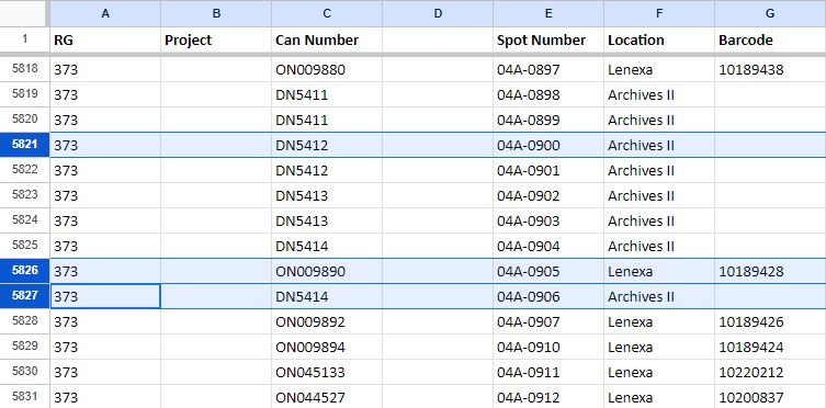
The spot number(s) will lead to film cans using the RG 373 can locator, available digitally by request at carto@nara.gov and in the Cartographic Research Room.
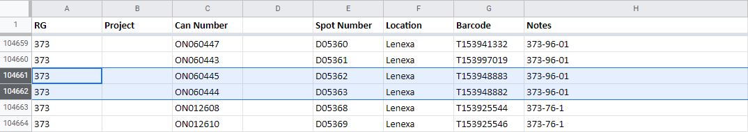
In this case, Spot Numbers D5362 and D5363 lead to film cans ON060445, Barcode T153948883 and ON060444, Barcode T153948882.
Cans with an “ON” identifier are original negatives which are stored at the Lenexa Federal Records Center. These cans can be ordered in the Cartographic Research Room and arrive at least four business days after ordering. You can send a cold storage request form to coldstorage.carto@nara.gov.
Cans with a “DN” identifier can be ordered and viewed on-site.
Once you order the cans at our facility, you can view and copy them in the Cartographic Research Room. We have light tables which allow you to view the film and take photographs on a personal camera. We also have aerial film scanners available. If you have a USB capable laptop, you can bring it to our research room and scan the photographs to your computer. You can learn more about aerial film reproductions here.
NARA has a partnership with the National Collection of Aerial Photography, Scotland. The photographs scanned by NCAP are currently being added to the National Archives Catalog and can be viewed via the series description. You can also search the catalog for a specific spot number or degree square to see if photographs have been digitized.
You can view a related blog post on The Unwritten Record blog here: Researching Foreign Aerial Photography.
RG 373: Mosaics of Military Sites in the United States and the World, 1941–1945
The overlays also include indexes to Mosaics of Military Sites in the United States and the World, 1941–1945 in Record Group 373. Available indexes are mixed in with indexes for other aerial photography and can be found when searching for photography from a specific degree square. These indexes look different from indexes for other aerial photography.
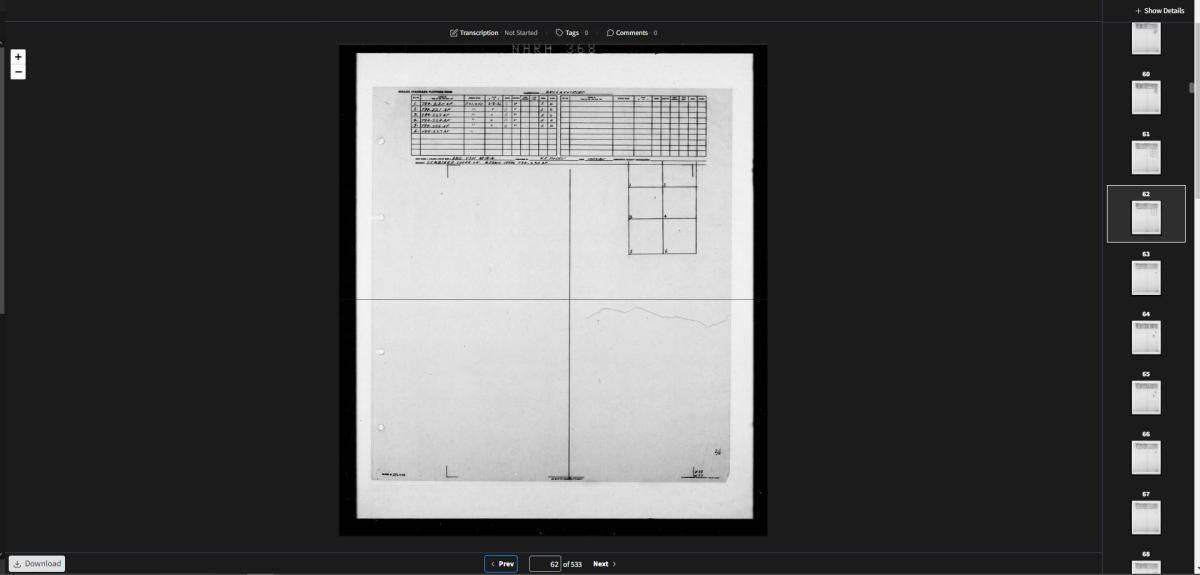
RG 373, Overlay Indexes for Aerial Photography of the Defense Intelligence Agency, 1935–1971, Overlay indexes for degree square 38N077W, Sheet NARA 368
Searching for photographs works the same as other indexes, but identifying photographs is a little different. Like the other indexes, the numbered boxes on the overlay represent individual frame numbers on the mosaics.
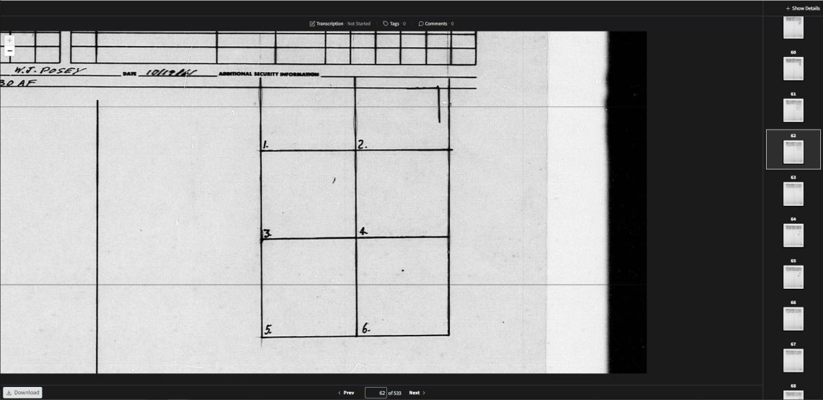
After locating photographs of interest, they are identified by file numbers which can be found on the top of the overlay.
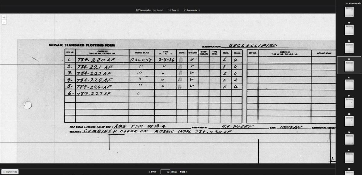
Once you have identified a file number that covers photographs of interest, you can look up the number in our digital finding aid (available by emailing carto@nara.gov). Alternatively, you can start your search by using this finding aid rather than the overlay indexes.

RG 373, Mosaics of Military Sites in the United States and the World, 1941–1945, Finding Aid
If the number is listed in the finding aid then the mosaics are available to view. The listed mosaics have accompanying prints available. They are onsite and can be requested in our research room by the file number.
Some mosaics may also have spot numbers listed with the file number. These spot numbers cross reference to the RG 373 can locator and provide additional coverage of areas found in the mosaics.
If you have any questions about these photographs, you can contact the Cartographic Branch at carto@nara.gov.