![]()
Aerial Photography in Record Group 57: Records of the U.S. Geological Survey in Special List 25
Special List 25 is the starting point for accessing any domestic aerial photography. This Special List provides information on which record groups and series hold photographs for specific domestic locations. It is available digitally on-site or by request by emailing the Cartographic Branch at carto@nara.gov. Additionally, a paper copy is available in the Cartographic Research Room, located at Archives 2, in College Park, Maryland. The list is arranged by state and thereunder by county.
Aerial photography listed in Record Group 57: Records of the U.S. Geological Survey (USGS) in the Special List can be found in the series Aerial Photography, 1935 - 1966.
You can access these records by first using the associated indexes: Aerial Photography Indexes, ca. 1935 - 1966. Most of the the indexes in this series are digitized. Digitized copies of the indexes are available for viewing and copying on a shared drive in the Cartographic Research Room. The project symbol listed in Special List 25 can be cross referenced with a spreadsheet on this drive, which provides the digitized folder where these particular indexes are held.
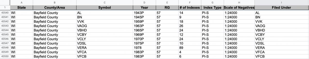
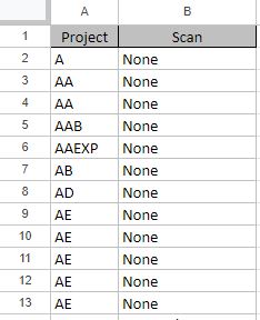
For example, the photographs for Bayfield, Rusk, and Sawyer Counties in Wisconsin are all under the project symbol of “AL."
This symbol can be found in the Special List entry for these counties. From there, you can cross reference the project symbol to the "RG 57 Quad Metadata" spreadsheet available on the shared drive. Looking at the project “AL” in this spreadsheet will lead you to the digital index identifiers for these counties.

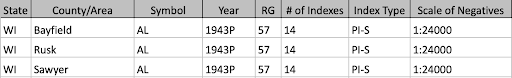
Once you find your project symbol in this spreadsheet, you can see which digitized indexes cover your area of interest. The scans are arranged into folders by cassette number. The first digits in the “Scan” field will tell you which cassette to navigate to. In this case it’s 01 (010021).

From the cassette folder, you can navigate directly to the scans that match the number from the “Scan” field in the spreadsheet.
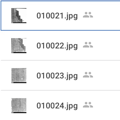
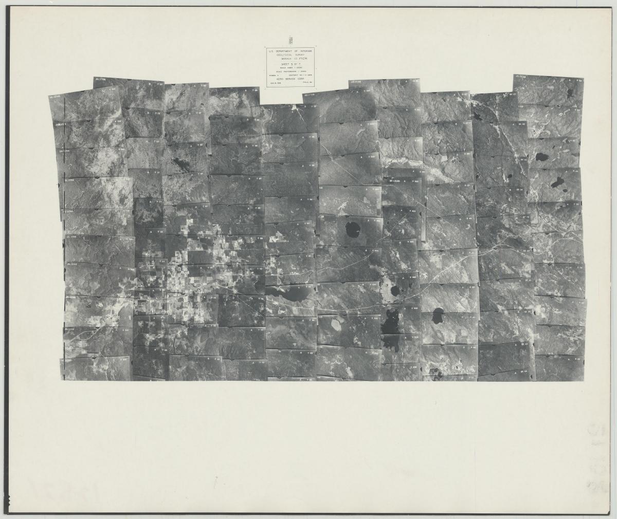
The indexes are mosaics of available photography. You can search for your specific area of interest on the mosaic. Once you find your spot of interest, a frame number will be shown in the image, which corresponds to a frame number on a film can.

RG 57, Aerial Photography Indexes, AL-010021
If you locate a project in the "RG 57 Quad Metadata" spreadsheet that lists "none" in the "Scan" column, this means that we do not have digitized copies of these indexes.
However, these indexes are available to request and view onsite in either large print or negative format.
Once you have your citation (ex: AL-1-10), you can find the film can where this photograph is held using our RG 57 Can Locator. This database is available digitally on-site or by request by emailing the Cartographic Branch at carto@nara.gov.

RG 57, Aerial Photography Can Locator
In this case, you can search for the symbol “AL” and the roll “1.” All of the photographs for this project will be on this can and the individual frame numbers can be found on the film. The photographs for AL-1 are on the film can ON175298, Barcode T357922606. Cans with an ON identifier are original negatives which are stored at the Lenexa Federal Records Center. These cans can be ordered in the Cartographic Research Room and arrive within three business days. If you already have a researcher card, you can order ON cans ahead of your visit to our site.
Once you order the cans and they arrive at our facility, you can view and copy them in the Cartographic Research Room. We have light tables which allow you to view the film and take photographs on a personal camera. We also have aerial film scanners available. If you have a USB capable laptop, you can bring it to our research room and scan the photographs to your computer.
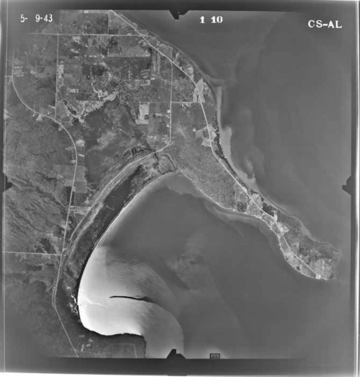
RG 57, Aerial Photography, AL-1-10 (available online at USGS EarthExplorer, entity ID AR1AL0000010010).
Searching RG 57 Aerial Photography on USGS EarthExplorer
Many RG 57 photographs at NARA can also be found already scanned on the USGS EarthExplorer website.
Follow these steps to search for specific aerial images:
1. Search Criteria: Set your Search Criteria using the options given
You can enter a date range to narrow down your search.

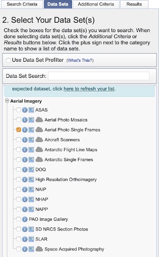
2. Data Sets: Select "Aerial Imagery," then "Aerial Photo Single Frames"
3. Additional Criteria: Enter the project identifier into the "Project" field

4. Click "Results"
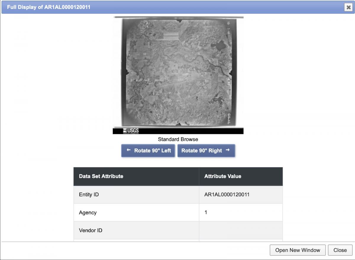
You will then see a list of the photographs for this project with thumbnails of the photographs.

Once you click on the thumbnail you will see a larger entry which includes the photograph and metadata. You can save the image from here or you can create an account and download or order the scan via the USGS.
If you prefer to view the original film at the National Archives, you can do so in the Cartographic Research Room.
You can view a related blog post on the History Hub here: Researching USGS Aerial Photography.
If you have any questions about these photographs, you can contact the Cartographic Branch at carto@nara.gov.