![]()
Aerial Photography in Record Group 145: Records of the Farm Service Agency in Special List 25
Aerial photographs for RG 145: Records of the Farm Service Agency are in the series Aerial Photographs of the United States, 1934 - 1957. Like other series of domestic photographs, you begin the search for these by using Special List 25, available for download digitally here and in the Cartographic Research Room.

Indexes are filed by state and county. When searching Special List 25 for your county of interest, you will see a list of years and projects. Most of these indexes are scanned and available digitally at RG 145: Indexes to Aerial Photographs of the United States, 1953 - 1957.
You can search the National Archives Catalog to see if the indexes are available for a specific county by following these instructions:
Step 1: Navigate to catalog.archives.gov.
Step 2: Click on the "Advanced Search" button next to the main search bar.
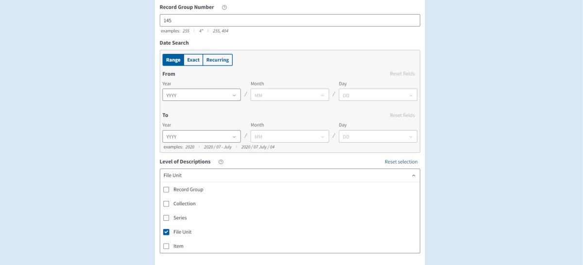
Step 3: Enter the following search data:
- Search Term: Enter "Year County Name, State". You can also just enter the county and state if you want to see all available indexes for that county.
- Record Group: Enter "145"
- Level of Descriptions: Select "File Unit"
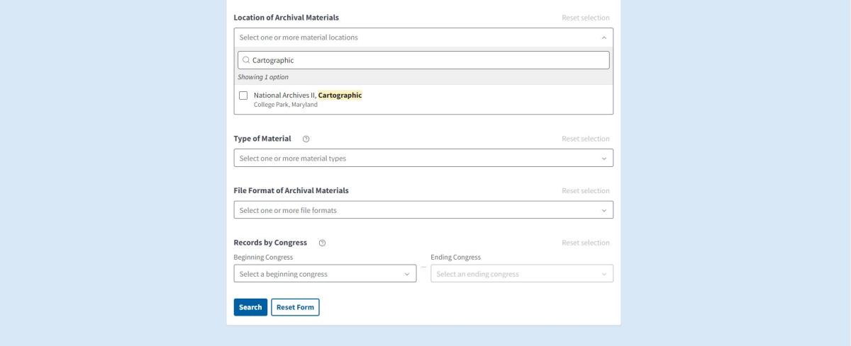
- Location of Archival Materials: Select "National Archives at College Park - Cartographic"
Scroll to the bottom of the search page and click "Search".

You will then see the search results for the available indexes:
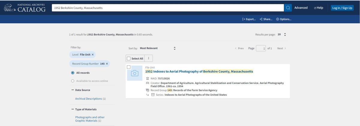
Step 4: Click on the file unit from the search results.
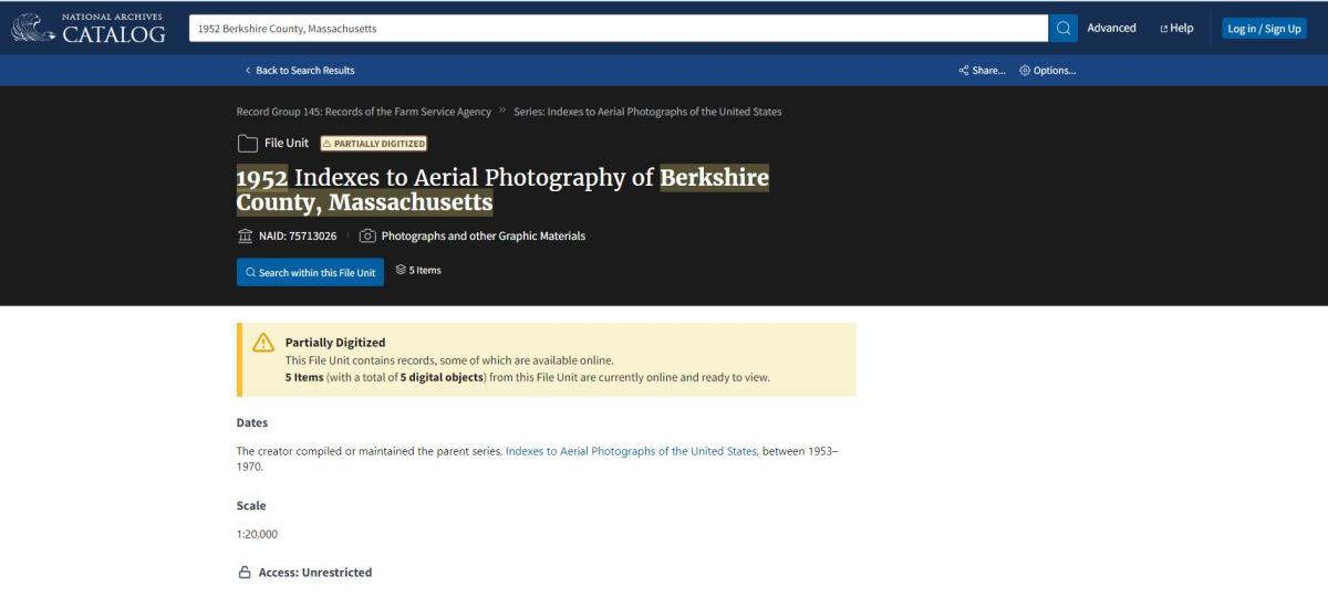
Step 5: Click on the "Search within this file unit" button. This will bring up all of the digitized sheets for the file unit. You can sort by "Title (Alphabetically, A-Z)" or "NARA ID (Lowest First)" to see the indexes in order.

You can then click on each sheet to view it.

You can hover the mouse over the scan and click the "Click to interact" button or the plus button in the upper left hand side to zoom in on the image. You can download the scans by clicking the download button to the left under the image.
If your specific county and year are not available in the Catalog, they are available in our research room. These indexes may be a large format negative mosaic or aperture card, which are not digitized.
The indexes for the RG 145 photography are photomosaics. You can search the index to find your area of interest.
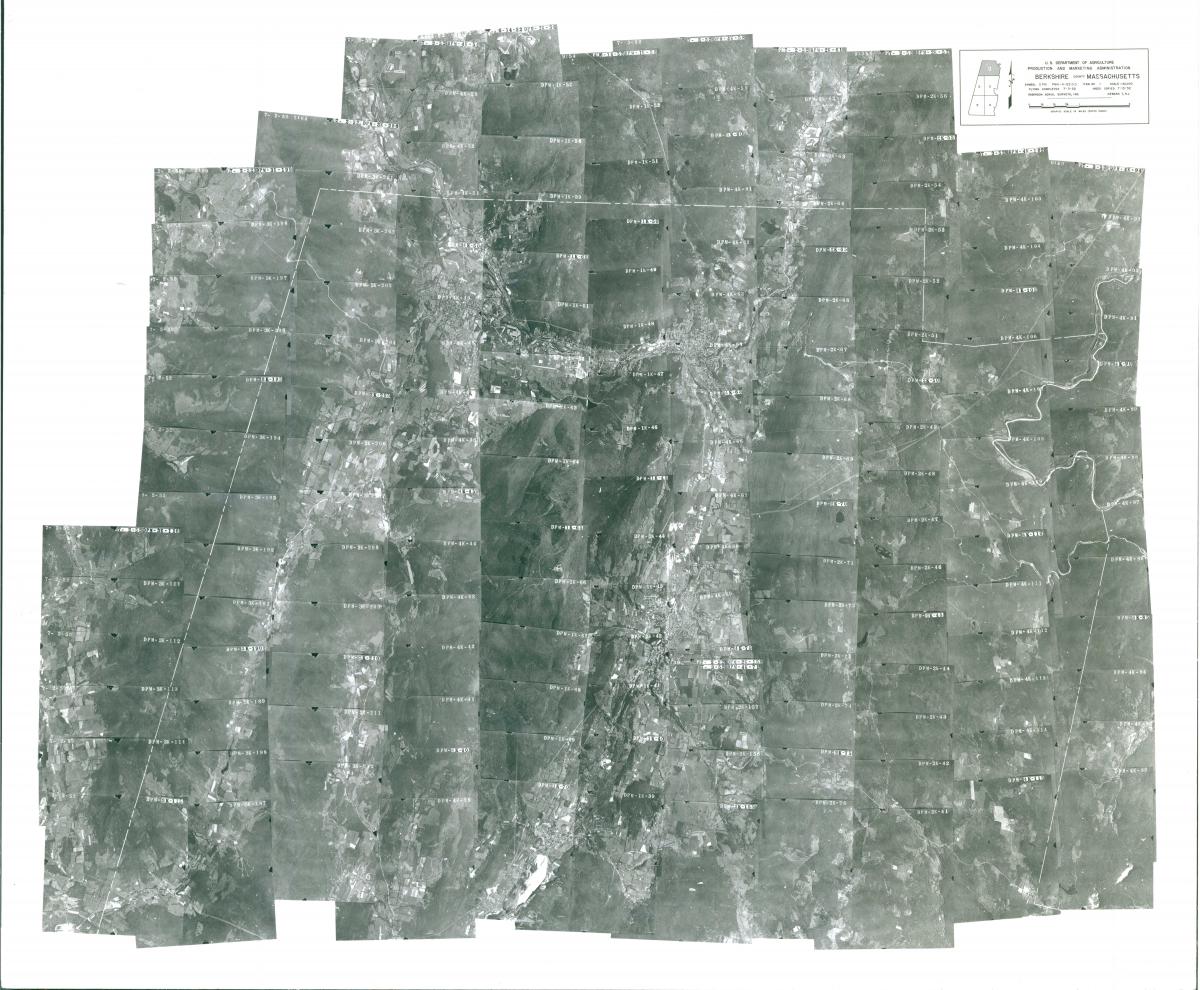
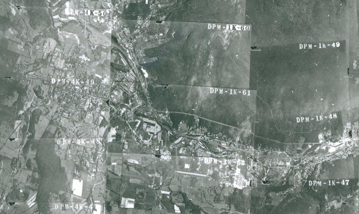
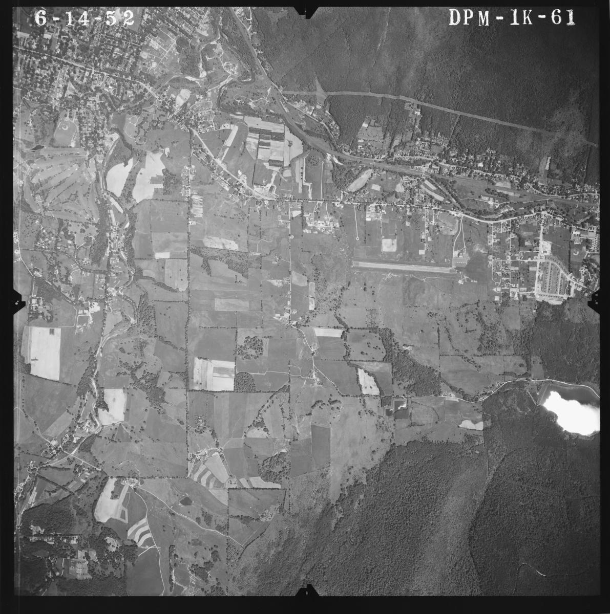
You can search the index for your area of interest. The symbol, roll and exposure on the frame creates a citation which can be used to locate the film can where the photographs are held (ex: DPM-1K-61). The symbol, roll and frame numbers can be searched in the RG 145 Can Locator, available digitally onsite.
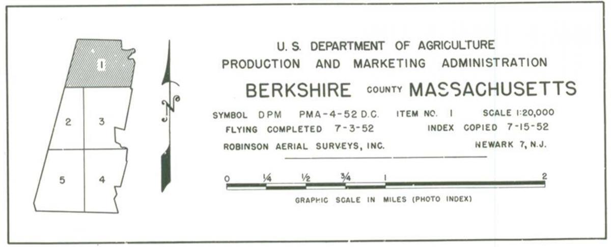
Information about the photographs, including the forest name, project and symbol, can be found on the index. There will also often be a diagram showing the full county and which sheets cover each part of the county.
Beginning in 1955, there is a mix of print and negative mosaic indexes. All indexes 1956 and later are negatives. These indexes are not in our Catalog, but they can be viewed and photographed on our oversize light table (see Aerial Photography Reproductions). We do not have the ability to scan these negatives in our research room.
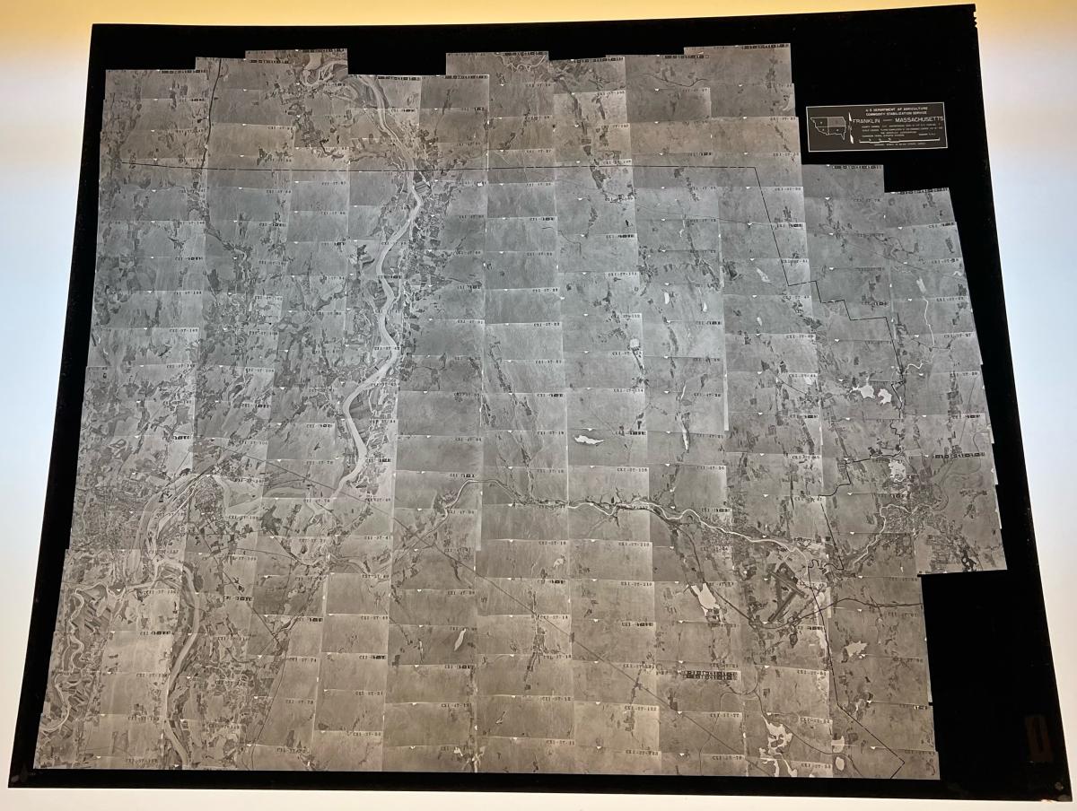
RG 145, Indexes to Aerial Photographs of the United States, Franklin County, 1957, CXI, Sheet 1
The negative indexes work the same way as the print indexes and provide symbols, rolls and exposures.
The symbol and roll can be searched in the RG 145 Can Locator, available digitally via carto.nara.gov.
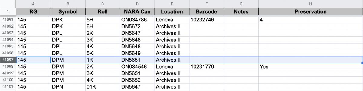
In this case, the photographs would be on film can DN5651, which is available to view onsite. Cans with an “ON” identifier are original negatives which are stored at the Lenexa Federal Records Center. These cans can be ordered in the Cartographic Research Room and arrive within three business days. If you already have a researcher card, you can order ON cans ahead of your visit to our site. Some ON cans for this record group are onsite and these are noted in the can locator. Cans with a “DN” identifier can be ordered and viewed onsite.
Once you order the cans at our facility, you can view and copy them in the Cartographic Research Room. We have light tables which allow you to view the film and take photographs on a personal camera. We also have aerial film scanners available. If you have a USB capable laptop, you can bring it to our research room and scan the photographs to your computer. Learn more about Aerial Photography Reproductions.
You can view a blog post on these photographs on the Unwritten Record blog here: Researching Aerial Photography of the United States : RG 145 Aerial Indexes Now Digitized.
If you have any questions about these photographs, you can contact the Cartographic Branch at carto@nara.gov.