![]()
Aerial Photography in Record Group 95: Records of the Forest Service in Special List 25
Aerial photographs for the Forest Service are held in the series Aerial Photographs, 1932 - 2011. As with other domestic photography, the search for these photographs begin with Special List 25, available for download digitally here and in the Cartographic Research Room.

While you search this list by State, thereunder by county, the indexes for the photographs are filed under the name of the National Forest or the project symbol. This can be found in the “Filed Under” field.
The search item listed in the “Filed Under” field corresponds to indexes in the series Indexes to Aerial Photography, 1932 - 2010.
You can search the National Archives Catalog to see if the indexes are available for a specific National Forest by following these instructions:
Step 1: Navigate to catalog.archives.gov.
Step 2: Click on the "Advanced Search" button next to the main search bar.
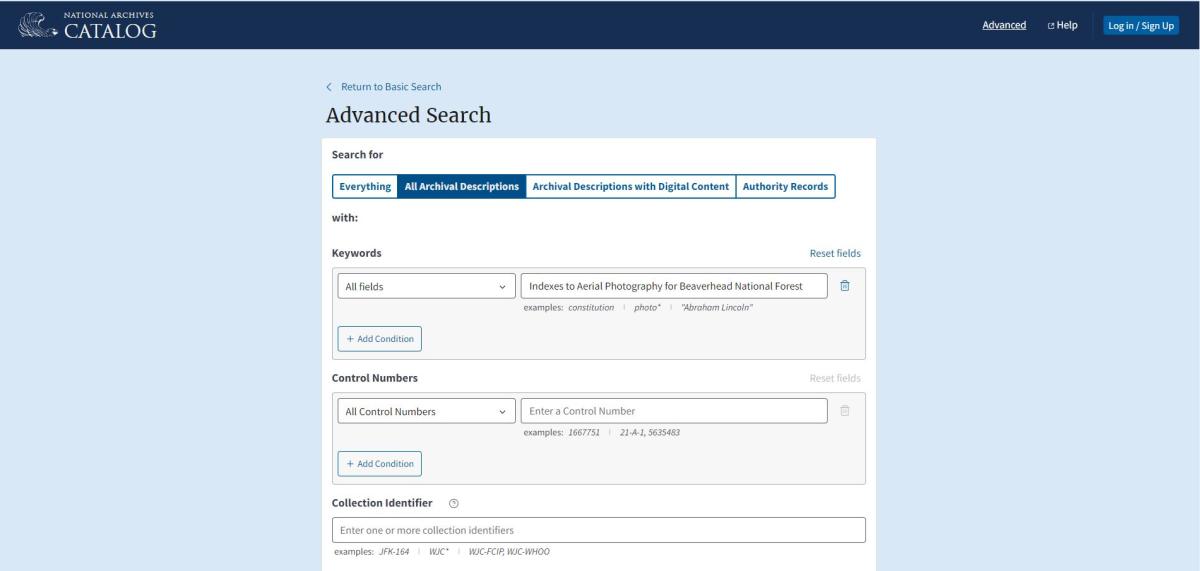
Step 3: Enter the following search data:
Search Term: Enter "Indexes to Aerial Photography for (forest name) National Forest". Ex: Indexes to Aerial Photography for Beaverhead National Forest
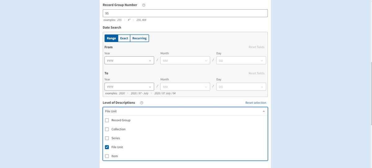
Record Group: Enter "95"
Level of Descriptions: Select "File Unit"
Location of Archival Materials: Search for "Cartographic" and select "National Archives II, Cartographic"
Scroll to the bottom of the search page and click "Search".
You will then see the search results for the available indexes:
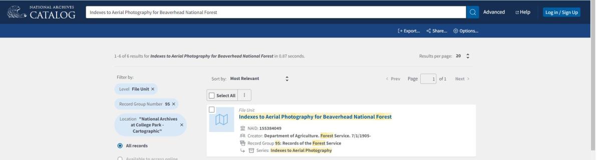
Step 4: Click on the file unit from the search results.
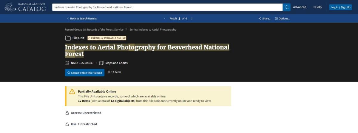
Step 5: Click on the "Search within this file unit" button. This will bring up all of the digitized sheets for the file unit.
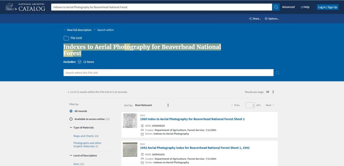
You can then click on each sheet to view it.
The indexes include line index maps and photomosaics that show the available coverage for each listed National Forest or project and the corresponding date of the photographs. You can search the index for your specific area of interest.
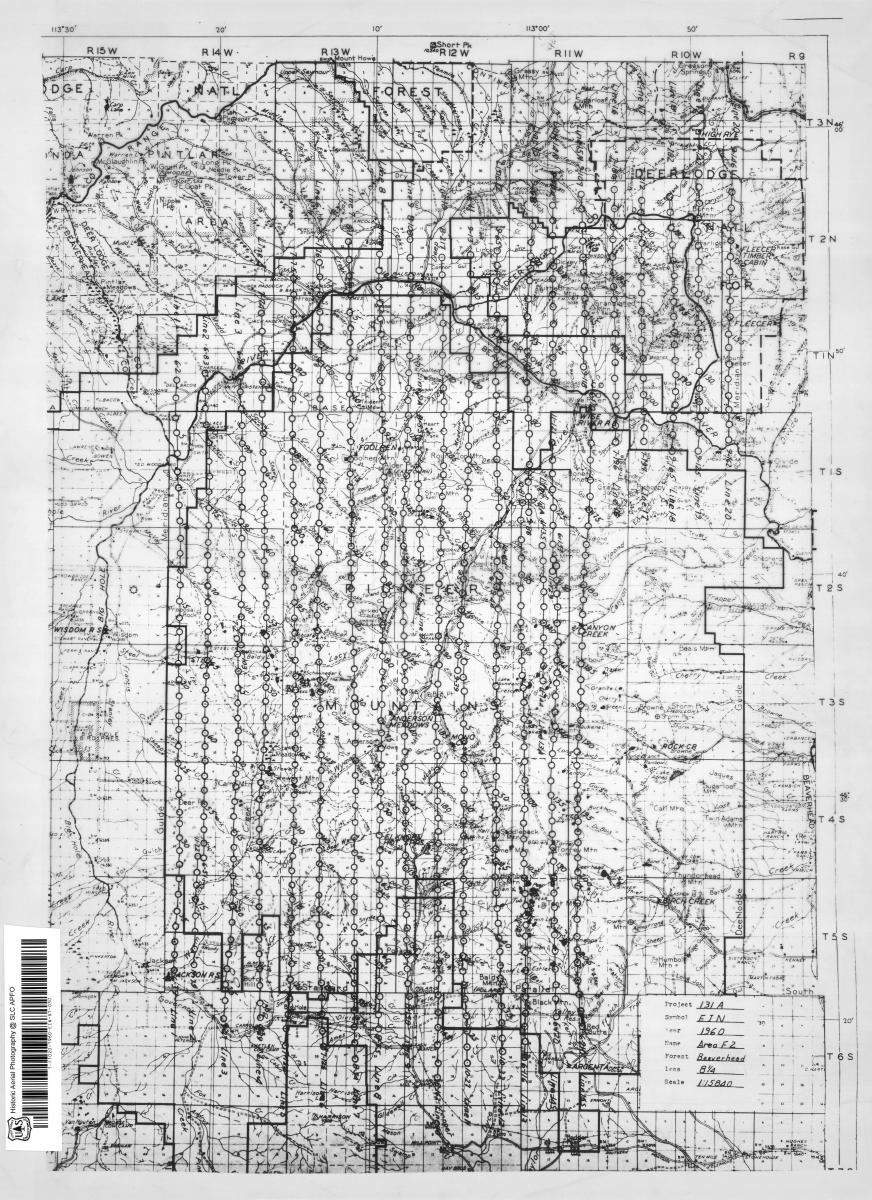
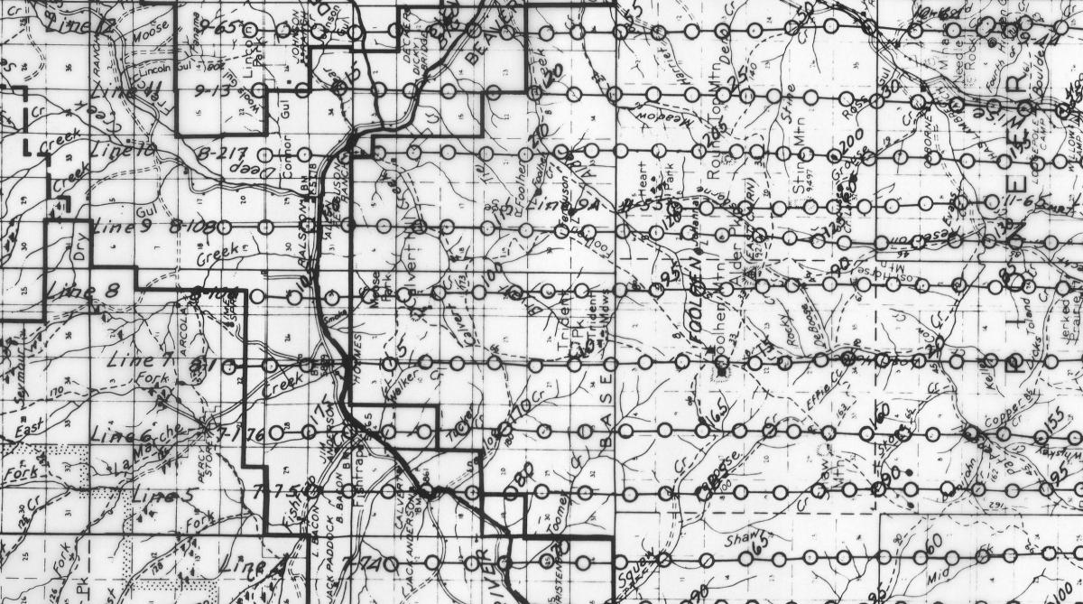
The first number in the line is the roll number for the line of photographs. The circles in the line indicate available photographic coverage. Each circle represents a different photograph. Circles without an exposure number can be counted from the previous provided number to determine which exposure number it represents on the film can. The symbol, roll and exposure creates a citation which can be used to locate the film can where the photographs are held. (ex: EIN-8-217)
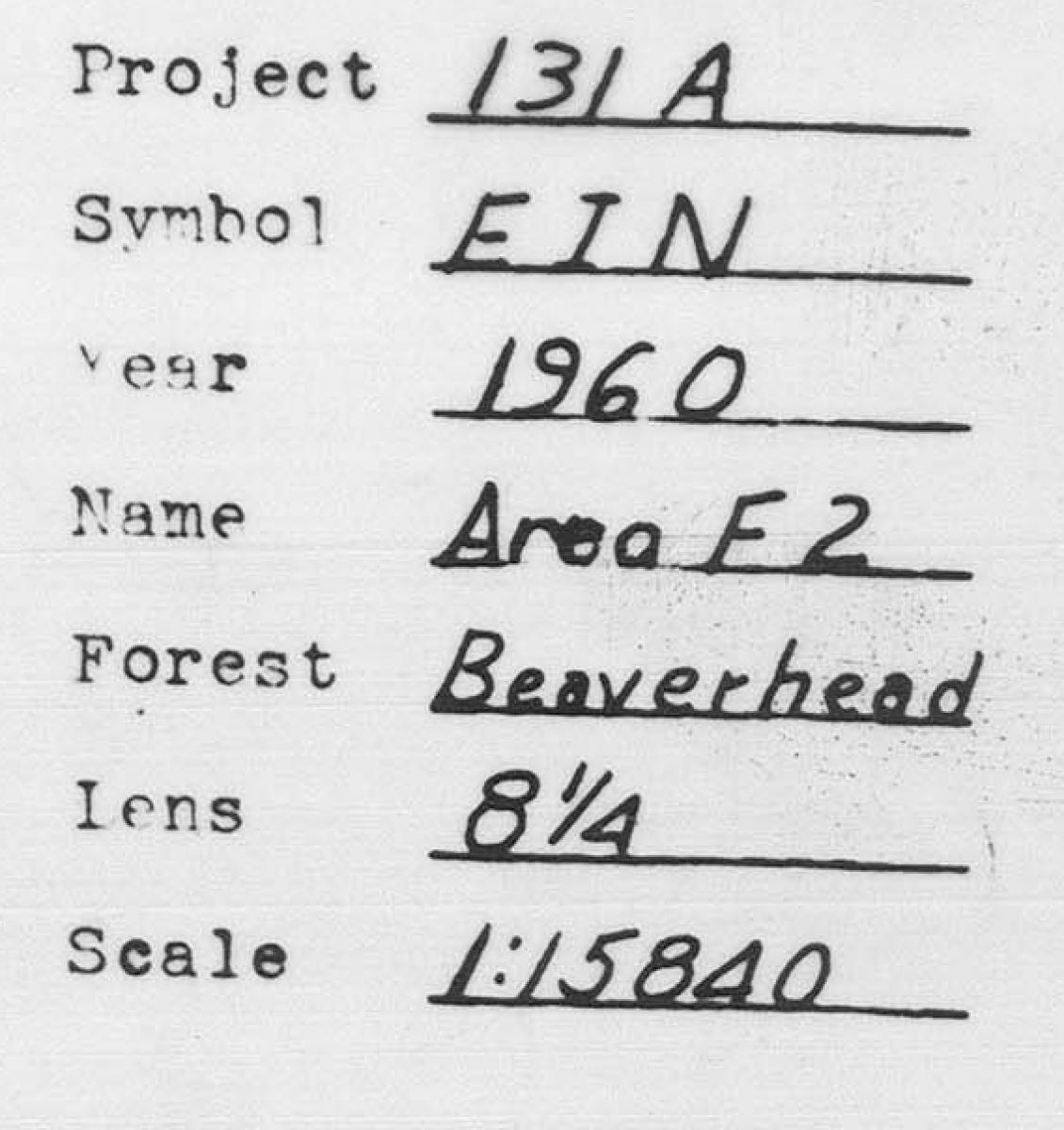
Information about the photographs, including the forest name, project and symbol, can be found on the index.
Photomosaic indexes for RG 95 work similarly to the line indexes for finding photographs.
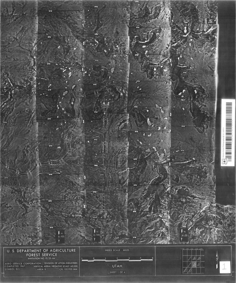
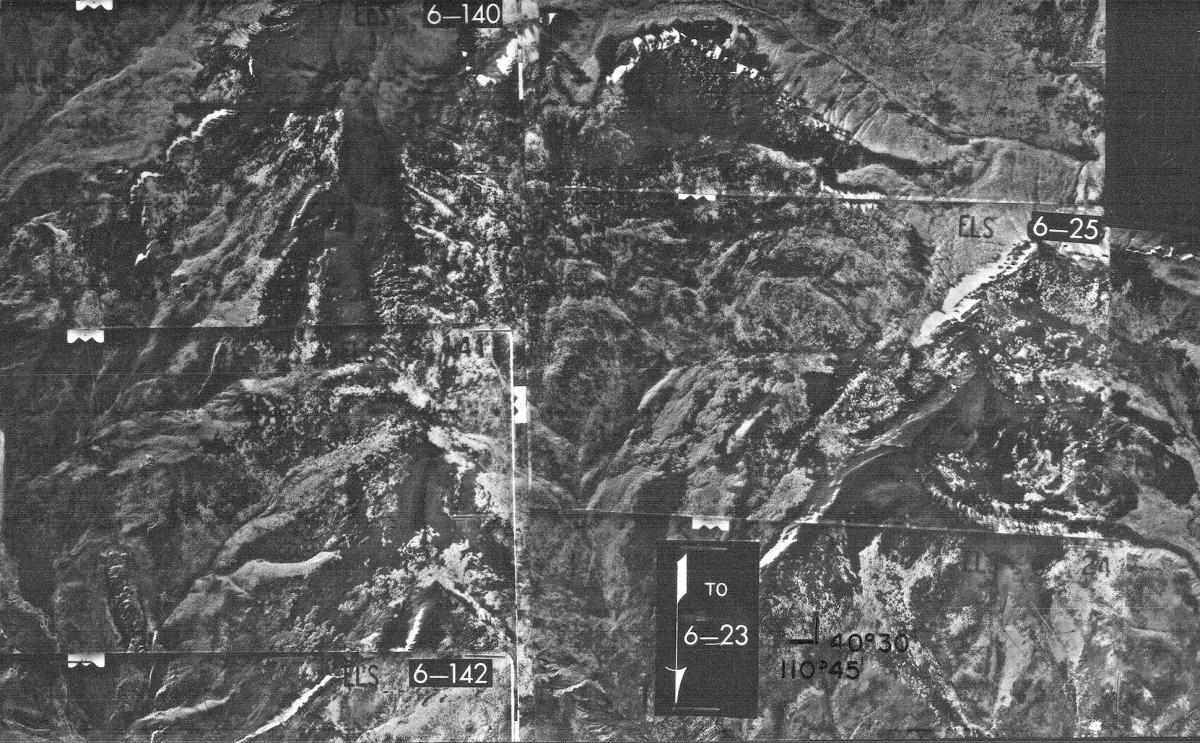
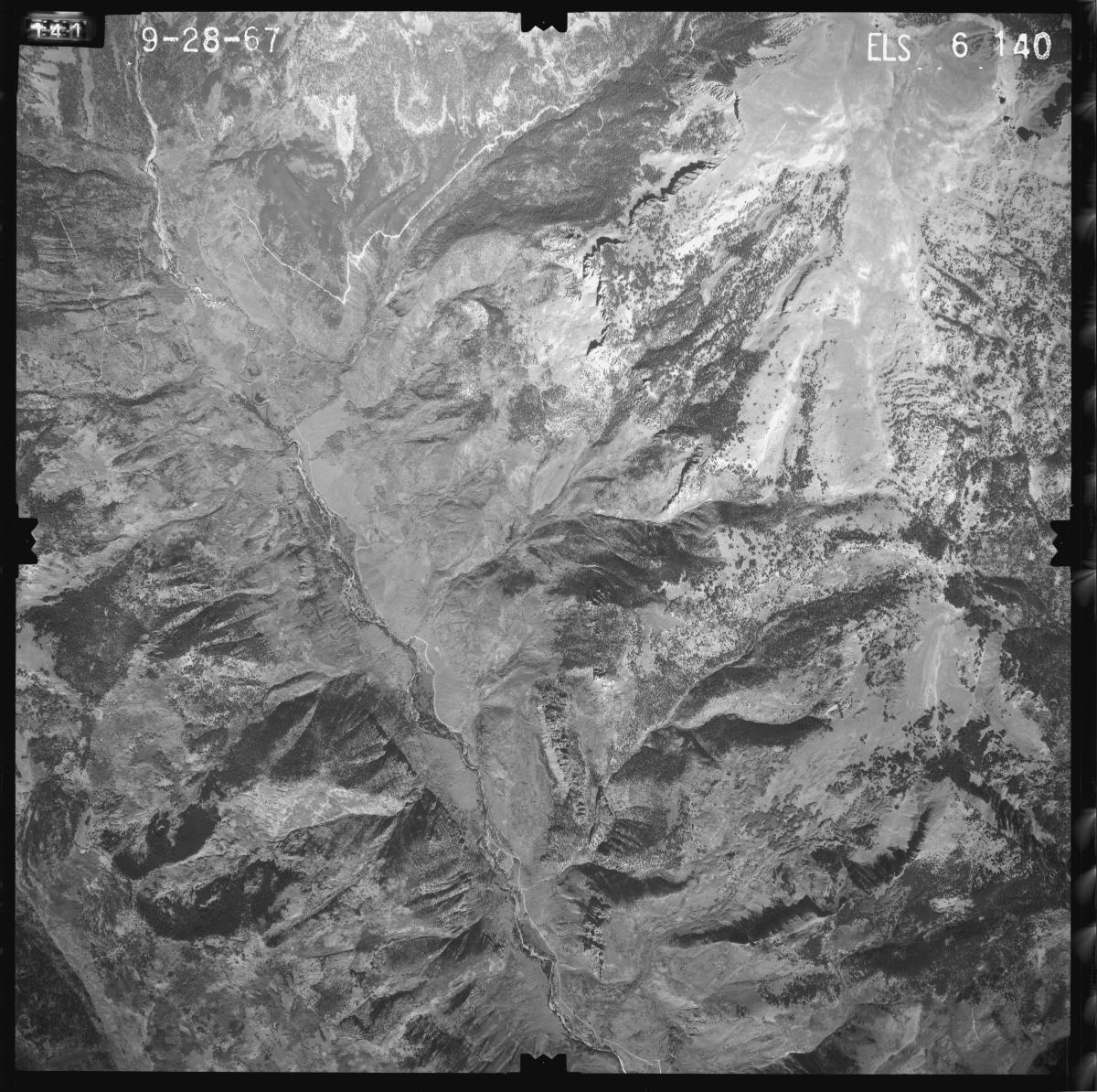
Like with the line indexes, the spot you locate on the index will include a project symbol, roll and frame number (ex: ELS-6-140).
Information about the photographs, including the forest name, project and symbol, can be found on the index.
The symbol, roll and exposure numbers from any RG 95 indexes correspond to a film can on the RG 95 Can Locator. Paper and digital versions of the can locator are available onsite in the Cartographic Research Room.
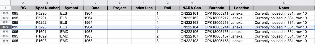
These film cans can be ordered in the Cartographic Research Room. Cans with an “ON” identifier are original negatives which are stored at the Lenexa Federal Records Center. These cans can be ordered in the Cartographic Research Room and arrive within three business days. If you already have a researcher card, you can order ON cans ahead of your visit to our site. Some ON cans for this record group are onsite and these are noted in the can locator. Cans with a “DN” identifier can be ordered and viewed onsite.
Once you order the cans and they arrive at our facility, you can view and copy them in the Cartographic Research Room. We have light tables which allow you to view the film and take photographs on a personal camera. We also have aerial film scanners available. If you have a USB capable laptop, you can bring it to our research room and scan the photographs to your computer. You can learn more about aerial film reproductions here.
If you have any questions about these photographs, you can contact the Cartographic Branch at carto@nara.gov.