![]()
Finding Aids: Special List 29
Special List 29: List of Selected Maps of States and Territories
names of cartographers, surveyors, publishers, and other persons and companies connected with the production of the maps described in Special List No. 29.
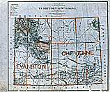 Wyoming Territory, 1879 (NNSC-49-OMF-WY6) |
This publication describes approximately 900 State maps selected from the holdings of the Special Media Archives Services Division, National Archives and Records Administration. The maps date from the late 18th century to 1920. Maps of the Territories are included to provide early coverage of areas which later became States. The list is intended primarily for use by researchers seeking general maps of States and Territories. Because of the general nature of the maps, their arrangement alphabetically by State and chronologically thereunder, and their relative uniformity of content, no subject index has been prepared for this publication. Variations in content, however, have been indicated in the descriptive entries. An accompanying index gives the names of cartographers, surveyors, publishers, and other persons connected with the production of the maps.
Maps described in this list were selected from 12 record groups and the Reference Map Collection (cited in this publication as Ref. Coll.). Record groups usually consist of the records of a single Federal agency, typically at the bureau level. The Reference Map Collection is a small group of published maps that are not a part of any record group. The Records of the Post Office Department (Record Group [RG] 28), the Bureau of Land Management (RG 49), and the Department of the Army, Office of the Chief of Engineers (RG 77) account for about two-thirds of the maps listed. Other record groups from which maps were selected are Records of the Coast and Geodetic Survey (RG 23), Records of the U.S. Senate (RG 46), Records of the U.S. Geological Survey (RG 57), Records of the Bureau of Indian Affairs (RG 75), Records of Boundary and Claims Commissions and Arbitrations (RG 76), Records of the Office of Territories (RG 126), Records of the U.S. House of Representatives (RG 233), and Records of U.S. Army Continental Commands, 1821-1920 (RG 393).
Many of the maps cover either an entire State or a portion of a State; some maps include several States or Territories. Basic information shown on the maps selected, however, applies to the State or Territory as a whole rather than to any one particular area. The number of maps listed for a given State often is indicative of Federal activity in that State. Those States within which the Federal Government has held much of the land, therefore, are better represented than the Thirteen Original Colonies.
In this publication a "manuscript" map is defined as one made with pencil, ink, watercolors, or some similar hand-applied medium, usually on paper or tracing cloth. Blueprints are identified as such, but other photographically reproduced records are referred to as "photo-processed." A "published" map is one that is issued for general distribution, usually in print or near print. An "annotated" map is a published or photo-processed map that includes information added by hand.
A map may be located within this list either by referring directly to the appropriate state section within the list, or by referring first to the "Name Index," and then to the list by using the corresponding entry number cited within the index. The maps are listed alphabetically by State and chronologically within each State listing. Maps including more than one State or Territory are listed under the name of the first State mentioned in the title and are cross-referenced under the other States. Please note that the list's entry numbers run sequentially and consecutively from the first entry listed for Alabama to the last entry listed for Wyoming.
Two brief paragraphs comprise most entries within this list. The first paragraph contains map title information gleaned directly from the record. For most entries the map title may include the name of the cartographer, the draftsman or originating Federal agency, and the publisher, if any; and the date. Unless enclosed in brackets, map titles shown in the entries as the first paragraph are quoted directly from the maps; but they do not always appear on the maps in title blocks or with the wording in consecutive order. Spelling, abbreviations, and capitalization in the titles and in quoted remarks in the entries are as they appear on the maps. Punctuation, however, has at times been changed or supplied in the interest of clarity. Information enclosed in brackets has been supplied by the compiler. Undated maps are indicated by "n.d." In some instances, a comparison with dated maps has enabled the compiler to establish an approximate date.
The second paragraph within an entry provides a description of the item followed by the file designation. Besides brief discussion of contents, the description may include scale; dimensions to the nearest half inch (from edge to edge of sheet, vertical dimension first); mention of publication; the number of sections or sheets that comprise the map; and presence of color or special markings. When appropriate, cross-references to related entries are included. Each entry closes by noting the map's file designation, which is the means by which the map may be retrieved from the file. The designator lists first the Record Group (RG) number to which the map belongs; next, the name of the record series within the RG; and lastly an identifying number, name, or date.
How to Obtain Copies of Records
On-site:
Cartographic records described in this publication generally are available in the Cartographic and Architectural Research Room for examination and electrostatic ("xerox") copying for a fee. The Cartographic and Architectural Research Room is located within the Steny H. Hoyer Research Center at Archives II, 8601 Adelphi Road, College Park, MD 20740-6001.
Off-site:
You may also be able to enlist the help of an Independent Researcher for hire to assist with ordering reproductions of records listed in Special List 29. You will need to provide the citation listed in Special List 29 as "Filed as," along with the entry number, number of sheets (if more than one), and the dimensions of the item to the researcher of your choice.
Requests concerning records and reproduction services should be addressed to:
Special Media Archives Services Division--Cartographic (NWCS)
National Archives and Records Administration
8601 Adelphi Road
College Park, MD 20740-6001
Telephone: 301-837-3200
Fax: 301-837-3622
Email: carto@nara.gov
When submitting a request via e-mail, please include a regular mailing address. At this time, if we do not have a regular mailing address, we will be unable to provide you with reproduction ordering information.
To receive ordering information for specific records listed within this publication, please provide the Cartographic and Architectural Branch the following information for each item:
Special List 29
Name of State
Entry Number
The date (if any) of the record
The file designation
Preliminary descriptions for this list were prepared under the direction of Ralph E. Ehrenberg by archivist trainees, and were compiled for publication by Janet L. Hargett in 1971. In 1995-96, the Cartographic and Architectural Branch staff verified and revised this list.
Please note: This web version may differ from other versions.