![]()
Domestic Aerial Photography
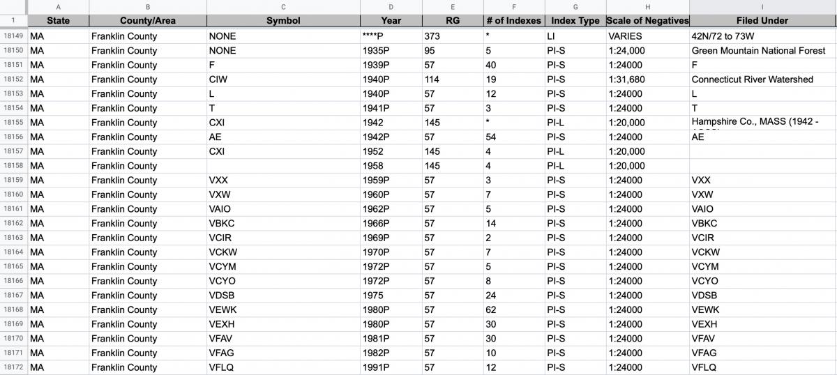
Special List 25
Special List 25 is the starting point for accessing most domestic aerial photography. This Special List provides information on which record groups and series hold photographs for specific domestic locations. Special List 25 is available for download digitally here. The most up to date version of the Special List can be requested by emailing carto@nara.gov.
The list is arranged by state and thereunder by county. Once you find the county that includes your area of interest, you will find a list of record groups and series with available photography.
Domestic Aerial Photography in Special List 25
Record Group 23: Records of the Coast and Geodetic Survey
Record Group 57: Records of the U.S. Geological Survey
Record Group 95: Records of the Forest Service
Record Group 114: Records of the Natural Resources Conservation Service
Record Group 142: Records of the Tennessee Valley Authority
Record Group 145: Records of the Farm Service Agency
Record Group 289: Records of the Naval Intelligence Command
Record Group 328: Records of the National Capital Planning Commission
Record Group 373: Records of the Defense Intelligence Agency (Domestic)